Stirling WalksWalking Routes & Hiking Trails
Find Stirling walks from the list below which features the best walking routes in the area. Most are circular walks and are listed from the shortest and easiest to the longest more challenging routes.
| Walk | Description | Grade | Miles |
|---|---|---|---|
| 2309★ | Ben A'an from Loch Achray | easy/mod | 2.50 |
| 2659★ | Conic Hill from Balmaha | easy/mod | 4.00 |
| 2709 | Dumyat Hill from Blairlogie | easy/mod | 4.50 |
| 3647★ | Callander, Samson's Stone & Coilhallan Wood | easy | 4.70 |
| 1350★ | Ben Ledi from near Falls of Leny | moderate | 5.50 |
| 2765★ | Conic Hill Circular from Balmaha | easy/mod | 7.00 |
| 3009★☩ | Ben Lomond from Rowardennan Pier | mod/hard | 7.50 |
| 2413★☩ | Ben Venue from Loch Achray | moderate | 8.20 |
| 2418★☩ | Inverlochlarig, Beinn a'Chroin & Beinn Chabhair | hard | 12.50 |
| 1493 | WHW - Day 3 - Rowardennan to Inverarnan | moderate | 14.00 |
| 1492 | WHW - Day 2 - Dryden to Rowardennan | moderate | 15.00 |
Walks that start in adjacent counties / areas.
Walks that start in adjacent counties or areas but cross the boundary and include sections of the route within Stirling.
| Walk | Description | Starts In |
|---|---|---|
| 2552 | West Highland Way Experience | East Dunbartonshire |
| 1490 | West Highland Way - A personal experience | East Dunbartonshire |
| 1491 | WHW - Day 1 - Milngavie to Drymen | East Dunbartonshire |
★ GPS file ☩ Route profile
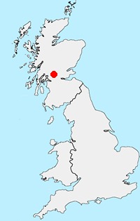
Location Map
Other walks in Britain - For a list of all the areas where walks are available go to the Main Walk Index.
Walk grading - Learn how each walk is assessed and select a walk to suit your ability and experience by going to Walk Grading Details.
Messaging & Social Media
Message Walking Britain and follow the latest news.

Mountain Weather
Stay safe on the mountains with detailed weather forecasts - for iOS devices or for Android devices.