Gunthorpe & Caythorpe from Hoveringham
Nottinghamshire Walk
County/Area - Nottinghamshire
Author - Lou Johnson
Length - 7.0 miles / 11.4 km Ascent - 50 feet / 15 metres
Time - 3 hours 30 minutes Grade - easy/mod
Walk Route Description
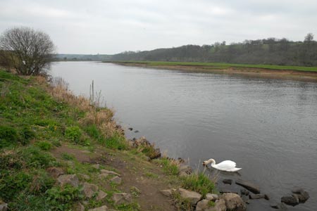
Click image to visit gallery of 12 images.
This circular walk follows a section of the River Trent and explores the adjoining countryside to the north of the river. The route takes you through three Nottinghamshire villages and uses generally well-signed paths and tracks. With route occupying the flood plain of the Trent there are no gradients to contend with.
The start is the riverside parking area (grid ref. SK700460) about half a mile south of the centre of Hoveringham village. After parking walk upstream with the river on your left and go through the gate which leads onto a wide grassy path a few metres from the Trent. The path in this area is well used and there is little need for detailed directions. After just over one and a half miles alongside the river you reach the sizeable locks at Gunthorpe. These give some idea of the size of boats and barges that can use this navigable section of the Trent.
Continue past the locks and join the road which leads through Gunthorpe village. There are a number of pubs and restaurants in this area which might be used for refreshments. Continue through Gunthorpe passing Davis's Lane on the right. After about 200 yards (grid ref. SK680442) turn right down Pecks Lane. Where this track goes sharp right continue ahead on a signed footpath. Reaching a small dyke, turn right and continue with the dyke on your left. Quite soon the path turns sharp left, crossing the dyke to continue with another drainage channel on your right.
This path leads through a garden and onto the road through Caythorpe village. Turn left along the road. Ignore the footpath sign on the right just after crossing Dover Beck and continue along the footpath through the village. You will pass a telephone box on the left which has now been converted into a book exchange for the village. After just over half a mile (grid ref. SK680461) turn right off the road down a track/bridleway. This leads without any navigational problems to picturesque Mill Farm. The route this area is well signed and the route leads out to a road (grid ref. SK688467).
Cross the road and take the continuing track opposite. This leads through fields and past a reclaimed gravel pit which is now been used as a haven for water birds and other wildlife. You are now approaching the village of Hoveringham. This name was synonymous with sand and gravel for many years and the numerous workings are gradually being restored to new uses. You reach another road (grid ref.SK699474). Turn right and walk through the village, bearing left at the junction. This leads you down to the River Trent. Follow the road as it bends sharp right and quite soon you are back at the start.
Maps 

| Ordnance Survey Explorer 260 | Sheet Map | 1:25k | BUY |
| Anquet OS Explorer 260 | Digital Map | 1:25k | BUY |
| Ordnance Survey Digital Map Subscription | |||
| Latest Ordnance Survey Discounts | |||
Other walks nearby
| Walk 3586 | Rolleston & Morton from Fiskerton | easy | 6.3 miles |
| Walk 1391 | Colston Bassett & Cropwell Bishop from Kinoulton | easy/mod | 8.5 miles |
| Walk 2134 | Linby and Newstead Abbey circular | easy | 5.9 miles |
| Walk 1513 | Newstead Abbey from Linby | easy | 5.8 miles |
| Walk 3312 | Woolsthorpe and Stenwith | easy | 3.7 miles |
| Walk 2540 | The Robin Hood Way Long Distance Circular | mod/hard | 27.0 miles |
| Walk 2823 | Greasley & Moorgreen Reservoir | easy | 5.9 miles |
| Walk 2429 | Edwinstowe, Sherwood Forest & Major Oak circular | easy | 5.9 miles |
| Walk 1431 | Haddington - Story of Two Churches | easy | 2.9 miles |
| Walk 1430 | Aubourn Country Circular | easy | 4.5 miles |
