Westonbirt Arboretum from Tetbury
Cotswolds Walk
Region - Cotswolds
County/Area - Gloucestershire
Author - Lou Johnson
Length - 10.0 miles / 16.3 km Ascent - 550 feet / 167 metres
Time - 5 hours 30 minutes Grade - moderate
Walk Route Description
Click image to visit gallery of 12 images.
This walk starts from the interesting Cotswold town of Tetbury with its many fine buildings and continues through a typical Cotswold landscape to reach the National Aboretum at Westonbirt. From here the route follows the Monarch's Way back to Tetbury passing close by Prince Charles' Highgrove House.
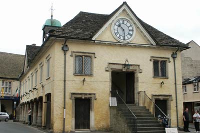
The start is the car park located on the site of the old railway station (Grid ref. ST893932) at the foot of Gumstool Hill. Walk up the hill to the town centre and locate the restored market house (built 1655). Walk down Fox Hill (B4014). Reaching the bottom of the hill, look out for a signed footpath (Grid ref. ST893929) on your right along a lane. After a short way the lane turns right. Keep straight on here following the path across meadows to reach a track (Grid ref. ST893922).
Go straight across the track and descend into a valley to reach a small stream (Grid ref. ST892918). Cross the stream and turn right to follow the path into a small valley. After approximately 500 metres the path turns left and climbs out of the valley alongside a small wood. Continue ahead to a small building and turn right along the hedge line to reach a road.
Turn right along the road. After a short way, turn left along Wormwell Lane (Grid ref. ST885910). This bridleway is very muddy after rain and it is better to walk inside the field on your left hand side wherever this is possible returning to the lane after about 500 metres. Reaching a road (Grid ref. ST881898), go straight across and take the signed footpath through a paddock on your right (Grid ref. ST882895). This path leads you through Hillcourt Farm and onto their access track. Take the path on your left (Grid ref. ST877896) and cross the fields to a road (Grid ref. ST872893). Go straight across and follow the path across more fields passing Westonbirt School on your right to reach a track by the golf course club house.
Stay on this track/lane to pass a row of houses. At the next road junction (Grid ref. ST855894) go straight ahead to reach the main road. Taking great care cross this busy main road and follow the bridleway ahead.
Optional addition - After 500 metres you can turn right and walk up to the main entrance to the Westonbirt National Arboretum. This wonderful site is worth visiting and is subject to the normal admission charge. Assuming you walk the full recommended circuit the visit adds a further 1.5 miles or 2.5 km to the distance.
Continuing on the main route, stay on the valley track for approximately 1 kilometre. Just before reaching the northern boundary of the Arboretum take the uphill path going right over grass (Grid ref. ST844901). This is the Monarch's Way and will be followed back to Tetbury. After cresting the hill the path crosses fields with the Arboretum on your right to reach a road (Grid ref. ST860906) Go straight across onto a track.
After a few minutes take care not to miss the footpath sign (Grid ref. ST865908) on your left directing you across meadows to pass in front of Elmestree House to reach a lane (Grid ref. ST874921) at Back Lodge (Elmedtree Lodge on OS maps). On this section you can see the "Phoenix" high on a column in the grounds of Highgrove House, which is on your right. Walk ahead on Longfurlong Lane towards the outskirts of Tetbury. Turn right down Berrells Road to reach Bath Road. Turn left here and walk into town passing the Parish Church of St Mary the Virgin, which has one of the highest spires in England, and is viewed by many as one of the finest examples of Georgian Gothic architecture in Britain. Shortly after passing the church the centre of town is reached and all that remains is to continue down to the start at the foot of Gumstool Hill.
Maps 

| Ordnance Survey Explorer 168 | Sheet Map | 1:25k | BUY |
| Anquet OS Explorer 168 | Digital Map | 1:25k | BUY |
| Ordnance Survey Digital Map Subscription | |||
| Latest Ordnance Survey Discounts | |||
Other walks nearby
| Walk 1977 | Lasborough & Ozleworth Bottom | easy/mod | 5.8 miles |
| Walk 1877 | Uley Bury & Cam Long Down | easy/mod | 5.5 miles |
| Walk 2674 | Source of the River Thames | moderate | 11.3 miles |
| Walk 1258 | The Tyndale Monument | easy/mod | 5.5 miles |
| Walk 3257 | Cirencester & Stratton Circular | easy | 4.7 miles |
| Walk 3347 | Ford & North Wraxall from Castle Combe | easy/mod | 8.0 miles |
| Walk 2698 | Castle Combe Circular | easy | 5.0 miles |
| Walk 3663 | Sudgrove & Edgeworth from Miserden | easy/mod | 6.0 miles |
| Walk 2147 | Arlington Peninsula from Saul Junction | easy/mod | 6.2 miles |
| Walk 3278 | Hinton & Dryham Circular | easy | 3.0 miles |
Recommended Books & eBooks
The Cotswold Way
 Guidebook to walking the Cotswold Way National Trail. Between Chipping Campden and Bath, the 102 mile route explores the Cotswolds AONB. Described in both directions over 13 stages, the Cotswold Way can be walked year round and is suitable for beginner trekkers. Includes separate OS 1:25,000 map booklet of the route.
More information
The Cotswold Way Map Booklet
 Map of the 102 mile (163km) Cotswold Way National Trail, between Chipping Camden and Bath. This booklet is included with the Cicerone guidebook to the trail, and shows the full route on OS 1:25,000 maps. The trail typically takes two weeks to walk, and is suitable for walkers at all levels of experience.
More information
