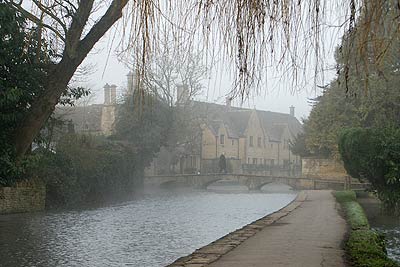
Naunton & the Slaughters from Bourton-on-the-Water
Cotswolds Walk
Region - Cotswolds
County/Area - Gloucestershire
Author - Lou Johnson
Length - 11.0 miles / 17.9 km Ascent - 1100 feet / 333 metres
Time - 6 hours 40 minutes Grade - moderate
Walk Route Description
Click image to visit gallery of 8 images.
This walk includes some attractive villages and glorious Cotswold countryside. Starting from the busy village of Bourton-on-the-Water it is probably advisable to avoid busy times of the year if you wish to enjoy the route in relative peace. The route was researched in winter and few other walkers were seen and parking was not problematic. One point worth noting is that the opportunities for refreshments on the route are limited once Bourton-on-the-Water has been left behind with only a pub in Naunton before the Slaughters are reached.
There is a public pay-and-display car park adjacent to Birdland (Grid ref SP171202), which is signed on all major routes into the village. Exit the car park and turn left into Rissington Road, which soon becomes the High Street with the River Windrush adding to the attractiveness of the village scene. High Street in turn becomes Lansdowne Road and this should be followed out of the village. Reaching 'Fosse Way', the A429, cross straight over taking great care as this a very busy trunk road. Join the signed and waymarked Windrush Way.
The River Windrush is on your left and this will form a recurring theme for the first half of the walk as it meanders through pleasant rolling Cotswold countryside. Passing under a disused railway you join a lane (Grid ref SP150213), which you follow over the River and uphill. At the top of the rise turn right through Aston Farm and follow the signed path. This undulating path leads you through a wood and down to meadows alongside the River Windrush past the site of the Medieval Village of Lower Barford.
Reaching a lane (Grid ref. SP129224) turn left and walk uphill. Turn right onto the next section of the Windrush Way and follow the path down to what is now a very narrow River Windrush (Grid ref. SP119225) where you leave the valley path and climb uphill alongside Naunton Golf Course (on your left) to reach a road (Grid ref. SP117231). Go straight across and descend the path with excellent views of Naunton village and the restored dovecote. Ignore the signed path going off to the right and continue down towards the church.
Turn right and follow the road through the village passing the Chapel to reach a road junction (Grid ref. SP118234). Turn left here and walk uphill. Take the signed path on your right, The Warden's Way. A steady climb takes you out of the valley to reach a road (Grid ref SP126242). Turn right. At the junction bear right. Turn left down the first farm track (Grid ref. SP134240) and follow this down to some derelict farm buildings (Grid ref SP136243). Turn right here (the path takes some finding!) and descend into the valley to reach a road (Grid ref. SP148240). Turn left along this road taking care as the traffic is quite fast.
Take the first track on your right (Grid ref SP152241) following the infant River Eye which is on your left. The path leads without any problem into the village of Upper Slaughter. Walk through this attractive village to take the signed path on your right (Grid ref. SP156231). Follow this path through to Lower Slaughter with its attractive cottages lining the banks of the River Eye. Walk through the village past the hotel and take the Warden's Way on your right (Grid ref. SP166225). This path leads you across meadows to the Fosse Way. Cross over using the pedestrian crossing and walk south. At the first road junction turn left and follow this road into Bourton-on-the-Water. Reaching High Street, turn left and the car park is on your right a few hundred metres along this road.
Maps 

| Ordnance Survey Explorer OL45 | Sheet Map | 1:25k | BUY |
| Anquet OS Explorer OL45 | Digital Map | 1:25k | BUY |
| Ordnance Survey Digital Map Subscription | |||
| Latest Ordnance Survey Discounts | |||
Other walks nearby
| Walk 2484 | Icomb & Wyck Rissington Circular | easy/mod | 5.2 miles |
| Walk 1848 | Turkdean & Notgrove from Cold Aston | easy/mod | 6.5 miles |
| Walk 2283 | Church Westcote & Icomb Circular | easy/mod | 5.1 miles |
| Walk 2454 | Farmington & Clapton-on-the-Hill | easy/mod | 6.4 miles |
| Walk 2168 | The Slaughters | easy/mod | 8.6 miles |
| Walk 2076 | Kingham to Charlbury | easy/mod | 10.5 miles |
| Walk 2186 | Adlestrop & Chastleton | easy | 3.8 miles |
| Walk 1439 | Fulbrook & Widford | easy | 6.0 miles |
| Walk 3636 | Bibury & Ablington Circular | easy | 4.1 miles |
| Walk 3635 | Barnsley Park | moderate | 11.0 miles |
Recommended Books & eBooks
The Cotswold Way
 Guidebook to walking the Cotswold Way National Trail. Between Chipping Campden and Bath, the 102 mile route explores the Cotswolds AONB. Described in both directions over 13 stages, the Cotswold Way can be walked year round and is suitable for beginner trekkers. Includes separate OS 1:25,000 map booklet of the route.
More information
The Cotswold Way Map Booklet
 Map of the 102 mile (163km) Cotswold Way National Trail, between Chipping Camden and Bath. This booklet is included with the Cicerone guidebook to the trail, and shows the full route on OS 1:25,000 maps. The trail typically takes two weeks to walk, and is suitable for walkers at all levels of experience.
More information
