Bibury & Ablington Circular
Cotswolds Walk
Region - Cotswolds
County/Area - Gloucestershire
Author - Lou Johnson
Length - 4.1 miles / 6.7 km Ascent - 250 feet / 76 metres
Time - 2 hours 20 minutes Grade - easy
Walk Route Description
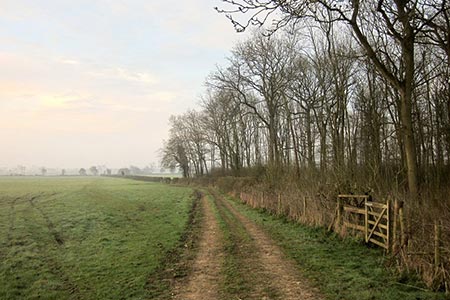
Click image to see photo description.
This short Gloucestershire circular walk in the Cotswolds explores the countryside to the north of the attractive village of Bibury. The routes uses well defined tracks and country lanes. The return leg of the route passes through Ablington village with its delightful cottages in a rural setting.
Parking in Bibury is available in a lay-by beside the River Coln just north of the small footbridge across the river (grid ref. SP115067). With the river on your right, walk south along the B4425, past the Post Office and around a left-hand bend. Continue to the end of the pavement, pass a letter box in the wall on your left and take the next left (Packhorse Lane) signed as a no-through road. The track bends left and then shortly after heads right and continues as a grassy track. Stay on the bridleway for about a kilometre, passing the rear of Bibury Far on your right and a barn on the left to reach a junction of tracks (grid ref. SP123082).
Take the left-hand-fork through a gate and follow the bridleway for a kilometre to reach Saltway Barn at a junction of tracks (grid ref. SP118092). Turn left along a bridleway, which is enclosed by hedges for part of the way, for two kilometres to reach a lane in Ablington village. Turn left along the lane and continue back to Bibury.
Maps 

| Ordnance Survey Explorer OL45 | Sheet Map | 1:25k | BUY |
| Anquet OS Explorer OL45 | Digital Map | 1:25k | BUY |
| Ordnance Survey Digital Map Subscription | |||
| Latest Ordnance Survey Discounts | |||
Other walks nearby
| Walk 2454 | Farmington & Clapton-on-the-Hill | easy/mod | 6.4 miles |
| Walk 3257 | Cirencester & Stratton Circular | easy | 4.7 miles |
| Walk 1848 | Turkdean & Notgrove from Cold Aston | easy/mod | 6.5 miles |
| Walk 1360 | Naunton & the Slaughters | moderate | 11.0 miles |
| Walk 1439 | Fulbrook & Widford | easy | 6.0 miles |
| Walk 2484 | Icomb & Wyck Rissington Circular | easy/mod | 5.2 miles |
| Walk 2168 | The Slaughters | easy/mod | 8.6 miles |
| Walk 2674 | Source of the River Thames | moderate | 11.3 miles |
| Walk 2283 | Church Westcote & Icomb Circular | easy/mod | 5.1 miles |
| Walk 3663 | Sudgrove & Edgeworth from Miserden | easy/mod | 6.0 miles |
Recommended Books & eBooks
The Cotswold Way Map Booklet
 Map of the 102 mile (163km) Cotswold Way National Trail, between Chipping Camden and Bath. This booklet is included with the Cicerone guidebook to the trail, and shows the full route on OS 1:25,000 maps. The trail typically takes two weeks to walk, and is suitable for walkers at all levels of experience.
More information
The Cotswold Way
 Guidebook to walking the Cotswold Way National Trail. Between Chipping Campden and Bath, the 102 mile route explores the Cotswolds AONB. Described in both directions over 13 stages, the Cotswold Way can be walked year round and is suitable for beginner trekkers. Includes separate OS 1:25,000 map booklet of the route.
More information
