Bunster Hill and Dovedale from Ilam
Peak District Walk
Nat Park - Peak District - Dovedale Manifold Valley
County/Area - Staffordshire & Derbyshire
Author - Lou Johnson
Length - 4.5 miles / 7.3 km Ascent - 1300 feet / 394 metres
Time - 3 hours 30 minutes Grade - easy/mod
Walk Route Description
Click image to visit gallery of 3 images.
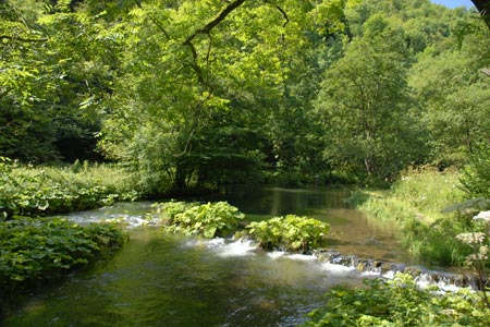
This Peak District walk starts from the village of Ilam and takes a high level route along the western rim of Dovedale to Ilam Rock. The route then descends into Dovedale and follows this well known river downstream. The walk offers some fine views typical of the White Peak and the limestone dales of Staffordshire and Derbyshire
The start is near the centre of Ilam village (grid ref SK135508) where on street parking is usually available. If not there is pay and display parking alongside Ilam Hall. After parking walk east along the road towards Thorpe. Just past the last building go over the stile on the left. Ignore the main path to Dovedale, instead walk north on a less obvious path that climbs across the western flank of Bunster Hill. The right of way crosses the field on your left but there is no need to follow this. Just continue walking uphill with the field boundary on your left. Ignore the path leading to Ilammoor Lane and continue alongside the field boundary to reach a stile (Grid ref. SK139520). Cross the stile and field to enter a walled lane with trees.
Turn right to Air Cottage as you reach Ilamtops Farm and continue to follow the waymarked route around the back of Air Cottage. The onward path follows the western rim of Dovedale and you get some good views into the dale and across to the other side. The route is well signed and eventually you begin to descend into Dovedale. The path zigzags down to reach the banks of the River Dove below Ilam Rock. Turn right, cross the River Dove using the footbridge and once on the other side follow the river downstream (right). Despite walking downstream there is still some ascent to complete on the section up to Lover's Leap.
It is likely, especially in fine weather, for this section to be very busy. However you can still admire the dramatic gorge through which the river flows. Quite soon the shapely outline of Thorpe Cloud comes into view. Arriving at the stepping stones (Grid ref. SK151514), stay on the eastern bank continuing downstream until you reach a footbridge. Cross this and walk along the lane. Reaching the entrance to the car parks on both sides of the lane, turn right into the car park and walk parallel with the lane to take the signed path on your right across fields and down to a lane in Ilam. Turn right along the lane back to the centre of the village.
Maps 

| Ordnance Survey Explorer OL24 | Sheet Map | 1:25k | BUY |
| Anquet OS Explorer OL24 | Digital Map | 1:25k | BUY |
| Ordnance Survey Digital Map Subscription | |||
| Latest Ordnance Survey Discounts | |||
Other walks nearby
| Walk 1195 | High-level Dovedale | moderate | 9.5 miles |
| Walk 3131 | Thorpe Cloud and the Dove Valley | easy | 1.6 miles |
| Walk 2259 | Ilam | easy | 4.5 miles |
| Walk 1021 | Milldale & Hall Dale | easy/mod | 5.0 miles |
| Walk 1257 | Wolfscote Dale | easy/mod | 7.5 miles |
| Walk 1709 | Milldale and Wolfscote Dale | easy/mod | 6.5 miles |
| Walk 3597 | Manifold Valley, Thor's Cave, Ecton & Wetton Hills from Alstonefield | moderate | 10.0 miles |
| Walk 3601 | Dove & Manifold Valleys | moderate | 10.0 miles |
| Walk 2762 | Slade House & Rushley | easy/mod | 6.3 miles |
| Walk 2263 | Grindon & the Manifold Way from Waterhouses | moderate | 8.0 miles |
Recommended Books & eBooks
Great Mountain Days in the Pennines
 An inspirational guidebook to 50 classic walks on the rolling Pennine landscape. The graded routes, between 6 and 13 miles in length, cover classic Pennine fells and moorland such as Whernside, Ilkley Moor and Pendle Hill; exploring the North and South Pennines, Yorkshire Dales, Howgills and Dark Peak. Many routes are also suited to fell running.
More information
Walking in the Peak District - White Peak East
 Guidebook describing 42 half-day and day walks in the limestone landscapes of Derbyshire's White Peak, part of the Peak District National Park. One of two volumes, this book covers the east of the region, with potential bases including Bakewell, Eyam, Castleton, Birchover, Matlock and Wirksworth.
More information
