Thornton Reservoir
Leicestershire Walk
County/Area - Leicestershire
Author - David McMahon
Length - 2.5 miles / 4.1 km Ascent - 25 feet / 8 metres
Time - 1 hours 20 minutes Grade - easy
Walk Route Description
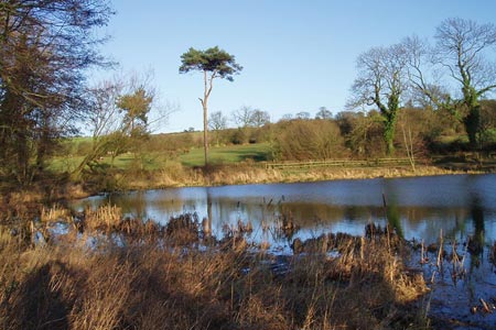
Click image to see photo description.
This is an easy walk on a wide flat surface. The walk is suitable for wheelchairs and pushchairs. It can also be added to walk 1591 (Ratby - Thornton walk) if people wish to make this walk longer. There is a refreshment lodge on the footpath. Car parking is available either end of Reservoir Road.
The route needs no explanation and all you need to decide is which way round you want to go. The path ahead is always clear and navigation is never a problem.
Maps 

| Ordnance Survey Explorer 233 | Sheet Map | 1:25k | BUY |
| Anquet OS Explorer 233 | Digital Map | 1:25k | BUY |
| Ordnance Survey Digital Map Subscription | |||
| Latest Ordnance Survey Discounts | |||
Other walks nearby
| Walk 1543 | Desford, Botcheston and Thornton Reservoir from Ratby | moderate | 11.0 miles |
| Walk 1591 | Thornton Reservoir from Ratby | easy/mod | 6.3 miles |
| Walk 2315 | Old John & Beacon Hill | easy/mod | 8.8 miles |
| Walk 2175 | Bradgate Park from Newtown Linford | easy | 4.8 miles |
| Walk 2187 | Bradgate Country Park from Hallgates | easy | 3.4 miles |
| Walk 1487 | Blackbrook Reservoir & Nanpantan | moderate | 12.0 miles |
| Walk 3486 | Sutton Cheney & Market Bosworth | easy/mod | 7.4 miles |
| Walk 1540 | Nanpantan Reservoir, Wood Brook and Buck Hill | easy | 2.5 miles |
| Walk 2941 | Out Wood & Beacon Hill from Loughborough | easy/mod | 6.8 miles |
| Walk 3087 | Normanton Park & Desford Crossroads | moderate | 11.5 miles |
