Normanton Park & Desford Crossroads from Croft
Leicestershire Walk
County/Area - Leicestershire
Author - David McMahon
Length - 11.5 miles / 18.7 km Ascent - 500 feet / 152 metres
Time - 6 hours 20 minutes Grade - moderate
Walk Route Description
Click image to see photo description.
Croft is a village 8 miles south east of Leicester. Arriva Bus 50 & 50a services the village. In addition, on-street parking is available although do be considerate to residents of the village. To start the walk head north up Station Road over the railway line and follow the road as it swings left past the Heathcote Arms and Michael & All Angels Church. At the next bend in the road take the footpath on the left, through the cemetery. At the end of it go right through the hedgerow, then turn left and follow the grassy track (grid ref. SP506961). Cross over the wooden footbridge and then over a stile and almost immediately go right over another stile and follow the headland to the far end of the field. Turn left and continue along the side of the field until you reach the small hamlet of Potters Marston.
Cross the road and go down the alleyway between the houses into a field. Head slightly diagonally right down towards Potters Marston Hall. Go over a stile and turn sharp right on to the farm courtyard, then right again and head for an enclosure of wooden cable reels. Take the footpath to the right of it and carry on as it swings to the right. Cross over a wooden footbridge and then straight up the side of the following field. When you reach the end of it go right and follow the line of the stream until you arrive at Stony Bridge (grid ref. SP503972).
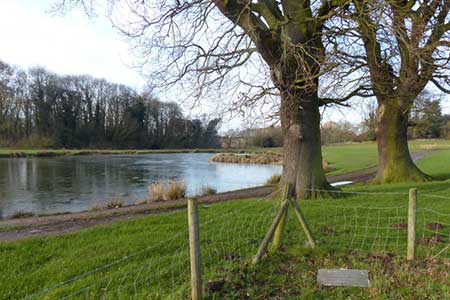
Turn left and road walk over the M1. Then go left along Watery Gate Lane until you reach Normanton Lodge (grid ref. SP495977). Go right immediately after the Lodge along the track into Normanton Park and continue until you arrive at Earl Shilton Road (grid ref. SP492989). Cross the road and continue along the footpath until you reach the A47 (grid ref. SP485999). Turn right and initially use the cycle lane until it runs out and then cross the road and use the wide grass verge past the bus shelter (if you wish to curtail the walk at this point, you can catch either a Stagecoach 48 or Arriva 158 bus back to Leicester) to reach the turnoff for Peckleton Common. Cross the road and once you have found the footpath (grid ref. SK492007) climb the stile and turn right, going to the left of the house.
Soon after take the stile to the right into the next field and turn sharp left. Follow the hedgerow. When the hedgerow finishes go straight across the field to the road (grid ref. SK494014). Continue ahead down the lane to Pendlewood Farm. Just short of the farm go through the enclosure you will see on the left and walk diagonally right to the far end of it. When you see the stile ignore the arrow indicating to the left and continue in a straight line past the barn and then take the stile to the right soon afterwards. Go into the field and straight across it. Then go diagonally left through the next two fields and then into the fourth field and, at first go straight on, then go diagonally left when the yellow post comes into view. Continue over two stiles, into a small field and straight across it and onto the B582 Leicester Lane (grid ref. SK500022).
Turn right you will pass what was the White Horse pub (now an Italian restaurant). Here again you have an option. If you continue along the road you will arrive at Desford Crossroads. Once there turn right past the garage to the bus stop which you can use to return to Leicester using either Stagecoach 48 or Arriva 158 buses.
To continue the walk, carry on past the old White Horse pub towards Desford Crossroads. When you see a bridleway sign on the left, look out for a footpath sign almost immediately opposite. Go right down an alleyway into a field. Go to the left of the pond and then swing right past the barn, then turn sharp left after the solar panels and carry past them to the far hedgerow. Continue into the next field and follow the well-marked route until you arrive out on the A47, opposite the 'Bulls Head' pub (grid ref.SK5000150.
Take the footpath to the right of the pub and follow it until you reach the road north of Thurlaston (grid ref. SP504993). Walk south along the road through the village, past the 'Elephant & Castle' pub and continue along the Croft road until you see a footpath sign on the left (grid ref. SP502988). Go over the stile into the field and walk diagonally right. Carry on in the same direction across to the corner of the second field and then aim for the far left-hand corner of the third field. Go through the hedgerow into the fourth field and onto a bridleway (grid ref. SP505985).
You now have a choice; you can go left along the bridleway and then go right when you reach the motorway embankment - or turn right along the bridleway and when you reach the field boundary, turn sharp left and go diagonally left across the field to the motorway tunnel. Whichever route you have used go under the motorway and continue along in the same direction. When you come to the footpath junction (grid ref. SP508973), cross the footbridge and carry on until you come to Thurlaston Lane (grid ref. SP508970). Turn left and walk to the junction with Croft Hill Road. Turn left again, cross the road and you see the entrance to the footpath that runs parallel to the road towards Croft. You can also use a stile which allows you onto Croft Hill itself. Otherwise follow the path as far as possible. Then take the left-hand path through the edge of a wood and eventually into the car park of Croft Granite. Go right and you will come out by the church in Croft.
Maps 

| Ordnance Survey Explorer 233 | Sheet Map | 1:25k | BUY |
| Anquet OS Explorer 233 | Digital Map | 1:25k | BUY |
| Ordnance Survey Digital Map Subscription | |||
| Latest Ordnance Survey Discounts | |||
Other walks nearby
| Walk 1441 | Broughton Astley, Leire, Claybrooke Magna & Sharnford | easy/mod | 11.0 miles |
| Walk 1840 | Sharnford & Claybrooke Magna from Sapcote | easy/mod | 10.0 miles |
| Walk 1624 | Willoughby Waterleys & Bruntingthorpe | easy/mod | 9.2 miles |
| Walk 2078 | Peatling Magna & Arnesby From Countesthorpe | easy/mod | 6.8 miles |
| Walk 1685 | Peatling Magna | easy | 4.1 miles |
| Walk 1543 | Desford, Botcheston and Thornton Reservoir from Ratby | moderate | 11.0 miles |
| Walk 1591 | Thornton Reservoir from Ratby | easy/mod | 6.3 miles |
| Walk 3486 | Sutton Cheney & Market Bosworth | easy/mod | 7.4 miles |
| Walk 1592 | Thornton Reservoir | easy | 2.5 miles |
| Walk 3415 | Wistow and Newton Bridge from Fleckney | easy | 6.5 miles |
