Hertfordshire Way Aldenham to Bricket Wood
Hertfordshire Walk
County/Area - Hertfordshire
Author - Donald Morton
Length - 5.5 miles / 8.9 km Ascent - 400 feet / 121 metres
Time - 3 hours 10 minutes Grade - easy
Walk Route Description
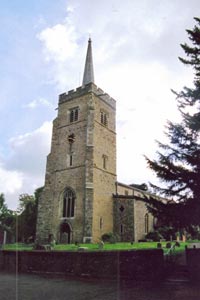
Click image to visit gallery of 6 images.
Aldenham is a village with ancient roots, a couple of miles NE from the centre of Watford, retaining a number of older dwellings in what is still a rural setting. It is possible to park by the village green or outside the church (Grid Ref TQ140985) and the walk starts on the Hertfordshire Way by walking up the road with the West end of the church to your right. The walk is described as starting from Aldenham, but for those who do not wish to use a car it is possible to start from Bricket Wood Station, turning right on leaving the station down Station Road and joining the walk at School Lane (Grid Ref TL133016). Bricket Wood is a station on a single track line which runs from Watford Junction to St Albans Abbey. The "Abbey Flyer" provides what is effectively a shuttle service running either way about every 45 mins weekdays and Saturdays and roughly hourly on Sundays. If you do just miss a train there are local pubs to help while away the time.
Just past Church Cottages turn left on a public footpath with a sign, rather buried in the hedge, to Blackbirds Lane. Follow the tarmac track and where this finishes continue straight on along the field edge, hedge right. At a crossing path with a metal kissing gate buried in the hedge, turn left to walk straight across a cultivated field. You come out onto a road. Turn right and follow the road into the Wall Hall estate. Wall Hall and surrounding buildings used to be a rather pleasant teachers' training college, a quiet academic institution in bucolic surroundings, centred round the ivy covered Wall Hall, a Gothic revival mansion built at the beginning of the 19th Century by a nouveau riche banker, mentioned in Dicken's Tale of Two Cities, and during World War II the home of the anti-British US Ambassador Joseph Kennedy. It has now been redeveloped into an executive village still providing a pleasant rural environment and which you quickly get through by turning left at a roundabout and going down Wall Hall Drive to a pair of metal gates ahead. As you go you will see Wall Hall over to the right, no longer ivy covered, and in its rawness looking rather like something from a Disney theme park. Perhaps it really did look like this when it was new, but I preferred it when it had been softened by the patina of age now brutally removed.
Go through the metal gates and down a gravel drive to go over or through a dried up pond. Then go half left over a cultivated field to another bridge over the River Colne. From here fork half right along a well trodden grassy path which goes through parkland. It crosses a drive and continues to a gravel track. (If you turn right you will come to a view of Munden House, another early 19th Century Mansion, and a ford across the Colne which only needs a haywain to be a Constable and eventually Grid Ref TL139004 - see below.) The walk, however turns left along the gravel drive and soon you reach a lane which you cross to enter Bricket Wood Common, an SSSI consisting of lowland heath and ancient broadleaf woods.
On entering the woods follow the broad bridleway more or less straight through fairly open woodland. At a crossways with finger post leave the Hertfordshire Way by turning right on Footpath 59 to Mt Pleasant Lane and follow this along a ride through the woods until you reach a second finger post where you turn left along a duck board through rather swampy ground. The path soon broadens and rises to cross the Watford to St Albans railway line. It comes to a cross way. On the left behind a wire fence is the national Building Research Establishment, but the walk turns right along the public bridleway which now runs parallel to the railway. It comes out at a road. Turn right under the railway bridge and then right again down School Lane (Grid Ref TL133016).
You will not see a school but this quiet lane takes you through a beautiful stretch of ancient coppiced hornbeam until you reach the entrance to Little Munden Farm. The footpath sign has gone missing but the dirt drive to the farm is in fact footpath 56. Follow it through the farm buildings. At the end of these turn left over the Colne again and follow the broad track past the riding ring to a cross path. Turn right along this old green lane and soon arrive at River Lodge (Grid Ref TL 139 004). Level with the gate to the back garden turn left and follow the track uphill for half mile or so until it turns sharp right (the alternative ahead is clearly marked as private) and follow it round through the agricultural buildings of Blackbirds Farm keeping the timbered farm house on the left (glimpsed through a gap between barns) but passing to the left of a red brick building. Once through the farm, go downhill and where the track swings right turn left not along the track but along the edge of the field to its right, keeping the hedge left. At the end of the field curve right and almost immediately turn left to continue along the edge of a second field, hedge left. Along the edge of a third field you soon come to the cross path near the start of the walk where you continue straight on to retrace your steps back to Aldenham.
Maps 

| Ordnance Survey Landranger 166 | Sheet Map | 1:50k | BUY |
| Anquet OS Landranger 166 | Digital Map | 1:50k | BUY |
| Ordnance Survey Digital Map Subscription | |||
| Latest Ordnance Survey Discounts | |||
Other walks nearby
| Walk 2062 | Cassiobury Park & Grand Union Canal, Watford | easy | 2.0 miles |
| Walk 2748 | Bowman's Lakes & Colney Heath | easy/mod | 7.5 miles |
| Walk 3122 | Moor Park to Rickmansworth | easy/mod | 7.0 miles |
| Walk 1343 | St Albans & Gorhambury circular | moderate | 9.5 miles |
| Walk 3664 | Northwood Hills to Northolt | moderate | 10.3 miles |
| Walk 1931 | Rickmansworth circular via Croxley Green and Watford | easy/mod | 7.0 miles |
| Walk 3403 | Chipperfield to Kings Langley Circular | easy | 5.0 miles |
| Walk 1507 | Chipperfield Common circular | easy | 2.0 miles |
| Walk 1815 | Hertfordshire Way between Chipperfield and Bovingdon | easy/mod | 7.5 miles |
| Walk 1122 | St Albans & Childwick Green | easy | 4.0 miles |
