St Albans & Gorhambury circular
Hertfordshire Walk
County/Area - Hertfordshire
Author - Lou Johnson
Length - 9.5 miles / 15.4 km Ascent - 700 feet / 212 metres
Time - 5 hours 30 minutes Grade - moderate
Walk Route Description
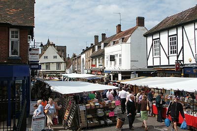
Click image to visit gallery of 9 images.
St Albans is an interesting city that is dominated by the Abbey with some interesting Roman ruins of the city of Verulamium. Within easy reach of central London and the Home Counties, this walk provides an excellent exercise, a taste of the Hertfordshire countryside and the opportunity to see at first hand some aspects of the city both past and present.
The start of this Hertfordshire walk is St Albans railway station (Grid ref. TL155070) where at weekends there is also some reasonably priced pay and display parking. Exit the station on the east side of the tracks and turn left into Station Way and then left again onto Hatfield Road. This climbs up to a busy roundabout where you turn left into St Peters Street. Follow this, the main shopping and market street, towards the Abbey. This street is particularly busy on market days with a wide range of goods for sale. By keeping to the right hand side of the street you will continue down Market Place to reach High Street. Cross straight over and continue down an alley to the Abbey, which is a wonderful mix of architectural styles and well worth a visit.
From the Abbey walk southwest across the grounds and down to and past the Old Fighting Cocks Pub to enter Verulamium Park (Grid ref. TL 141068). Turn north and with the lake on your left follow the wide path to reach the exit at St Michael's Bridge (Grid ref. TL 137074). Turn left into St.Michaels Street and follow this past some attractive houses, Roman City Museum and St Michael's Church to reach the A4147. Cross over this busy road and take the wide drive leading to Gorhambury.
Passing Mayne's Farm on your right you get a good view across the fields to the main house at Gorhambury on your left. Stay on the drive but take the right fork at the junction (Grid ref. TL 114080). This leads you behind the main house and past the remains of the original house on your right. Staying on the main drive continue past Hill End Farm to reach the A4147 again (Grid ref. TL 107060).
Cross the A4147 and take the lane opposite taking care as traffic is very fast on this busy road. There follows an extremely unattractive section of walk past a garden waste disposal centre on your left and the noisy M10 motorway on your right. Thankfully this section is relatively short and you soon enter more pleasant surroundings. Reaching a road junction (Grid ref. TL 115051) turn left to reach the Holly Bush pub. Bear right at the junction by the pub along Ragged Hall Lane.
After approximately one kilometre you reach a road junction (Grid ref. TL 126051) with Park Wood on your left. Keep straight ahead on the lane and at the end of the wood turn left onto a footpath. This leads to a footbridge over the M10 motorway and across a field to reach the edge of the St Stephens housing estate. By keeping in a northeasterly direction you will find that a series of alleys and roads leads without problems back to Verulamium Park (Grid ref. TL 135065).
As you enter the park you follow a section of the city wall to reach the Lake and the Fighting Cocks Pub. Retrace your steps uphill past the Abbey, through the Alley across High Street and into Market Place. Rather than continue on St Peter's Street to the roundabout, turn right down Victoria Street and in a few minutes you will be back at the start.
Parts of this walk are over concessionary paths. Walking Britain has been informed that the permissive path is normally open from 8am to 6pm. However the path can be closed at any time at the owner's discretion and is closed on Saturdays from 1 September to 31 January. Please see the Gorhambury website at www.gorhamburyestate.co.uk for notice of planned closures. You are asked to respect these restrictions.
Maps 

| Ordnance Survey Explorer 182 | Sheet Map | 1:25k | BUY |
| Anquet OS Explorer 182 | Digital Map | 1:25k | BUY |
| Ordnance Survey Digital Map Subscription | |||
| Latest Ordnance Survey Discounts | |||
Other walks nearby
| Walk 1122 | St Albans & Childwick Green | easy | 4.0 miles |
| Walk 1022 | Sandridge Circular | easy | 4.0 miles |
| Walk 1607 | Sandridge, Coleman Green & Brocket Hall Circular | easy/mod | 9.0 miles |
| Walk 2748 | Bowman's Lakes & Colney Heath | easy/mod | 7.5 miles |
| Walk 1139 | St Albans via Redbournbury Watermill from Harpenden | moderate | 12.0 miles |
| Walk 1532 | Wheathampstead circular | easy | 4.5 miles |
| Walk 2457 | Stanborough Park, Welwyn Garden City | easy | 2.0 miles |
| Walk 2945 | Lea Valley from Batford to Mill Green | easy/mod | 8.5 miles |
| Walk 1609 | Hertfordshire Way Aldenham to Bricket Wood | easy | 5.5 miles |
| Walk 3511 | Aldenham to Watling Street Circular | easy | 5.5 miles |
