Cheeseden Brook & Pooley Bridge from Heywood
Greater Manchester Walk
County/Area - Greater Manchester - Rochdale
Author - Allan Friswell
Length - 7.4 miles / 12 km Ascent - 700 feet / 212 metres
Time - 4 hours 20 minutes Grade - easy/mod
Walk Route Description
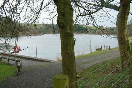
Click image to visit gallery of 9 images.
A mixture of on road, pasture, woodland, riverside and hilltop, with the Calderdale signature note of running water rarely far away. In winter an extremely muddy walk, and the half mile ridge overlooking Cheeseden Brook is vertiginous, making the use of a walking pole a good idea. But wonderful high views over to Heywood and to the impressive turbines on distant Scout Moor.
Park the car below the end of little Victoria Terrace off Bamford Road at SD 8523 1178, in the small lay-by car parks. Continue down the track towards the sewage works, climbing the broad steps on their right to the main road A6222. Cross and walk left up the hill past the defunct Bird i'th' Hand pub to the bridleway on the right (Gristlehurst Lane). After three quarter's of a mile, keeping left at forks, reach the B road (Elbut Lane); turn right and just before the Pack Horse Inn take the setted road on the left in front of cottages. After passing two small reservoirs, you eventually turn right at a streetlamp, (no signing), going between two sturdy trees on to the paved forecourt of a huddle of small houses, then going left to face number 10. To the right are some steps leading to a short tight delightful tunnel and more steps.
The track leads to an old quarry whose right side you follow up to a stile. Cross and follow the r/h wall uphill through two more stiles. Turn left where a track crosses at a T junction, following the increasingly obvious bridle way past the stables and round right, eventually reaching Castle Hill Road. Turn right, pass the golf course, and at its end climb up to take the path on the right.
Follow the line of the right hand wall to the very crest of the meadow. Go over the left of centre marked stile, turn right, at about 2 o/clock, to drop down (fabulous sight) to another marked stile and a narrow track.
Follow this track to where it crosses a broader one, veers left then back right to start edging its way along the rim of a gorge overlooking Cheeseden Brook. This can be alarmingly narrow with a deep fall to the left, and a walking pole is strongly recommended. After about half a mile you leave this (a short but difficult few feet drop in wet weather), entering a field and following its edge to the exit on to a track at right angles. Turn left.
Walk down, then take the right-hand bridleway down a steep concrete ridged track to the bridge at the bottom. Left on the bridleway, immediately bending right (ignore the footpath on the left) up big steps before dropping to a ford, crossed relatively easily. Climb right, through a gate, pass Black Dad Farm along the bridleway track, and then Dairy House to Ashworth Road, with around 240 degree views around. Turn right, and a quarter of a mile turn later left along School Lane. This gets to the bridge, where you cross the Naden Brook; go through the right hand gap down the zigzag path to cross the tunnel mouth on the brook.
Follow the generally very muddy bank shortly to a kissing gate. Pass in front of the single-storey dwelling, with a (dummy) climber seemingly immobile on the high crag on the left. Continue along the bank, following the paths closest to the Brook, and alongside some falls, and beneath superb gorge formations, to the end of the bank. Here you exit through an Immobile Home Park just after a green metal bridge to Ashworth Road. Turn left. Make your way to the main A6222, cross, go down the (unmarked) track opposite to retrace your steps to the start.
Maps 

| Ordnance Survey Explorer OL21 | Sheet Map | 1:25k | BUY |
| Anquet OS Explorer OL21 | Digital Map | 1:25k | BUY |
| Ordnance Survey Digital Map Subscription | |||
| Latest Ordnance Survey Discounts | |||
Other walks nearby
| Walk 1421 | Turf Moor & Black Hill | moderate | 10.5 miles |
| Walk 3691 | Scout Moor from Ashworth Moor Reservoir | easy/mod | 4.5 miles |
| Walk 3380 | Blackstone Edge from Hollingworth Lake | moderate | 9.0 miles |
| Walk 2584 | Turton & Entwistle and Wayoh Resrs. from Jumbles | moderate | 10.0 miles |
| Walk 2183 | Irwell Sculpture Trail | easy | 4.5 miles |
| Walk 1458 | The Rossendale Way from Greave | easy/mod | 7.0 miles |
| Walk 3719 | Ramsden Wood & Hades Hill from Walsden | easy/mod | 6.1 miles |
| Walk 1849 | Blackstone Edge and the Pennine Way without a car | moderate | 8.0 miles |
| Walk 2260 | White Hill from Hollingworth Lake | moderate | 11.2 miles |
| Walk 1411 | Walsden & Warland Reservoir | easy/mod | 6.5 miles |
