Luddenden Foot Circular
West Yorkshire Walk
County/Area - West Yorkshire - Calderdale
Author - Allan Friswell
Length - 7.5 miles / 12.2 km Ascent - 1100 feet / 333 metres
Time - 4 hours 50 minutes Grade - easy/mod
Walk Route Description
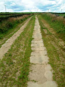
Click image to visit gallery of 8 images.
As always Calderdale offers you here a multitude of small, stone-walled enclosures and secretive tracks, its unmistakable architectural vernacular, its slight sense of being "unfinished" (as neat Wharfedale or Upper Airedale are "finished") the constant reminder that this was once a dense hive of mills and industry: spinning, carding and weaving. Like the mill workers of old, you have to work hard to gain reward here; but the views from the tops, above all on the return leg, are spectacular.
From the west end of the Station Road bridge over the Rochdale Canal (SE 0363 2504), climb your first test, the setted Blackwood Hall Lane. Shortly, where the Calderdale Way continues left you keep ahead up Milnergate, the Old School House on your right. At the entrance to the dwelling at the top turn left along a narrow and typically Calderdale path, with undergrowth obscuring its steps - take care. At its top go right, climb to the T-junction (Sowerby Lane), go through the unmarked gate opposite and cross the field. By the adjacent cricket pavilion you leave this field, briefly cross the corner of a second and enter a third, following a vague path which brings you to a clear track. Left along this and round to the farm.
Here climb right, keeping this side of the fence, to reach the cottages, before which you pass via a little wooden gate. Follow the lane and take the (wrongly signed) Calderdale Way stile on the first corner. Ahead to the field corner; ignore its stile, instead climbing right, through three stiles, to reach New Lane. Go right, cross and take the stile. Follow the wall up to Moor Bottom Lane which you follow right before going left along the setted track of two, soon crossing a bridleway at right angles; then shortly, at the cairn where the path splits in three, take the left hand fork. This takes you to Weather Hill Lane - left here; then after around 150 yards go through the insignificant right hand gap in the wall guarded by an old, half rotten post. Follow the wall to reach Weather Hill Lane; turn right, passing Pitts Farm. Stoodley Pike with Withens Clough Reservoir are distantly clear on your right. Soon after, take the rising asphalted track on the left and keep along it (Water Stalls Road - for the first time the walk levels; you have climbed 850 feet in 2.25 miles). This clear track becomes first earthen (at a power pole and farm), then later is joined by the Calderdale Way - follow it over 1.3 miles of heather moorland.
Arriving at a meeting-place of paths and gates you take that on the left which seems to double back the way you've come. Soon another path joins from the right. After passing a cottage and gate you soon descend quite sharply to Kennel Lane. Right, and follow the lane, crossing Shaw's Clough beck on its hairpin bend. With a church steeple straight ahead, leave the lane, taking the bridleway on the left (Clough Bank Lane). Somewhere in the ensuing climb, pretty overgrown and much narrower at the top end, this becomes a footpath! Either way, mind your ankles.
At the top go right, pass the kennels on the right along Parkin Hall Lane. Very soon, at the triangle of roads, go right then cross to follow the track between wall and fence. Arriving at Shaw's Lane go right, then left up past the cottages. The views across to Hebden and Sowerby Bridges are stunning. Take the first stile on the right almost at once, descend close to the power pole to pass through the former gateway, then follow the wall hard round left until you reach a steep gulley, the road wall and the barely visible stile at the stables. Go through their gates, follow the overgrown path ahead along the fence, then the field edge to Mirey Lane. The path across the road here takes you over three fields to the delightfully named Higham and Dob Lane.
Turn right, then turn left on to the beautifully setted bridleway about 50 yards down. From its end follow the equally attractively "sidewalked" field edge by Glen View cottages (1898), with its centuries old slabs still doing a fine job of keeping boots mud-free. At Shield Hall Lane turn right, and after quarter mile take (with care) the overgrown stepped path down to the cottages. Turn left, then drop down the setted track to where the beck runs noisily. Turn right going with it along the final setts and, with the path now an asphalted lane, descend to the railway bridge (Stoney Lane); right at the cottages over the Calder; gain the Rochdale Canal towpath, do a final left and the last half a mile home.
Maps 

| Ordnance Survey Explorer OL21 | Sheet Map | 1:25k | BUY |
| Anquet OS Explorer OL21 | Digital Map | 1:25k | BUY |
| Ordnance Survey Digital Map Subscription | |||
| Latest Ordnance Survey Discounts | |||
Other walks nearby
| Walk 1057 | Luddenden Dean and the Calderdale Way | easy/mod | 6.5 miles |
| Walk 1336 | Sowerby Bridge and Norland Moor | easy/mod | 7.0 miles |
| Walk 1291 | Stoodley Pike | moderate | 11.0 miles |
| Walk 2121 | Crimsworth Dean, Lumb Bridge & Hardcastle Crags | moderate | 7.5 miles |
| Walk 1091 | Ripponden and the Calderdale Way | easy/mod | 6.5 miles |
| Walk 1041 | Halifax - the Magna Via and Southowram | easy/mod | 5.5 miles |
| Walk 3015 | Stoodley Pike & Withens Clough Reservoir from Lobb Mill | moderate | 9.0 miles |
| Walk 1584 | Ogden Reservoir | easy | 4.0 miles |
| Walk 1587 | Scammonden Reservoir | easy | 4.0 miles |
| Walk 1849 | Blackstone Edge and the Pennine Way without a car | moderate | 8.0 miles |
