Hadrian's Wall & Simonburn circular
Northumberland County Walk
County/Area - Northumberland County
Author - Lou Johnson
Length - 6.8 miles / 11.1 km Ascent - 650 feet / 197 metres
Time - 4 hours 0 minutes Grade - easy/mod
Walk Route Description
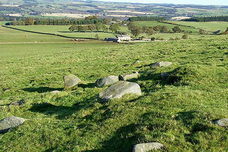
Click image to see photo description.
A circular walk from Simonburn exploring the pleasant rural countryside to the south of the village. The route includes a section of Hadrian's Wall from Brocolitia to an un-excavated Roman Camp just east of milecastle 30. The walk includes a section of the Hadrian's Wall Path and some well-preserved sections of the wall.
The start is the car park opposite St Mungo's Church in Simonburn (grid ref. NY871736). Exit the car park and turn right to the village green. Turn left along Castle Lane, continue past a row of cottages on your left, then fork left by the notice board on a tree. Continue along the lane for 600 metres to the edge of woodland. Cross the small bridge and continue ahead on a track (signed Fenwickfield). Continue along the track to exit the trees and reach Fenwickfield Farm (grid ref. NY853736).
Turn left (not signed) on a bridleway, aiming for the far corner of the plantation on your right. Cross a stream and stile and maintain direction on the left-hand side of a strip of woodland. Exit to a lane near Greehhaugh. Turn left and continue to the end of the lane (grid ref. NY851728). Turn right over stile by fingerpost and maintain direction down an enclosed track for 1.5 kilometres to reach the B6318. Cross the road and take ladder stile opposite and continue along the Hadrian's Wall Path to Bricoliltia and Mithraeum (Temple of Mithras).
From Bricolitia the path returns towards the road to exit onto the road at a wall stile. Turn left along the road and almost immediately right down a track. Turn right over the stile and continue along the Hadrian's Wall Path which runs parallel to the road. The view to your left is across the North Tyne Valley with the Cheviot Hills in the distance. As you make progress there is more evidence of the defensive earthworks and some sections of the wall.
Reaching a lane (grid ref. NY883713), turn left and continue along this quiet by-way to pass Sharpley Farm on your right. Continue walking north for 750 metres and follow the lane as it bends left to a junction (grid ref. NY875730). Turn right and follow this lane back passing Hall Barns on your left into Simonburn. Cross the river bridge and bear left back to the start.
Maps 

| Ordnance Survey Explorer OL43 | Sheet Map | 1:25k | BUY |
| Anquet OS Explorer OL43 | Digital Map | 1:25k | BUY |
| Ordnance Survey Digital Map Subscription | |||
| Latest Ordnance Survey Discounts | |||
Other walks nearby
| Walk 2803 | Hadrian's Wall and Haughton Common | hard | 20.0 miles |
| Walk 3331 | Cragend & Crow Crags from Housesteads | easy/mod | 8.4 miles |
| Walk 1477 | Bellingham to Kiln Rigg by Pennine Way Circular | moderate | 14.3 miles |
| Walk 1478 | Ladyhill to Bellingham circular | moderate | 16.0 miles |
| Walk 1677 | Peel Crags & Winshield Crags from Vindolanda | easy/mod | 7.8 miles |
| Walk 2671 | Hotbank Crags & Housesteads from Vindolanda | easy | 5.3 miles |
| Walk 1198 | Hadrian's Wall & Steel Rigg | moderate | 8.0 miles |
| Walk 2337 | Greenlee Lough and Steel Rigg | easy/mod | 7.5 miles |
| Walk 3404 | Hadrian's Wall - Cawfields to Steel Rigg | easy/mod | 3.5 miles |
| Walk 1987 | Allendale Town Circular | easy/mod | 6.6 miles |
Recommended Books & eBooks
Walking in Northumberland
 This guidebook contains detailed route descriptions for 36 day walks in Northumberland including the Cheviot Hills. The terrain varies from wild walks and craggy ascents to gentle riverside strolls. Each route ranges from 4 to 16 miles in length and there is the opportunity to link several walks together to create longer treks.
More information
Hadrian's Wall Path
 Hadrians Wall Path guidebook to walk the 84 mile National Trail. Described in both directions, the main description is west to east between Bowness-on-Solway and Wallsend, Newcastle, with extensions to Maryport and South Shields. With extensive historical information related to this World Heritage site and separate 1:25,000 OS map booklet included.
More information
