Hertfordshire Way between Chipperfield and Bovingdon
Hertfordshire Walk
County/Area - Hertfordshire
Author - Donald Morton
Length - 7.5 miles / 12.2 km Ascent - 500 feet / 152 metres
Time - 4 hours 20 minutes Grade - easy/mod
Maps 

| Ordnance Survey Landranger 166 | Sheet Map | 1:50k | BUY |
| Anquet OS Landranger 166 | Digital Map | 1:50k | BUY |
Walk Route Description
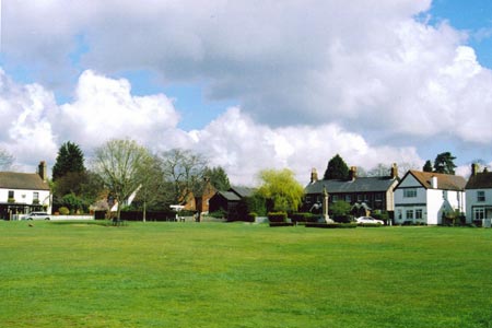
Click image to visit gallery of 5 images.
There are two car parks at Chipperfield Common - one outside the church and one parallel to the road facing the cricket pitch and opposite the pavilion. This walk description starts from the latter (Grid Ref TL045015). (Optionally the walk could be started from Bovingdon well-house– see below)
Facing the cricket pitch, back to the road, turn left to the corner of the pitch and follow the path into the woods (easy access route, local path no 8). Follow this broad obvious path straight through the woods, ignoring paths to left and right, (but noticing a fine 400 year old sweet chestnut on the right and further along on left and right low Bronze Age grave mounds, previously quite missable but now made prominent by recent fencing) until reaching the Apostles Pond with its 12 new lime trees planted in the 1980s and rather fewer old trees from the early 18th Century. Pass to the left of the pond and on reaching a cross track turn right still on the easy access route.
You are now on the Hertfordshire Way (although it is only signed in the opposite direction) which will take you all the way to Bovingdon. Follow the broad bridleway running just inside the woods, and now local path 3, straight on past a sign to a sweet chestnut and through a gate. Again go straight on, ignoring paths left and right still on path 3 (and leaving the easy access path which turns right). Pass White Oaks, Mahogany Hall and Penmans End and continue straight on. Pass through a fence and go straight on still on path 3 down to a lane: care - look right but turn left and left again along the main road which runs along the bottom of the valley.
Soon turn right onto a footpath signed to Holly Hedges Lane. Go up the field edge and at the top continue straight on into woods. The path goes just inside the woods until it goes down to a bottom where paths cross: go straight on to a waymark and here turn left onto a track with a parallel footpath: the track may be muddier; the footpath is more sinuous; they both come out at the same point on Holly Hedges Lane. Turn right down this quiet lane: pass a bridleway on the right and soon after passing Hollow Hedges cottage on the right and the Chiltern Way footpath sign pointing left, you come to a crossing path with a finger post on the right. Again there is a Chiltern Way sign pointing left as well as back down the lane. This is the cross over point of the figure of eight (Grid Ref TL 023 017). (If you want to return directly to Chipperfield turn right at this point – see below.) The full walk carries straight on down the lane.
At the T junction at the end of the lane cross the road and continue straight on up the footpath. This is signed as the Chiltern Way and you will be on this - as well as the Hertfordshire Way - until you come to Bovingdon. It starts off on the edge of a field, hedge on left. At the next finger post continue on with the Chiltern Way. Where the hedge ends, bear right diagonally across a field to a hedge corner on the opposite side. There bear left to follow the hedge on your right. Go through a metal kissing gate, down an enclosed path, through a gate, bear right to follow a fence to another gate. Go through this, down an enclosed path and through a final kissing gate to emerge in a small housing estate. Turn right and follow the road out to the main road.
Turn left down the road to the cross roads with its wooden well-house, an 1881 memorial to local worthy Sir Granville Ryder. On one corner is the Bull, a little further on the Bell and going up the high street two convenience stores, a wine shop, two butchers (one with the old sign butcher and grazier on the front facade, a reminder of the time when butchers really were butchers of their own fattened animals), a greengrocers, a hardware shop, a chippy, and a Chinese - not bad for a village within 3 miles of Hemel Hempstead "sheds". (Parking in Bovingdon is unrestricted if you can find a place: if you want to start the walk from here, wherever you park walk downhill to find the crossroads with the well-house.)
At the cross roads turn up Green Lane. This is lined with houses but not without interest, since most are individually designed late 20th Century with a few 1930s bungalows and one block of Victorian cottages, which must originally have been surrounded by fields. At the end of the houses you reach Bovingdon Green where the road divides. Take the left hand fork and proceed with the green on the right and more, rather larger, houses on the left. Where the road divides into three take the appropriately named Middle Lane to the right of the Royal Oak. Walk down this quiet lane until you come to the T junction at Venus Hill. Turn left. At the next T junction turn right and immediately left up a driveway signed public footpath 15 to Tower Hill. Do not enter the yard but fork left to follow an enclosed footpath to a kissing gate. Through this, go straight on down the field edge, hedge on left to a second kissing gate, and then straight on over a field to a set of large metal gates seen on the opposite side.
Go through the gates into the lane. You are once more at the cross over point of the figure of eight. (Those who started at Bovingdon and wish to curtail the walk at this point should turn left to return to Bovingdon – see above). The full walk carries straight on over the lane and into the field the other side.
Walk along the field edge, hedge on right. At the field end dog leg through the hedge and continue with the hedge on the left. A farmhouse comes into view ahead. At one time the footpath went through the back yard as footpaths were designed to do but many years ago the then owner had it diverted. So at the end of the hedge turn left along a field edge, hedge on right; when the field behind the hedge finishes turn right through a hedge gap and along the field edge; cross the access road and strike diagonally right across the field (it should be said that thus far this path has always been restored after ploughing and planting but it is a ploughed field so after much rain ...). Join the original path on the other side; turn left and in about 100yds at a finger post turn right, along a field break, then hedge, then field break. At the end go through a new metal kissing gate and down a field edge - hedge on right. Half way down pass into the neighbouring field and continue, hedge left, to the woods ahead. Go through another kissing gate to follow the path through the woods.
On emerging continue straight on following the edges of two fields down to a road. Cross the road with care, go through a kissing gate and slightly right diagonally up the field (aim for the left end of the line of trees at the top). Go through the gate and down a narrow enclosed path to arrive at a road. The Windmill pub is just to the right, a pair of 1725 cottages to the left. You go left passing two more parking areas on the right and the Blackwell Cafe on the left. When you arrive at the Green, The Two Brewers is on the left and the start of the walk diagonally right across the Green.
Other walks nearby
| Walk 2907 | Hemel Hempstead Circular | easy | 6.5 miles |
| Walk 3537 | Hemel Hempstead, Great Gaddesden, Nettleden & Potten End | moderate | 10.8 miles |
| Walk 2062 | Cassiobury Park & Grand Union Canal, Watford | easy | 2.0 miles |
| Walk 1071 | Chalfont & Latimer, Chalfont St Giles & Chorleywood | easy/mod | 12.6 miles |
| Walk 1536 | Sarratt Bottom and Chenies from Little Chalfont | easy/mod | 6.3 miles |
| Walk 1568 | Chalfont and Latimer, Flaunden and Chorleywood | moderate | 11.7 miles |
| Walk 3443 | Chalfont & Latimer, Latimer and Flaunden | moderate | 13.7 miles |
| Walk 1931 | Rickmansworth circular via Croxley Green and Watford | easy/mod | 7.0 miles |
| Walk 1504 | Potten End Circular | easy/mod | 6.0 miles |
| Walk 2369 | Chesham & Little Missenden Circular | easy/mod | 9.4 miles |
Recommended Books & eBooks
No suggestions for this area.Messaging & Social Media
Message Walking Britain and follow the latest news.

Mountain Weather
Stay safe on the mountains with detailed weather forecasts - for iOS devices or for Android devices.