Wheeldale Moor circular
North York Moors Walk
Nat Park - North York Moors - North York Moors East
County/Area - North Yorkshire
Author - Andy Chaplin
Length - 11.3 miles / 18.4 km Ascent - 820 feet / 248 metres
Time - 6 hours 30 minutes Grade - moderate
Walk Route Description
Click image to visit gallery of 3 images.
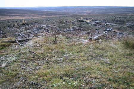
The last 4 miles of this North York Moors walk across White Moor then Wheeldale Moor, where there are remarkably few rights of way, adds a sense of isolation to this route which is heightened by the fact that you walk this four miles, not on a shooting track or a flagged footpath, but rather, on a simple walkers' path across the open-access moorland. Coming south from Egton Bridge there is a reasonable amount of off road parking just after the Wheeldale Bridge river ford at SE801968. Walk south on the Keys Beck road to the ford over the Keys Beck then turn off right into Cropton Forest on the forest track.
The track is relatively open as it is on the northern edge of the forest. It continues westwards until it meets another track/path where you go right and head north. It is signed at this junction as a right-of-way path and this signing continues as the path follows tracks off left past a ruined shooting house then right/north again. Watch out for the path marker at SE767969 which takes you off the forest roads and onto a path heading westwards.
This path, which descends through the trees, comes out at a gate where the map-marked footpath across the heath is not well defined and the subsequent bridleway is also difficult to follow. There is a stone bridge/path over the Priest's Sike Slack but it is easy to get over at most points so don't worry if you don't find it. Either way, cross the stream then head to the left of the trees in the wire-fenced field to the north of you. You should find a grass farm-track that will lead to a gate to the open country north of Howth Rigg.
Pass through the gate and the farm track then heads north-east past a stone-walled enclosure with an old farm barn and then continues on to the road. Go right on the road for 300m then find the path off to the right. It is not a right of way so is not signed but its start is marked by an open country marker post.
The path follows a series of boundary stones as it heads westwards back across White Moor. It is easy to follow but can be boggy and often looks like a stream. There are sections where matting has been used to make a track but it has degraded. Even more unhelpful are wooden walkways that resemble piers as they start and end in the middle of boggy ponds. The path is worse up to the Blue Man i' th' Moss stone and then gets better as it heads towards Bumble Wood. As you come back to the Wheeldale road it is still quite difficult walking - boggy when wet and rocky all the time.
If in doubt, when paths branch or diverge, keep walking towards the RAF Fylingdales building which is visible ahead of you across the moors. At the road turn right and walk down to the ford and parking.
Maps 

| Ordnance Survey Explorer OL27 | Sheet Map | 1:25k | BUY |
| Anquet OS Explorer OL27 | Digital Map | 1:25k | BUY |
| Ordnance Survey Digital Map Subscription | |||
| Latest Ordnance Survey Discounts | |||
Other walks nearby
| Walk 2563 | Egton Bridge & Grosmont from Goathland | moderate | 12.5 miles |
| Walk 3533 | Mallyan Spout and Beck Hole from Goathland | easy | 3.0 miles |
| Walk 2262 | Goathland & Grosmont | easy/mod | 7.7 miles |
| Walk 1922 | Goathland & Howl Moors | moderate | 11.2 miles |
| Walk 1397 | Hole of Horcum from Levisham Station | easy/mod | 8.5 miles |
| Walk 3534 | Dundale Pond & Hole of Horcum from Saltergate | easy/mod | 5.2 miles |
| Walk 1602 | Saltergate, Fylingdales & Allerston High Moor | moderate | 11.5 miles |
| Walk 2077 | Glaisdale Moor circular | moderate | 11.9 miles |
| Walk 3337 | Dundale Pond from Levisham | easy | 4.8 miles |
| Walk 3585 | Skelton Tower & Hole of Horcum from Levisham | easy/mod | 7.4 miles |
Recommended Books & eBooks
Trail and Fell Running in the Yorkshire Dales
 Guidebook to 40 of the best trail and fell runs in the Yorkshire Dales National Park. Ranging from 5 to 24 miles, the graded runs start from bases such as Ribblehead, Dent, Sedbergh, Malham and Grassington and take in the region's diverse delights, from castles and waterfalls to iconic mountains such as Whernside, Ingleborough and Pen Y Ghent.
More information
