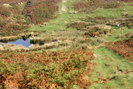
Dundale Pond from Levisham
North York Moors Walk
Nat Park - North York Moors - North York Moors East
County/Area - North Yorkshire
Author - Lou Johnson
Length - 4.8 miles / 7.8 km Ascent - 750 feet / 227 metres
Time - 3 hours 10 minutes Grade - easy
Walk Route Description
Click image to see photo description.
This short circular North York Moors walk starts from the village of Levisham (grid ref. SE831906) where limited parking is available. Do remember to park with courtesy so that residents' access is not inhibited. The village does still have a pub, the Horseshoe Inn, where your patronage will be welcome.
After parking walk west along the no through road continuing onto a footpath that continues to the edge of Keldgate Slack Wood (grid ref. SE824905). Turn right on the path down the incline before turning left up to Levisham Station on the North York Moors steam railway. If you are lucky you will see steam trains in operation. Walk north up the road towards Levisham, talking the path to Dundale Pond at grid ref. SE828918).
From Dundale Pond continue east along Dundale Griff towards Levisham Beck. After approximately one kilometre along this path you reach a junction (grid ref. SE838917). Turn right signed to Levisham and follow the woodland path until you reach a road (grid ref SE832902). Turn right along this road back into the Levisham.
Maps 

| Ordnance Survey Explorer OL27 | Sheet Map | 1:25k | BUY |
| Anquet OS Explorer OL27 | Digital Map | 1:25k | BUY |
| Ordnance Survey Digital Map Subscription | |||
| Latest Ordnance Survey Discounts | |||
Other walks nearby
| Walk 1397 | Hole of Horcum from Levisham Station | easy/mod | 8.5 miles |
| Walk 1396 | Hole of Horcum and Saltergate Brow from Lockton | moderate | 10.3 miles |
| Walk 1867 | Hole of Horcum & Bridestones from Lockton | moderate | 9.8 miles |
| Walk 3534 | Dundale Pond & Hole of Horcum from Saltergate | easy/mod | 5.2 miles |
| Walk 1602 | Saltergate, Fylingdales & Allerston High Moor | moderate | 11.5 miles |
| Walk 2665 | Cawthorne Roman Camp Circular | moderate | 12.2 miles |
| Walk 1930 | Wheeldale Moor circular | moderate | 11.3 miles |
| Walk 1922 | Goathland & Howl Moors | moderate | 11.2 miles |
| Walk 2325 | Troutsdale Circular | moderate | 10.1 miles |
| Walk 2563 | Egton Bridge & Grosmont from Goathland | moderate | 12.5 miles |
Recommended Books & eBooks
Trail and Fell Running in the Yorkshire Dales
 Guidebook to 40 of the best trail and fell runs in the Yorkshire Dales National Park. Ranging from 5 to 24 miles, the graded runs start from bases such as Ribblehead, Dent, Sedbergh, Malham and Grassington and take in the region's diverse delights, from castles and waterfalls to iconic mountains such as Whernside, Ingleborough and Pen Y Ghent.
More information
