River Don & New Junction Canal from Fishlake
South Yorkshire Walk
County/Area - South Yorkshire - Doncaster Rotherham
Author - Andy Chaplin
Length - 12.6 miles / 20.5 km Ascent - 100 feet / 30 metres
Time - 6 hours 20 minutes Grade - moderate
Maps 

| Ordnance Survey Explorer 279 | Sheet Map | 1:25k | BUY |
| Anquet OS Explorer 279 | Digital Map | 1:25k | BUY |
Walk Route Description
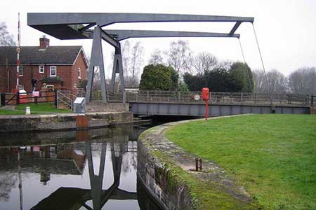
Click image to visit gallery of 3 images.
The walk starts in Fishlake, north of Doncaster, where there is a reasonable sized lay-by in the village at grid ref. SE654131 and some parking around the Hare and Hounds pub nearby. Although it is a relatively long walk it is easy to follow and the paths alongside the river and canal make for quick walking.
Walk towards the church and when you have just passed the hare & Hounds pub go right on a footpath towards the Don. The best view of the river - and easiest walking - is on the top of the flood defence bank nearest to the river. Walk east then north along the river for 3.75 miles, passing the Ferry Road bridge and the houses on Cowick Road, then turn left on Oak Lane and walk west for a mile and a half, through Pincheon Green, to the New Junction Canal.
Follow the canal paths all the way to Low Lane near Kirk Bramwith. Then continue on the footpath at the side of the canal down to the aqueduct over the Don. There is a footbridge over the canal here where you can cross and then take the path on the south side of the river to the Low Lane bridge over the Don. At this point you have the river on your left and the Stainforth & Keadby canal on the right.
Cross over the Don and take the path on the right along the flood defence bank back towards Fishlake. Before Stainforth you pass a loop of the course of the old river. At the Fishlake Nab road bridge it is possible to go straight on, over the fence and by the side of the river and behind the houses, or go left up Fishlake Nab road and over a stile just past the houses.
When you come near to Fishlake there is a path off to the left, coming down from the flood defence bank, which leads down behind the Old Anchor pub to Main Street in Fishlake.
Other walks nearby
| Walk 1755 | Hooton Pagnell circular | easy/mod | 9.8 miles |
| Walk 3627 | Epworth Circular | easy | 6.4 miles |
| Walk 3397 | High Melton & Cusworth Hall | moderate | 12.0 miles |
| Walk 2113 | Haxey, Westwoodside & the Turbary | easy/mod | 7.0 miles |
| Walk 3566 | Alkborough & Winteringham from Whitton | easy/mod | 9.4 miles |
| Walk 2717 | Wentworth Woodhouse and its follies | easy/mod | 7.5 miles |
| Walk 2943 | Newmillerdam Country Park from Notton | easy | 5.7 miles |
| Walk 1937 | Morthen & Upper Whiston from Ulley | easy/mod | 8.8 miles |
| Walk 1760 | Pocklington Canal, Melbourne & East Cottingwith | easy/mod | 11.0 miles |
| Walk 2141 | Brantingham & Elloughton Dale | easy/mod | 5.7 miles |
Recommended Books & eBooks
No suggestions for this area.Messaging & Social Media
Message Walking Britain and follow the latest news.

Mountain Weather
Stay safe on the mountains with detailed weather forecasts - for iOS devices or for Android devices.