Brantingham & Elloughton Dale
Yorkshire Wolds Walk
Region - Yorkshire Wolds
County/Area - East Yorkshire
Author - Lou Johnson
Length - 5.7 miles / 9.3 km Ascent - 790 feet / 239 metres
Time - 3 hours 40 minutes Grade - easy/mod
Walk Route Description
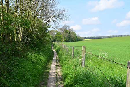
Click image to see photo description.
Yorkshire Wolds walk from Brantingham, which lies near the A63 northwest of Hull. The Wolds is an area of upland farmland dissected by steep sided dry valleys cut into the plateau. This route uses sections of the Yorkshire Wolds Way and the High Hunsley Circuit long distance footpaths.
The start is a small layby by the telephone box beside the green in Brantingham (grid ref. SE941296). After parking walk east along Main Road using the pavement on the south side. Continue ahead to the next junction (with a small green in the junction. Bear right here up Spout Hill. Continue up the lane for 600 metres and take the first footpath on the right. Pass through a metal gate and continue along the path in woodland. After 700 metres the path turns right and shortly after, at a path junction, it heads left to reach a lane in Elloughton Dale (grid ref. SE953289).
Turn left and after 300 metres turn right up steps onto the High Hunsley Circuit. Continue ahead, ignoring a footpath on the right, and remain on the HHC to reach a kissing gate and Wauldby Road (grid ref. SE964288). Turn left along the grass verge and after 400 metres turn right down a concrete track with trees to your right. Continue along the track for about 400 metres past a small wood on the left and turn left onto the Yorkshire Wolds Way (grid ref. SE969293). Continue downhill along the left-hand side of a field with trees also on your left. Reaching a T-junction of tracks (by a pond on your left), bear left and follow the track as it bends right past Wauldby Manor Farm and continues north. Shortly after the track bends right you reach a cross track at Turtle Hill (grid ref. SE972305).
Turn left still following the Yorkshire Wolds Way. Pass Bottom Plantation on your right to reach a road. Go straight across to follow a lane. Where the lane bends left, continue ahead along a broad gravel track. Soon after joining this track you reach the highest elevation of the walk which is followed by a steady descent into Brantingham.
Maps 

| Ordnance Survey Explorer 293 | Sheet Map | 1:25k | BUY |
| Anquet OS Explorer 293 | Digital Map | 1:25k | BUY |
| Ordnance Survey Digital Map Subscription | |||
| Latest Ordnance Survey Discounts | |||
Other walks nearby
| Walk 3566 | Alkborough & Winteringham from Whitton | easy/mod | 9.4 miles |
| Walk 1414 | Barton and Barrow-on-Humber | easy/mod | 8.3 miles |
| Walk 1575 | Tophill Reservoir | easy | 3.0 miles |
| Walk 1760 | Pocklington Canal, Melbourne & East Cottingwith | easy/mod | 11.0 miles |
| Walk 3127 | Bishop Wilton & Millington | moderate | 13.4 miles |
| Walk 2727 | Pocklington Canal from Allerthorpe Wood | moderate | 11.0 miles |
| Walk 3349 | Pasture Dale, Frendal Dale and Horsedale from Huggate | easy/mod | 9.1 miles |
| Walk 1779 | Horse Dale, Holm Dale, Tun Dale and Frendal Dale from Huggate | easy/mod | 9.0 miles |
| Walk 2655 | Wayram To Fridaythorpe Circular | easy/mod | 7.5 miles |
| Walk 2906 | Circular from Wayrham Through Painsthorpe | moderate | 8.5 miles |
