Golden Valley - Hardwicke to Dorstone
Herefordshire Walk
County/Area - Herefordshire
Author - Lou Johnson
Length - 11.4 miles / 18.5 km Ascent - 1600 feet / 485 metres
Time - 7 hours 20 minutes Grade - moderate
Walk Route Description
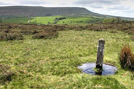
Click image to see photo description.
This linear walk explores two ridges of hills lying between the Wye Valley and the Black Mountains in the Brecon Beacons National Park. The route also threads its way through some beautiful Herefordshire countryside which forms part of the Golden Valley. To complete the walk a bus service is used between Dorstone and Hardwicke. Note that this service (Hereford to Hay-on-Wye) does not operate on Sundays. A short version of this walk can be found at Walk 1950.
On street parking is available by the village green in Dorstone (grid ref. SO313417). The bus stop is adjacent to the village green. The bus takes about ten minutes to reach Hardwicke at the junction of the B4348 and B4352). After alighting walk towards Hay-on-Wye and after 100 metres take the signed footpath on the left. Continue straight across the first field and then head half-right across the next to near the far right-hand corner. In the third field walk half-right and cross a stream into the next field. The path continues south across two more fields passing to the right of Mill Cottage. The path continues southwest to reach a stile by a metal gate and a lane (grid ref. SO261424).
Turn left and take the first path on the right (fingerpost adjacent to telegraph pole). Follow the hedge (on your left) across a field. Reaching a path junction continue ahead to a finger post in the hedge and a lane. Turn right and continue along the lane for 600 metres to a road junction (grid ref. SO254418). Turn left (signed Michaelchurch) and follow the lane uphill. Stay on this lane for just under two kilometres to reach a solitary house on the left (New House). Just beyond the house turn right onto a track into New House Wood (grid ref. SO267401).
Follow the main track to a junction. Ignore the track on the right. Continue for 25 metres to a footbridge and follow a path through conifers to exit onto Cefn Hill Common. The grassy rises to the summit from where you can enjoy an excellent view to the right including Hay Bluff. Continue across the common on the grassy path for two kilometres to reach a junction of bridleways (grid ref. SO282376). Bear left, cross a stile and follow the path downhill to reach a lane by Llanrosser Chapel (grid ref. SO289377). Turn left and then right at the first junction.
Continue to the entrance to Pike's Farm (grid ref. SO292381). Turn right onto a track and cross the stile on the left. Walk half-left across the field to the far right-hand corner and exit onto a lane. Cross the road to an information board and fingerpost, cross the adjacent stile onto Vagar Hill Common. Follow the grassy path for 120 metres and fork left and head uphill to the highest point. As you make progress uphill veer towards the right-hand edge of the common. Continue along a walled path to the right of the abandoned Gils Farm and continue along a rough grassy track to a gate (grid ref. SO267396) marking the northern end of the common.
Turn right and follow the track along the right-hand side of the field. Pass the radio mast and follow a clear track downhill to a crossroads. Turn right and continue to a fingerpost on the left. Cross West Lawn Common to reach an enclosed track on the right (grid ref. SO306401). Continue downhill along the track to reach a tarmac track. Bear left and follow the track into Snodhill. Keep left at the road junction and turn left onto the Herefordshire Trail (grid ref. SO319404). The path leads across several fields to reach a gate Pitt Lane. Turn right and continue to a T-junction. Turn left back to the village green in Dorstone.
Maps 

| Ordnance Survey Explorer OL13 | Sheet Map | 1:25k | BUY |
| Anquet OS Explorer OL13 | Digital Map | 1:25k | BUY |
| Ordnance Survey Digital Map Subscription | |||
| Latest Ordnance Survey Discounts | |||
Other walks nearby
| Walk 1957 | Cefn Hill & Vagar Hill - Golden Valley | easy/mod | 5.5 miles |
| Walk 1660 | Craswall Priory & Hay Bluff | easy/mod | 6.0 miles |
| Walk 1238 | Hay Bluff & Twmpa Circular | moderate | 6.0 miles |
| Walk 3204 | Hay Bluff & Twmpa | moderate | 10.3 miles |
| Walk 2935 | Llanthony Priory from Capel-y-ffin | easy/mod | 7.7 miles |
| Walk 3622 | Llanthony Priory from Longtown | mod/hard | 7.0 miles |
| Walk 1237 | Cwmyoy & Hatterrall Hill from Llanthony Priory | moderate | 10.0 miles |
| Walk 3203 | Vale of Ewyas from Llanthony Abbey | moderate | 10.7 miles |
| Walk 3342 | The Hatterall Ridge from Llanthony Priory | very hard | 10.0 miles |
| Walk 3285 | The Hergest Ridge and Huntington from Kington | moderate | 12.0 miles |
