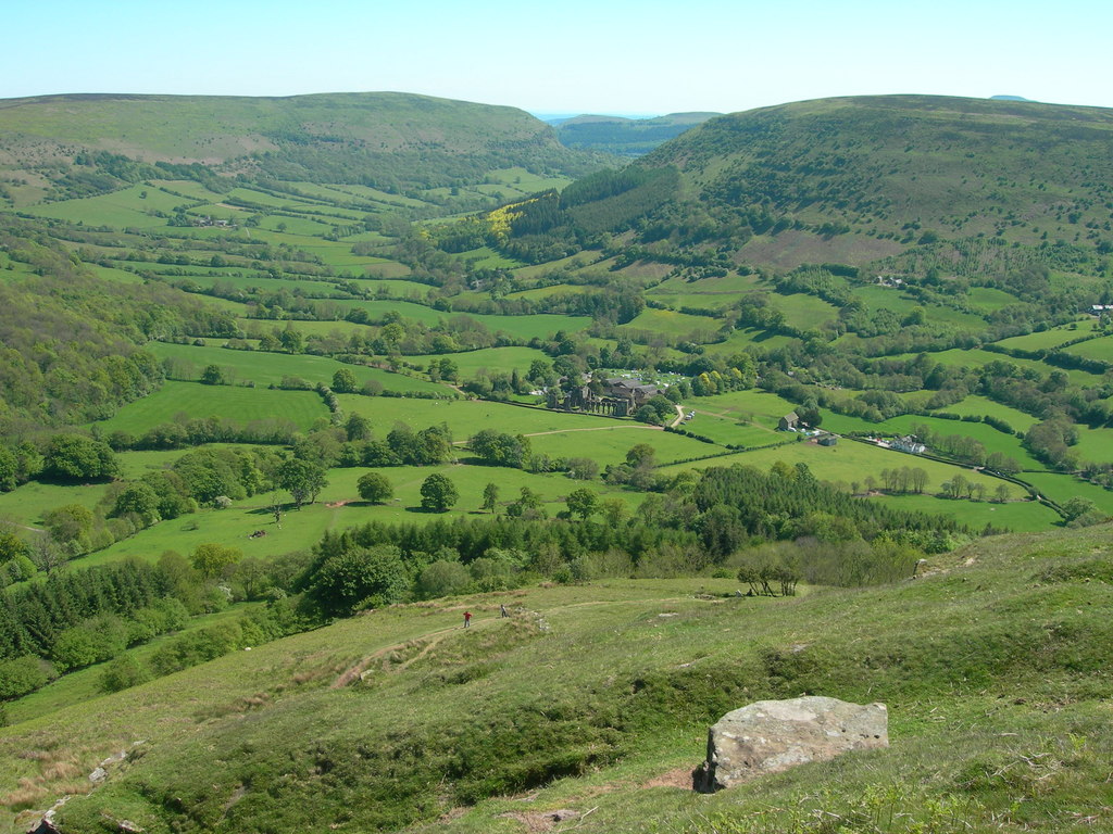
Llanthony Priory from Longtown
Brecon Beacons/Bannau Brycheiniog Walk
Nat Park - Brecon Beacons - Brecon Beacons East
County/Area - Herefordshire & Monmouthshire
Author - Lou Johnson
Length - 7.0 miles / 11.4 km Ascent - 2100 feet / 636 metres
Time - 5 hours 40 minutes Grade - mod/hard
Walk Route Description
Click image to see photo description.
This energetic walk starts from Longtown in Herefordshire and crosses the Hatterrall ridge before descending to Llanthony Priory in the Vale of Ewyas. The return route re-crosses the ridge before returning to the start. Despite its relatively short length, this is an energetic walk involving considerable ascent with the climb out of the Vale Ewyas being steep and unrelenting. Some parts of the route need careful navigation and a 1:25k OS map is essential. As recompense the views from the higher ground are superb covering the Black Mountains to the west and most of Herefordshire to the east.
A suitable place to park is the lay-by opposite the village hall in Longtown (grid ref. SO322290). After parking walk back to the village hall (on your left) and enter the car park. Cross the stile on the left. Walk through the field with the hedge on your right. Enter the next field and after a few metres go half right. Maintain direction across a small field and then head half right across another field to cross a footbridge (grid ref. SO320288) to reach an access track. Turn left along the access track and continue through Cayo Farm keeping the buildings on your left.
The onward path runs parallel to hedges on your right across several fields for 800 metres. The path then veers half left across the field to a track enclosed by hedges (grid ref. SO310280). Go straight over a cross track and then walk half left onto a clearer path heading uphill diagonally across the hillside. Just below the top of the ridge the track forks. Bear right to reach the Offa's Dyke Path, by a small marker stone, running along the ridge (grid ref. SO308269). You are now on the England Wales border.
Go straight over the ODP and follow path going downhill which slants across the hillside. You are now on the Beacons Way. The path is soon joined by a wall on the left. The wall is replaced by a fence and continue down the clear path to reach a fingerpost (grid ref. SO295279). Turn left and descend to a wood. The path continues half right through the wood. Exit the wood a follow the path across a field to a gate. Follow the path with wall and Llanthony Priory on your left. Turn left through a gate with three-way finger post adjacent and continue to the Priory and refreshments in season.
To start the return route, retrace your steps back to the gate and three-way fingerpost. Follow the clear track to Hatterrall Ridge North. At the next finger post by a tree stump go left signed All Routes. Go through a gate and continue uphill. Go through a gap in the fence by a fingerpost (grid ref. SO289282) into a field. Halfway across the field leave the main path and swing down to a building. Cross a stile and a stream and after the next stile bear left and head uphill aiming left of some trees to a stile (grid ref. SO291286). Using sheep-trods and feint paths make your way up the steep slope to a derelict wall using zigzags to ease the workload. Just beyond the wall a clearer path traverses across the hillside to reach a wide track along the ridge - the Offa's Dyke Path (grid ref. SO298285).
Because of the multitude of paths and sheep-trods on the uphill section, the precise point you reach the ridge maybe different. With careful navigation and the aid of a GPS you should be able to locate the descending path. However, if in doubt walk to the east side of the ridge and check your location against the OS map.
If you have reached the ridge at SO298285, take the narrow path heading east from the ODP. This leads on to a wider path descending north across the hillside. Maintain direction for 600 metres to reach a path junction (grid ref. SO299191). Turn sharp right and continue the descent to reach a track at grid ref. SO203287. Turn left along the track to a lane. Turn right along the lane and continue for 700 metres (ignoring signed paths on either side) to reach a wooden gate with two fingerposts on the right. Take the left-hand path heading straight across a field. The route crosses an old enclosed track and maintains direction across another field passing a small pond on your right (grid ref. SO312292).
Go half-right across the next field to a gate. For a brief section you walk alongside a small stream on your left. Then go straight across to a footbridge (grid ref. SO315292). Once across the bridge go half right across the field. Maintain direction across two more fields. Entering another field aim for the far-left hand hedge and follow the path alongside Longtown Castle to reach the road. Turn right back to the start.
Maps 

| Ordnance Survey Explorer OL13 | Sheet Map | 1:25k | BUY |
| Anquet OS Explorer OL13 | Digital Map | 1:25k | BUY |
| Ordnance Survey Digital Map Subscription | |||
| Latest Ordnance Survey Discounts | |||
Other walks nearby
| Walk 1237 | Cwmyoy & Hatterrall Hill from Llanthony Priory | moderate | 10.0 miles |
| Walk 3203 | Vale of Ewyas from Llanthony Abbey | moderate | 10.7 miles |
| Walk 3342 | The Hatterall Ridge from Llanthony Priory | very hard | 10.0 miles |
| Walk 3204 | Hay Bluff & Twmpa | moderate | 10.3 miles |
| Walk 2935 | Llanthony Priory from Capel-y-ffin | easy/mod | 7.7 miles |
| Walk 1660 | Craswall Priory & Hay Bluff | easy/mod | 6.0 miles |
| Walk 3723 | Garway Hill from Kentchurch | easy/mod | 6.4 miles |
| Walk 1238 | Hay Bluff & Twmpa Circular | moderate | 6.0 miles |
| Walk 1957 | Cefn Hill & Vagar Hill - Golden Valley | easy/mod | 5.5 miles |
| Walk 2670 | Ysgyryd Fawr (The Skirrid) near Abergavenny | easy/mod | 3.5 miles |
Recommended Books & eBooks
Walking on the Brecon Beacons
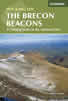 45 circular day walks are described in this guidebook to the Brecon Beacons National Park. From west to east, Mynydd Du, Fforest Fawr, the Brecon Beacons and the Black Mountains these mountain and valley routes offer many options, highlighting the natural features. The walks described explore dramatic waterfalls, wooded gorges and upland valleys.
More information
Walking in Carmarthenshire
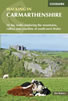 Guidebook to 30 walking routes (2 to 10 miles) in Carmarthenshire, south Wales, including sections of Carmarthenshire Coast Path. Walks for all abilities, including coastal, river, forest and hill walks in Cambrian Mountains, Tywi Valley, Y Mynydd Du (Black Mountains) and Brecon Beacons. Easy access from Bristol, Cardiff and Swansea.
More information
