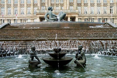
Farmer's Bridge Locks & Centenary Sq, Birmingham
West Midlands Walk
County/Area - West Midlands
Author - Lou Johnson
Length - 2.0 miles / 3.3 km
Ascent - nominal or unknown
Time - 1 hours 0 minutes Grade - easy
Walk Route Description
Click image to visit gallery of 12 images.
This city walk explores the northwestern sector of central Birmingham. It includes some of the city's most modern areas together with some of the city's rich industrial past. Birmingham is often quoted as having more canals than Venice although it might be argued the latter city does have a wealth of art and architecture that Birmingham lacks. Whatever your opinion Birmingham is 'going places' and this walk will explore some of its recent successes.
This route starts outside the Council House in Victoria Square (grid ref SP066869), which can be reached quite easily from most major car parks, the railway stations and by bus. With your back to the Council House and facing the 'Floozie in the Jacuzzi', turn left and left again into Eden Place with its mixture of modern and contemporary architecture. Continue straight ahead into Margaret Street to take the first right, Cornwall Street which is followed to the next junction. Do not cross Newhall Street but left and continue across the dual carriageway and down past Lionel and Fleet Streets to reach a bridge over the canal. Descend steps to the tow-path on the north side of the bridge.
You are now at the "Old Thirteen" or Farmer's Bridge Locks. Tightly constrained between buildings it is hard to imagine this was once a very busy section of the canal system. Go up the chain of locks with modern construction mixed with older buildings. There are also a number of informative signs explaining historical aspects of the canals.
Continue past Cambrian Wharf and under Tindal Bridge to reach a canal junction with many cast iron bridges crossing the canals. On your right is the National Indoor Arena with the Sea Life Centre opposite. Cross the first bridge to pass in front of the Malt House pub. The tow-path will take you on past the canal-side entrance of the ICC and Symphony Hall complex to pass under Broad Street to reach Gas Street Basin where many narrow-boats are usually moored. This was once one of the key locations on the canal network and where the Birmingham Canal Navigations and the Worcester and Birmingham canals met.
Return to the ICC entrance passed a few minutes earlier and go through the glass doors to enter the complex. Continue through the building to emerge into Centenary Square where a "big wheel" offers to give you a grand view of Birmingham. Cross the Square with the Birmingham Repertory Theatre on your left passing the Hall of Memory. Ahead the walk takes you through the much-maligned Central Library to emerge with the Town Hall on your right and the Council House to its left. Go between these two buildings to reach the start of the walk.
Maps 

| Ordnance Survey Explorer 220 | Sheet Map | 1:25k | BUY |
| Anquet OS Explorer 220 | Digital Map | 1:25k | BUY |
| Ordnance Survey Digital Map Subscription | |||
| Latest Ordnance Survey Discounts | |||
Other walks nearby
| Walk 3068 | Canal from Birmingham to Sandwell | moderate | 8.0 miles |
| Walk 1501 | Lickey Hills, Barnt Green and the Bittell Reservoirs | easy | 4.5 miles |
| Walk 2716 | Walton & Clent Hills from Nimmings Wood | easy | 3.5 miles |
| Walk 2667 | Barston Circular | easy | 4.3 miles |
| Walk 3683 | Hockley Heath and Packwood Circular | easy | 4.1 miles |
| Walk 3711 | Heronfield & Temple Balsall Circular | easy/mod | 7.2 miles |
| Walk 1614 | Meriden & Berkswell Circular | easy/mod | 8.0 miles |
| Walk 1713 | Packwood House Circular | easy | 4.0 miles |
| Walk 3689 | Balsall Common & Berkswell Circular | easy | 5.6 miles |
| Walk 2759 | Danzey Green Circular | easy | 5.0 miles |
