The Needles & Tennyson's Monument from Freshwater Bay
Isle of Wight AONB Walk
Region - Isle of Wight AONB
County/Area - Isle of Wight
Author - Lou Johnson
Length - 6.0 miles / 9.8 km Ascent - 600 feet / 182 metres
Time - 3 hours 40 minutes Grade - easy/mod
Walk Route Description
Click image to visit gallery of 12 images.
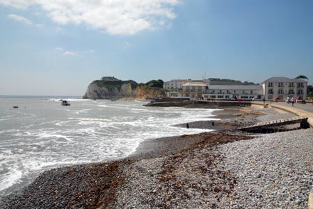
Starting from Freshwater Bay this walk crosses Tennyson Down to explores the wonderful chalk cliffs and downs at the western end of the Isle of Wight. The start is the pay and display car park in opposite the beach at Freshwater Bay (grid ref. SZ346858) just off the A3055.
After parking exit the car park to the beach. Facing the sea, turn right and walk along the road to the public conveniences and turn left up the signed footpath along a lane. This climbs steadily and quite soon you leave the lane for the open downs. Do remember there are high unprotected cliffs so care is needed with children. Following the clear path ahead you soon see the Tennyson Monument ahead of you. From here the view extends along the southern coast of the Isle of Wight.
From the monument there is a main ridge path veering slightly right and a lesser used green path that veers slightly to follow the cliffs more closely. Take the latter eventually reaching a stile in a wire fence (grid ref. SZ318851). Cross the stile and continue now with a fence between you and the cliffs. Continue in a westerly direction aiming for the radio mast ahead.
Cross the fence here, pass the radio station and drop down on a stony path to a concrete road. Bear left and then turn right on a concrete path to the observation point for the Needles. This area was used for rocket testing in the 1960s and 70s and there are some information boards detailing this piece of modern history. The observation post offers the best view of the Needles from the land.
Return to the concrete road and bear left. This will lead you round to the Needles Old Battery now managed by the National Trust. In season there are refreshments available here. To continue walk up to the old coastguard cottages and take the path that goes behind them. This leads you back onto the downs. Instead of dropping down to the clifftop path used on the outward route stay on the crest of the ridge. This path offers some excellent views across Alum Bay to the mainland.
Reaching a junction of paths at a fence (grid ref. SZ318853), bear slightly right and continue along the main ridge path to the Tennyson Monument. You have now rejoined the outward route and all that remains is a gentle descent to the start with some excellent views east along the coast.
Maps 

| Ordnance Survey Explorer OL29 | Sheet Map | 1:25k | BUY |
| Anquet OS Explorer OL29 | Digital Map | 1:25k | BUY |
| Ordnance Survey Digital Map Subscription | |||
| Latest Ordnance Survey Discounts | |||
Other walks nearby
| Walk 2223 | The Needles & Tennyson's Monument from Nodewell Farm | easy | 4.0 miles |
| Walk 2414 | Compton Down and Five Barrows from Compton Chine | easy/mod | 5.0 miles |
| Walk 1546 | Yarmouth, Freshwater and Norton from Yarmouth | easy | 5.0 miles |
| Walk 3541 | Keyhaven & Hurst Castle | easy | 3.3 miles |
| Walk 2435 | Compton Down circular | moderate | 12.5 miles |
| Walk 3142 | Bowcombe Down | easy | 4.8 miles |
| Walk 1601 | Bowcombe Down & Upper Watchingwell | easy/mod | 8.0 miles |
| Walk 1751 | St Catherine's Hill & Coastal Path | moderate | 6.7 miles |
| Walk 2916 | Gatcombe and Shorwell from Carisbrooke, IOW | moderate | 10.0 miles |
| Walk 3542 | RAF Beaulieu near East Boldre | easy | 5.1 miles |
