Around Dogmersfield on the Basingstoke Canal
Hampshire Walk
County/Area - Hampshire
Author - Peter Lane
Length - 3.0 miles / 4.9 km Ascent - 60 feet / 18 metres
Time - 1 hours 30 minutes Grade - easy
Walk Route Description
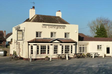
Click image to visit gallery of 3 images.
This leisurely walk (ideal for working off Sunday lunch) has the advantages of starting and finishing at a pub and has no hills to climb! It passes through the Dogmersfield estate and past the picturesque Tundry Pond.
The starting point is the public car park opposite the Barleymow Inn, just a few yards along Sprat's Hatch Lane, grid reference SU777538. Walk up to the Basingstoke Canal from the car park and turn right, under Sprat's Hatch Lane and following the towpath under Stacey's Bridge and Basely's Bridge all the way to the Sprat's Hatch Bridge. Cross over the bridge and follow the footpath past Sprat's Hatch Farm.
Shortly after the path turns sharp left at the farm, look out for a footpath on the right adjacent to the big iron gates to the estate. Follow this path, fenced at either side with pigs, cows and assorted farm animals to see until it joins the main drive. Shortly afterwards a metal gate to the left leads to Tundry Pond. Walk along the bank of this lovely lake all the way to the woods at the far end. Here turn right and follow the path over the canal bridge. Once across the bridge, take the towpath on the left back to the start point.
Maps 

| Ordnance Survey Explorer 144 | Sheet Map | 1:25k | BUY |
| Anquet OS Explorer 144 | Digital Map | 1:25k | BUY |
| Ordnance Survey Digital Map Subscription | |||
| Latest Ordnance Survey Discounts | |||
Other walks nearby
| Walk 1726 | Weston Corbett from Upton Grey | easy | 5.6 miles |
| Walk 3693 | Alton to Farnham using St Swithun's Way | moderate | 12.0 miles |
| Walk 1025 | Farleigh Wallop and Ellisfield | easy/mod | 6.5 miles |
| Walk 1847 | Silchester Common & Calleva Atrebatum | easy/mod | 6.2 miles |
| Walk 1128 | Bradley & Burkham Circular | easy | 5.5 miles |
| Walk 1976 | Noar Hill from Selborne | easy/mod | 5.0 miles |
| Walk 2459 | Upper Wield & Godsfield Circular | easy/mod | 6.7 miles |
| Walk 1901 | Around Aldermaston | easy | 5.0 miles |
| Walk 3082 | Sonning Eye & Shiplake circular | easy | 5.7 miles |
| Walk 1514 | Gibbet Hill & the Devil's Punch Bowl from Haslemere | easy/mod | 7.0 miles |
Recommended Books & eBooks
Walking Hampshire's Test Way
 Guidebook to walking the 71km (44 mile) Test Way in Hampshire from high on the chalk downs of Inkpen Beacon to the Eling Tide Mill near Southampton Water. Following the beautiful, crystal clear River Test, it passes picturesque villages and fascinating historic sites. Also includes 15 day walks to explore this lovely part of pastoral England.
More information
