 Walking Britain
Forth & Clyde Canal & Antonine Wall
North Lanarkshire Walk
County/Area - North Lanarkshire & East Dunbartonshire
Author - Rob Kay
Length - 6.0 miles / 9.8 km Ascent - 720 feet / 218 metres
Time - 3 hours 30 minutes Grade - easy
Walk Route Description
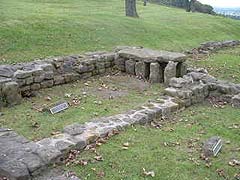
Click image to visit gallery of 5 images.
A circular, low-level route taking in some of the best sections of both the Forth & Clyde canal and the Roman Antonine Wall.
The walk starts at Auchinstarry Marina (grid ref. NS719769), a haven for many small craft, and proceeds along the canal towpath in an easterly direction for a mile and a half to Craigmarloch (Grid ref. NS737774). Turn right over the bridge and continue uphill towards Condorrat on the minor road for a couple of hundred yards then climbing steadily, follow the signs to the Antonine Wall and continue along the ridge to Croy for a couple of miles, with superb views over the Kilsyth Hills to the north. The Antonine Wall is clearly visible to your right as a deep ditch and embankment.
Past Croy, cross the main road and continue along the good path to Barr Hill for a mile, where you can view the excavated ruins of an excellent Roman fort with bath-house and underfloor heating. Continue downhill to Twechar - the excellent local pub offers liquid refreshment but no food. At Twechar turn right down to the canal swing bridge, turn right, and proceed along the canal for a mile or two back to Auchinstarry. A pub and hotel complex is being built and will offer food and accommodation from early 2007.
Maps 
| Ordnance Survey Explorer 349 | Sheet Map | 1:25k | BUY |
| Get Ordnance Survey Digital Map Subscription | |||
| Latest Ordnance Survey Discounts | |||
Other walks nearby
| Walk 2785 | Campsie Fells Horseshoe from near Lennoxtown | moderate | 6.0 miles |
| Walk 2552 | West Highland Way Experience | moderate | 95.0 miles |
| Walk 1490 | West Highland Way - A personal experience | moderate | 96.0 miles |
| Walk 1491 | WHW - Day 1 - Milngavie to Drymen | moderate | 12.0 miles |
| Walk 1557 | The Falkirk Wheel and the Kelpies | easy/mod | 8.0 miles |
Start Point Details
Ordnance Survey Grid Ref NS719769
Latitude 55.96796 Longitude -4.0539271
Postcode G65 9SG
what3words start tall.wedding.rebounded
Walk description may contain detailed information on the start point for this walk.
Further Information
Accommodation
Find Accommodation nearby by using the regional accommodation lists
Go to regional accommodation lists
Self Catering & Cottage Holidays
Properties throughout the UK & Europe
Messaging & Social Media
Message Walking Britain and follow the latest news.


Mountain Weather
Stay safe on the mountains with detailed weather forecasts - for iOS devices.