Malham Cove, Malham Tarn & Watlowes
Yorkshire Dales Walk
Nat Park - Yorkshire Dales - Malhamdale
County/Area - North Yorkshire
Author - Lou Johnson
Length - 4.4 miles / 7.2 km Ascent - 450 feet / 136 metres
Time - 2 hours 40 minutes Grade - easy
Walk Route Description
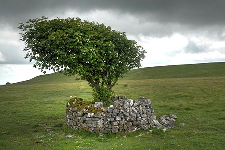
Click image to visit gallery of 12 images.
The limestone scenery between Malham Tarn and Malham Cove is some of the finest in Britain. This short Yorkshire Dales walk offers the opportunity to explore this area avoiding many of the crowds that use the approach from Malham village. The start is the free car park near Malham Tarn (grid ref. SD894658) which can be reached using lanes from Malham and Settle.
After parking, walk north towards the shores of Malham tarn and bear right with the tarn to your left. Continue ahead to the first area of woodland (Lings Plantation) and then take a clear track on the left. This track leads southeast and soon passes another small area of woodland which is passed on your left. Continue along this track to regain the tarmac lane from the carpark. Turn left leaving the lane and walk the short distance along the lane to reach Street Gate (grid ref. SD905656).
Turn right along the wall which should be to your left and continue to regain the tarmac lane after 350 metres. Continue south along this quiet lane for just over a mile. The walking is easy with improving views especially as you descend towards Malham. After a couple of bends you reach a ladder stile on your right (grid ref. SD902637) with a footpath finger post. Cross this stile and follow the clear path across grass to soon be rewarded with a glorious view of the limestone pavement at the top of Malham Cove. Continue ahead through a wall (grid ref. SD897641).
From this point, you can explore the limestone pavement and enjoy the views down Malhamdale. Return to the wall. Do not cross the wall and turn left keeping the wall to your right. You are now entering Watlowes dry valley with its impressive limestone crags. You are also following a section of the Pennine Way long distance footpath. The path is initially flat but soon gains height passing through a rocky section and climbing a series of rock steps to reach a junction of paths (grid ref. SD891649).
Turn sharp left at the top of the climb out of Watlowes staying on the Pennine Way. Almost immediately you have a fine view looking south down Watlowes dry valley. Stay on the clear path keeping the wall to your right. You will soon pass the point where the stream leaving Malham Tarn disappears underground and shortly after the lane adjacent to where you parked. In season, a refreshment van and an ice-cream van are usually here.
Maps 

| Ordnance Survey Explorer OL2 | Sheet Map | 1:25k | BUY |
| Anquet OS Explorer OL2 | Digital Map | 1:25k | BUY |
| Ordnance Survey Digital Map Subscription | |||
| Latest Ordnance Survey Discounts | |||
Other walks nearby
| Walk 1282 | Malham Tarn & Arncliffe | moderate | 12.5 miles |
| Walk 1051 | Gordale Scar & Malham Cove (Route 2) | moderate | 7.0 miles |
| Walk 1239 | Gordale Scar & Malham Cove | easy/mod | 6.5 miles |
| Walk 1274 | Nappa Cross & Malham | easy/mod | 5.5 miles |
| Walk 2602 | Gordale Scar & Malham Cove (Route 3) | moderate | 9.1 miles |
| Walk 2704 | Kirkby Malham & Hanlith from Malham | easy | 4.0 miles |
| Walk 2737 | The River Aire & Kirkby Malham from Malham | easy | 3.0 miles |
| Walk 3577 | Malham Cove from Malham | easy | 3.0 miles |
| Walk 2332 | Mastilles Lane & Bordley from Kilnsey | easy/mod | 6.8 miles |
| Walk 2385 | Airton & Bell Busk Circular | easy/mod | 6.8 miles |
Recommended Books & eBooks
Walking in the Yorkshire Dales: South and West
 Part of a two-book set, this guidebook describes 44 walks in the southern and western Yorkshire Dales, including the famous 23 mile Three Peaks circuit over Pen-y-Ghent, Whernside and Ingleborough. The other, mostly circular routes of 3½ to 13 miles cover the scenic region between Sedbergh, Kirkby Lonsdale, Settle, Skipton and Grassington.
More information
The Pennine Way
 Guidebook to the Pennine Way National Trail with OS map booklet. The 265 mile route from Edale to Kirk Yetholm takes three weeks to walk and is suitable for fit and experienced long distance walkers. The route crosses the Peak District, Yorkshire Dales and North Pennines National Parks. Includes separate OS 1:25,000 map booklet of the route.
More information
