Enville Estate and the Sheepwalks
Staffordshire Walk
County/Area - Staffordshire - South Staffordshire
Author - Peter Lane
Length - 4.0 miles / 6.5 km Ascent - 450 feet / 136 metres
Time - 2 hours 30 minutes Grade - easy
Walk Route Description
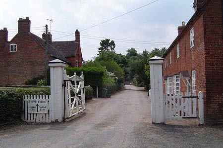
Click image to visit gallery of 6 images.
This short South Staffordshire route provides plenty of interest passing Enville Hall and taking in the spectacular (and appropriately named) Sheepwalks with superb views to Kinver Edge. The territory in the latter part of the walk can be heavily overgrown, and for this reason, long trousers and long sleeves are recommended in the summer.
The starting point is the War Memorial in Enville village (Grid ref. SO826866) on the A458 between Stourbridge and Bridgnorth. Park on the road near the memorial, or in the pub car park (so long as you intend to become a patron!) Turn into the Estate through the large gates and walk along the metalled road past the sports fields and the mews.
A stile ahead leads through a field with a good retrospective view of the Hall. Head for another stile on the opposite side of the field and follow the path next to the lovely Temple Pool. Continue directly across an enclosure via stiles at either end and turn right along a rutted track. When the track forks, take the left, climbing steadily on grassy slopes with improving views to the left of Kinver Edge.
When the path meets a minor road (Grid ref. SO821851) turn right and head along the edge of Priest Wood. The views from up here on the Sheepwalks are spectacular and you're only likely to have the sheep for company! Strategic marker posts along the route make it virtually impossible to lose the way, although there is no discernible path on the ground.
When the route starts to descend, follow a ridge (still post-marked) down to the left hand corner of a muddy lake behind a hedge. Locate the stile and negotiate the damp, muddy and overgrown path as it winds its way out into a field. Keeping the hedge to the right as you emerge into the field, do a left-handed dog-leg and walk uphill until you reach a small wood. Turn to your left and then after about 30 yards right, keeping the wood to your right.
Upon reaching a hedge, turn right along a highly overgrown, nettle strewn avenue, emerging at a field with a distinct path leading directly ahead of you. Resist the temptation to follow it and turn right. Follow the path until reaching a distinct path to the left heading down the middle of the field to a hedge below with no immediately obvious way through. A stile will appear as you get to it, cross over and find a route to the right, following (as best as possible) the boundary to your right and a stream below to your left.
Eventually emerge at a noisy stream and turn left and right through more undergrowth (a machete would be more use than a walking pole here!) Follow this jungle route until the noise of the vehicles gets louder signalling the "civilisation" of the A458 ahead. Turn right and walk along the edge of the A458, taking care.
Meet the Staffordshire Way and proceed to the red sandstone St Mary's Church, typical of the area. Walk into the Church car park and through the churchyard to a kissing gate. Walk through the gate and across a field to regain the tarmac road into the Enville Estate. Retrace the few hundred yards back to your car, or stop off at the pub for some light refreshment!
Maps 

| Ordnance Survey Explorer 218 | Sheet Map | 1:25k | BUY |
| Anquet OS Explorer 218 | Digital Map | 1:25k | BUY |
| Ordnance Survey Digital Map Subscription | |||
| Latest Ordnance Survey Discounts | |||
Other walks nearby
| Walk 3003 | Kinver Edge & Blakeshall from Holy Austin Rock | easy | 4.3 miles |
| Walk 2834 | Kinver Edge circular | easy | 4.2 miles |
| Walk 3241 | Kinver Edge & Holy Austin Rock | easy | 2.6 miles |
| Walk 1806 | Kinver Stroll | easy | 2.0 miles |
| Walk 2024 | Kinver Edge, South Staffordshire | easy/mod | 6.0 miles |
| Walk 1934 | Highgate Common and Surrounding Country | easy | 6.0 miles |
| Walk 1603 | Shatterford Wood and Castle Hill circular | easy/mod | 5.5 miles |
| Walk 2092 | Highley from the Severn Valley Country Park | easy/mod | 4.5 miles |
| Walk 3504 | Highley to Bewdley along the River Severn | easy/mod | 7.0 miles |
| Walk 2466 | The Severn Valley from Trimpley Reservoir | easy | 6.0 miles |
Recommended Books & eBooks
Walking in the Peak District - White Peak East
 Guidebook describing 42 half-day and day walks in the limestone landscapes of Derbyshire's White Peak, part of the Peak District National Park. One of two volumes, this book covers the east of the region, with potential bases including Bakewell, Eyam, Castleton, Birchover, Matlock and Wirksworth.
More information
