Aonach Mor and Aonach Beag - two of the "Lochaber giants"
Highland Walk
County/Area - Highland - Fort William Lochaber
Author - Peter Smyly
Length - 9.0 miles / 14.6 km Ascent - 4600 feet / 1394 metres
Time - 9 hours 10 minutes Grade - mod/hard
Maps 

| Ordnance Survey Explorer 392 | Sheet Map | 1:25k | BUY |
| Anquet OS Explorer 392 | Digital Map | 1:25k | BUY |
| Ordnance Survey Landranger 41 | Sheet Map | 1:50k | BUY |
| Anquet OS Landranger 41 | Digital Map | 1:50k | BUY |
Walk Route Description
Click image to visit gallery of 8 images.
Aonach Mor (4,006 feet) and Aonach Beag (4,049 feet) belong to a select group of only nine mountains in the United Kingdom that exceed four thousand feet in height and are two of four in that height bracket in the Lochaber area, the others being Ben Nevis (4,406 feet) and Carn Mor Dearg (4,012 feet). The four are sometimes known as the Lochaber Giants. They are the ninth and seventh highest mountains in the UK.
While most people have heard of Ben Nevis, the highest mountain in the UK, Aonach Mor and Aonach Beag, despite belonging, in height terms, to the elite 4,000 foot plus category, are nowhere near as well-known or frequented. "The Ben", as it is known locally, is easily the bigger draw for walkers in the Lochaber area. To give an idea as to what is involved in this walk, you start at 300 feet above sea level and ascend to over four thousand feet. It therefore follows that appropriate changes of clothing should be taken as weather conditions over 4,000 feet are likely to be very different from those at the start of the walk.
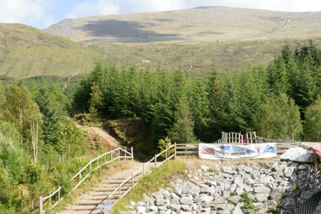
As the two Aonachs are about a mile apart on a ridge, most walkers who climb one Aonach, also climb the other one as part of the same walk. This walk route goes against the grain in terms of the usual approach from the head of Glen Nevis by suggesting an alternative start point from the Nevis Range car park to the north. There is the option of taking the gondola part of the way up though, in June 2011, it did not start running until 10am. Therefore this walk suggests an early start and a walk up through the forest, before emerging on to open felllside. An early start brings another advantage and that is that use of the cycle route in places makes the route up easier and this is forbidden (for obvious safety reasons) when the cycle track is in use from later in the morning. The gondola station has a shop and a restaurant. There are a couple of viewpoints within a few minutes walk of the top station (in opposite directions) which offer those coming up by gondola shorter walk options. Unlike the clear path up Cairngorm mountain from the funicular railway top station, there is nothing similar here. Instead, the priority is to try to avoid the ski-ing paraphernalia and make your own way up the steep, mostly grassy, pathless slope. For example, shortly to the right of the restaurant is a fence going uphill and you can follow it. The route up to Aonach Mor from the top gondola station passes through three stages. Firstly, there is a slog to gain the Aonach an Nid ridge, then the gradient eases off somewhat as you follow the ridge south-west (a relatively short section compared with the first one), then finally the broad plateau of Aonach Mor which offers easy walking particularly compared with the steep stretch up from the gondola station.
By the time the plateau stage is reached, the view has opened out and, if visibility permits, there is a striking view of the north cliffs of Ben Nevis to the right with Carn Mor Dearg's red stony ridge in between. To the left, the aptly-named Grey Corries dominate the view beyond wild corries where snow cornices may be seen over the edge even in summer. It is advisable not to wander too near the edge to the left as a warning danger sign with a symbol of a falling person indicates. The Mamores range appears in the distance ahead and people familiar with that range should be able to name the individual peaks with the pyramid-like shape of Binnein Mor being distinctive.
Trending due south leads along the plateau to the summit cairn of Aonach Mor, marked by a sizeable cairn and, by now, Aonach Beag, can also be seen ahead to the south. Follow the path south down to the bealach (col). Aonach Beag reveals some dramatic cliffs to its left and the approach to it passes close to a steep slope down to the left where, in June 2011, a huge snow cornice was present just below the ridge. A rocky path winds its way up, sometimes dividing and then rejoining higher up, but the general way up is clear. The path emerges on to the summit ridge and a short walk leads to the top cairn which is significantly smaller than the one on Aonach Mor. It is situated on a much narrower ridge and just a few feet from a big, though not sheer, drop to the east. There is no obligation though to go near the edge, as the ridge is not an arete. In good visibility it is the two thousand foot high cliffs of Ben Nevis (which are not seen if walking up "The Ben" via the usual approach route of the tourist track.) which dominate the view to the west It can also be seen at first hand why walking books don't suggest linking the Aonachs with Carn Mor Dearg as there is no path and the terrain is particularly steep and rocky on both sides of the divide. The Ring of Steall can be seen to good effect as well as part of the Mamores range to the south.
Options to conclude the walk are limited. If you haven't pre-arranged to be collected by car at the head of Glen Nevis, then the only other likely option is to reverse the outgoing route as far as the gondola station. At this point you might want to take the gondola back down rather than walk by way of variation.
Other walks nearby
| Walk 3066 | Carn Mor Dearg (via Allt a' Mhuilinn trail) | mod/hard | 8.7 miles |
| Walk 2105 | Ben Nevis via Carn Mor Dearg arete | hard | 10.5 miles |
| Walk 3270 | Ben Nevis | mod/hard | 9.7 miles |
| Walk 1338 | Ben Nevis Tourist Path | mod/hard | 8.7 miles |
| Walk 3303 | Mamores Ridge - Stob Ban, Am Bodach and Sgurr an Iubhair | hard | 9.0 miles |
| Walk 3095 | Stob Ban (Mamores) | mod/hard | 6.0 miles |
| Walk 2824 | Arkaig Hills Circular | moderate | 8.8 miles |
| Walk 3106 | Binnein Mor from Kinlochleven | hard | 10.2 miles |
| Walk 1039 | Am Bodach and Stob Coire a' Chairn | mod/hard | 9.5 miles |
| Walk 1094 | Blackwater Reservoir | moderate | 11.5 miles |
Recommended Books & eBooks
Skye's Cuillin Ridge Traverse
 This 2-volume set provides all the information required to complete the main ridge traverse on Skye's Black Cuillin. Strategy, gear, training, navigation and logistics are covered, and 10 classic scrambles are described. A lightweight second guidebook gives the scrambler detailed maps, topos and route description for the ridge traverse itself.
More information
Walking the Munros Vol 2 - Northern Highlands and the Cairngorms
 Guidebook to walking the northern Munros, covering the northern Highlands, the Cairngorms and the Isle of Skye. 70 routes are described, including those up Ben Macdui, Braeriach and Cairn Gorm. Routes range from 7 to 46km, requiring a fair level of fitness. The second of two guidebooks to walking Scotland's Munros: peaks higher than 3000ft.
More information
Messaging & Social Media
Message Walking Britain and follow the latest news.

Mountain Weather
Stay safe on the mountains with detailed weather forecasts - for iOS devices or for Android devices.