The Dingle & Y Golfa from Welshpool
Powys Walk
County/Area - Powys - Powys North
Author - Lou Johnson
Length - 6.6 miles / 10.7 km Ascent - 900 feet / 273 metres
Time - 4 hours 10 minutes Grade - easy/mod
Walk Route Description
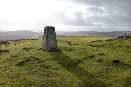
Click image to see photo description.
This walk from Welshpool (Y Trallwng) explores the undulating countryside to the west of the town. The main objective is Y Golfa, a rounded hill from where there are excellent views to the Breidden Hills and other parts of Powys. The route follows sections of the Cross Britain way and Glyndwr's Way through lovely countryside.
The start is Raven Square at the western end of Welshpool at the junction of the A458 and A490 close to the eastern terminus of the Welshpool and Llanfair Light Railway (grid ref. SJ218075). Parking is available at the Raven Inn for customers and other places nearby. After parking take the A490 from the roundabout signed to Llanfyllin. Follow the road for a short way and take the first road on the left. Follow the road around to the left and continue head to a cattle grid. Stay on the drive for 800 metres to a fork (grid ref. SJ211077).
Bear right and follow the clear track to pass Lower Llanerchydol. Pass the buildings on your right and then bear left past a barn (on your left) (grid ref. SJ206079). Cross stile with yellow waymark and keep the hedge on your right and continue to a gate in a group of trees (grid ref. SJ203080). Continue across field heading half left through another gate to a road (grid ref. SJ200082). Turn left and at the next junction bear left (signed to The Dingle).
Follow this pleasant lane for 1.5 kilometres to pass Gaer on your left (grid ref. SJ187079). After the farm, the lane rises and turns sharp left. Cross the stile ahead (grid ref. SJ185079) and cross two fields to a road (grid ref. SJ180079). Turn left and in 200 metres turn left through a small metal gate onto the Glyndwr's Way (this onward path is opposite wooden railings on the right of the road). One through the gate bear right and follow the grassy track across the field towards woodland. Enter the trees and bear left to exit the wood on the southern edge.
The onward path (GW) crosses a small field and then enters Welshpool Golf Club (grid ref. SJ175075). Turn left and initially follow the hedge on your left. The path soon turns right. Maintain direction for 350 metres before turning left following the path to the summit of Y Golfa (grid ref. SJ182071). Take time to enjoy the extensive view. If you are lucky, you may see a train on the Welshpool & Llanfair Light Railway below.
The hill is crossed by several paths as well as the greens and fairways of the golf course. Leave the summit in a southerly direction and turn left onto a cross path heading towards the south-east corner of Golfa Wood (grid ref. SJ186070). Note - you can see the corner of this wood from the summit. Continue along the southern edge of Golfa Wood still following Glyndwr's Way to reach Pen-y-golfa. Bear left just past the house to join a grassy track which gradually becomes clearer as you make progress. Stay on the track to Llanerchydol Home Farm after which careful navigation is required. After the farm, the next objective is the main access drive to Llanerchydol Hall, which, once found, is followed back to the A490 and Raven Square, Welshpool.
Maps 

| Ordnance Survey Explorer 215 | Sheet Map | 1:25k | BUY |
| Anquet OS Explorer 215 | Digital Map | 1:25k | BUY |
| Ordnance Survey Explorer 216 | Sheet Map | 1:25k | BUY |
| Anquet OS Explorer 216 | Digital Map | 1:25k | BUY |
| Ordnance Survey Digital Map Subscription | |||
| Latest Ordnance Survey Discounts | |||
Other walks nearby
| Walk 2939 | Montgomery Canal & River Severn near Welshpool | easy/mod | 7.0 miles |
| Walk 1876 | Breidden Hill from Middletown | moderate | 6.5 miles |
| Walk 2814 | Corndon Hill from Priest Weston | easy | 1.5 miles |
| Walk 1072 | Stiperstones low level circular | easy | 4.0 miles |
| Walk 3529 | Stiperstones from Snailbeach | easy/mod | 7.0 miles |
| Walk 1871 | Snailbeach & the Stiperstones | moderate | 7.0 miles |
| Walk 1809 | Shelve & the Stiperstones from The Bog | moderate | 9.0 miles |
| Walk 2083 | Linley Hill and Linley from The Bog | moderate | 8.5 miles |
| Walk 1832 | The Hollies & Poles Coppice from near Habberley | easy/mod | 5.0 miles |
| Walk 3395 | The Stiperstones Ridge | easy/mod | 5.5 miles |
Recommended Books & eBooks
The Cambrian Way
 Guidebook to the Cambrian Way, a challenging three-week mountain trek through Wales from Cardiff to Conwy. The 470km un-waymarked route is presented from south to north. Often sticking to long, beautiful ridgelines, it crosses wild and rugged terrain and visits many of Wales's highest mountains, including Snowdon.
More information
