Powys WalksWalking Routes & Hiking Trails
Find Powys walks from the list below which features the best walking routes in the area. Most of routes are circular walks although there are a few linear hikes. The walks are listed from the shortest and easiest to the longest more challenging routes. The walks are divided into sub areas so you can find specific walks.
The Powys walks listed below cater for walkers of all abilities from easy low-level walks to more demanding long day walks in the hills and mountains. All walks are free to download and print and all routes have GPS files. The walks cover some sections of the Offa's Dtyke long distance path.
Brecon Beacons West - Black Mountain Walks
The Black Mountain should not be confused with the Black Mountains, which lies in the east of the Brecon Beacons National Park, nor with a 703 metres (2,306 ft) summit in the Black Mountains that is confusingly also called Black Mountain. Summits of interest to walkers include Fan Brycheiniog, Picws Du and the summits of Fforest Fawr amongst others. Lower level walks include the waterfalls on the Afon Mellte.
| Walk | Description | Grade | Miles |
|---|---|---|---|
| 3205★ | Carnau Gwynion from Ystradfellte | easy | 4.00 |
| 3616★☩ | Fan Fawr from Storey Arms | moderate | 6.00 |
| 2641★☩ | Fan Fawr & Fan Frynych, Fforest Fawr | moderate | 6.50 |
| 2646★☩ | Fan Nedd & Fan Bwlch Chwyth, Fforest Fawr | moderate | 7.00 |
| 3563★☩ | Fan Brycheiniog and Picws Du | moderate | 7.10 |
| 2643★☩ | Fan Frynych & Fan Llia, Fforest Fawr | moderate | 8.00 |
| 2645★☩ | Fan Gyhirych & Fan Bwlch Chwyth, Fforest Fawr | moderate | 8.00 |
| 1283★☩ | Fan y Big from Torpantau | moderate | 8.50 |
| 3206★ | Ystradfellte Waterfalls Walk | moderate | 9.20 |
| 2647★☩ | Fan Gyhirych, Fan Nedd & Fan Bwlch Chwyth | moderate | 10.00 |
Brecon Beacons Central - The Beacons Walks
The central section of the Brecon Beacons National Park is the most popular area for walking with dramatic north facing sandstone escarpments and lofty ridges. The area lies south of Brecon and north of Merthyr Tydfil. The Brecon Beacons include six main peaks - Corn Du, Pen y Fan (the highest peak), Cribyn and Fan y Big form a long ridge which offers a superb horseshoe walk around the head of the Taf Fechan. The other two summits, Bwlch y Ddwyallt, and Waun Rydd lie further east and see fewer walkers as access is harder and the scenery not so spectacular. The mountains are the great attraction, but lower level walks are also popular especially in the Usk Valley and near Brecon.
| Walk | Description | Grade | Miles |
|---|---|---|---|
| 3210★ | Pen-y-Crug hill fort from Brecon | easy | 3.00 |
| 2349★☩ | Pen Y Fan & Corn Du from near Storey Arms | moderate | 4.60 |
| 2400★ | Pen y Fan from Cwmgwdi near Brecon | moderate | 5.00 |
| 3546★ | Pen y Bryn from Pencelli | moderate | 5.00 |
| 1552★ | Waun Rydd | easy/mod | 5.50 |
| 3209★ | Llanfrynach and Pencelli circular | easy/mod | 5.60 |
| 3564★ | Groesfford and M & B Canal from Brecon | easy/mod | 6.20 |
| 2754★☩ | Allt Lwyd & Waun Rydd | moderate | 7.30 |
| 1903★☩ | Pen y Fan & Corn Du from Cwmgwdi | moderate | 7.50 |
| 1123★☩ | Brecon Beacons Horseshoe | moderate | 8.50 |
| 3236★ | Pen-y-crug, Sarnau and Battle from Brecon | moderate | 10.00 |
| 2934★☩ | The High Peaks of the Brecon Beacons | mod/hard | 10.70 |
| 2074★☩ | Highest Peaks of the Brecon Beacons | mod/hard | 11.00 |
| 3536★☩ | Pen y Bryn & Carn Pica from Pencelli | mod/hard | 11.30 |
Brecon Beacons East - Black Mountains Walks
The Black Mountains are the hills spread across parts of Powys and Monmouthshire that extend across the England - Wales border into Herefordshire. The lie in the eastern sector of the Brecon Beacons National Park and should not be confused with Black Mountain in the west. The Black Mountains can be found between the towns of Abergavenny, Hay-on-Wye and the village of Llangors. The highest mountain in this area is Waun Fach. Other summits of interest to walkers include Black Mountain, Hay Bluff, Rhos Dirion and Twmpa. Other hills worth visiting include Crug Mawr and Pen Allt-mawr. Other summits include the Sugar Loaf and the Skirrid, Lower level walking is also available in this area in the Vale of Ewyas and the in the area near Abergavenny.
| Walk | Description | Grade | Miles |
|---|---|---|---|
| 3717★☩ | Table Mountain from Crickhowell | easy/mod | 5.00 |
| 1238★☩ | Hay Bluff & Twmpa Circular | moderate | 6.00 |
| 2065★☩ | Waun Fach & Y Grib from Pengenfford | moderate | 6.50 |
| 3134★ | The Llangatwg Escarpment from near Crickhowell | moderate | 6.50 |
| 1106★☩ | Waun Fach | mod/hard | 7.50 |
| 3204★☩ | Hay Bluff & Twmpa | moderate | 10.30 |
Powys North Walks
The northern part of Powys includes a variety of walking. The towns of Welshpool and Newtown are in this area. Other excellent walks can be found around Lake Vyrnwy and in the Berwyn mountains.
| Walk | Description | Grade | Miles |
|---|---|---|---|
| 2814 | Corndon Hill from Priest Weston | easy | 1.50 |
| 3736★ | Ffrydd Farm & Penshwa Lane from Newtown (Y Drenewydd) | easy | 4.30 |
| 3735★ | Newtown (Y Drenewydd) - Waterways & Town | easy | 5.30 |
| 3707★ | Fachwen Pool from Newtown (Y Drenewydd) | easy/mod | 6.00 |
| 1086 | Post Gwyn and Craig-y-Mwn from Pistyll Rhaeadr | moderate | 6.50 |
| 1876★☩ | Breidden Hill from Middletown | moderate | 6.50 |
| 3266★ | The Dingle & Y Golfa from Welshpool | easy/mod | 6.60 |
| 2939★ | Montgomery Canal & River Severn near Welshpool | easy/mod | 7.00 |
| 3706★ | Newtown (Y Drenewydd), Brimmin Wood & Kerry | moderate | 8.30 |
| 3102★ | Bwlch Sych and Tynygarreg from Lake Vyrnwy | moderate | 8.50 |
| 3708★☩ | Bwlch y ffridd & Fachwen Pool from Newtown | moderate | 9.00 |
| 3031★ | Cadair Berwyn | moderate | 9.25 |
| 3705★ | Newtown (Y Drenewydd) & Bettws Cedewain Circular | mod/hard | 10.10 |
| 3696★ | Newtown (Y Drenewydd) & Gregynog Circular | mod/hard | 10.30 |
| 1898★ | Severn Valley from Llanidloes | moderate | 11.30 |
| 3053★ | Berwyn Tops from Tan Y Pystyll | moderate | 14.00 |
Powys Central Walks
The central part of Powys has much to offer walkers. The area includes the hills near Rhayader, Knighton, Kington and Builth Wells.
| Walk | Description | Grade | Miles |
|---|---|---|---|
| 3253★ | Warren Hill, Gors Lydan & Moelfre Hill | easy/mod | 6.00 |
| 3565★☩ | The Hergest Ridge from Gladestry | easy/mod | 6.10 |
| 3355★ | Llandeilo Hill from Aberedw | easy/mod | 6.20 |
| 2472★ | Abbeycwmhir Circular | easy/mod | 7.20 |
| 3674★ | Claerwen Valley & Dam from Dolymynach Reservoir | moderate | 7.40 |
| 3643★☩ | LLan-fawr & Lugg Valley from Whitton | moderate | 7.50 |
| 3023 | Great Rhos & the Radnor Forest from New Radnor | moderate | 9.00 |
Cambrian Mountains Walks
The Cambrian Mountains offers walks across some wild terrain in an area that might have been a National Park. This area also includes the Elan Valley with its string of reservoirs.
| Walk | Description | Grade | Miles |
|---|---|---|---|
| 2736★ | Teifi Pools from near Strata Florida | easy/mod | 6.20 |
| 2498★ | Gorllwyn circuit, Elan Valley | easy/mod | 6.75 |
| 3297★ | Crugyn Ci, Esgair Perfedd & Penygarreg - Elan Valley | moderate | 7.50 |
Walks that start in adjacent counties / areas.
Walks that start in adjacent counties or areas but cross the boundary and include sections of the route within Powys.
| Walk | Description | Starts In |
|---|---|---|
| 1672★☩ | Llyn-y-Fan-Fawr & Mynydd Ddu from Llanddeusant | Carmarthenshire |
| 3203★☩ | Vale of Ewyas from Llanthony Abbey | Monmouthshire |
| 2935★ | Llanthony Priory from Capel-y-ffin | Monmouthshire |
| 3285★ | The Hergest Ridge and Huntington from Kington | Herefordshire |
| 3300★ | The Hergest Ridge from Kington | Herefordshire |
| 1660★ | Craswall Priory & Hay Bluff | Herefordshire |
★ GPS file ☩ Route profile
Location Map
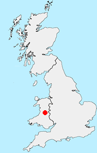
Powys Guide
Powys is a large county in east and central Wales, bordering England. The county features a rugged landscape of valleys and mountains, including most of Brecon Beacons National Park. The valley lowlands contrast with the highlands which include the Radnor Forest, the Black and Berwyn mountains, and the Brecon Beacons. The Offa's Dyke long distance path crosses the county on the eastern border with England. The county offers a wide range of walking from gentle valley paths to adventurous mountain walks.
Other walks in Britain - For a list of all the areas where walks are available go to the Main Walk Index.
Walk grading - Learn how each walk is assessed and select a walk to suit your ability and experience by going to Walk Grading Details.
Messaging & Social Media
Message Walking Britain and follow the latest news.

Mountain Weather
Stay safe on the mountains with detailed weather forecasts - for iOS devices or for Android devices.