Ben Tee & Kilfinnan Falls from Laggan
Highland Walk
County/Area - Highland - Fort William Lochaber
Author - Lou Johnson
Length - 7.5 miles / 12.2 km Ascent - 2900 feet / 879 metres
Time - 6 hours 40 minutes Grade - mod/hard
Walk Route Description
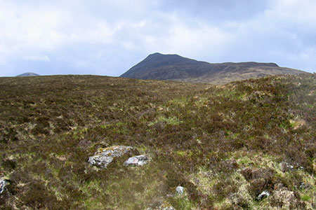
Click image to see photo description.
This walk to the summit of Ben Tee (901 m.) also includes Kilfinnan Falls. However, the more adventurous (or daring) can get a closer view of the falls on a narrow path. The ascent across open country to the summit is straightforward in clear weather. However, in poor visibility good navigational skills are vital. The summit of this Corbett offers a superb panorama of the West Highlands.
The start is signed to Laggan Locks off the A82 with Laggan Locks car park (grid ref. NN287963) on your left as you leave the A82. Exit the car park and turn left and cross the Caledonian Canal. Take the narrow lane signed to Gairlochy following the Great Glen Way. You soon pass a row of lodges on your right. Continue over the cattle grid and bear left along the lane towards Kilfinnan. Cross another cattle grid and continue for 700 metres to reach a bridge over Kilfinnan Burn. Do not cross the bridge but turn right to follow a grassy track on the east side of the burn.
Continue up alongside the burn eventually joining a narrow path on the steep slope. Eventually you get your first sight of falls through the trees. At this point scramble up the slope on your right for 50 feet to get an improved view. From here you have two options. Either continue ahead on what some will see as a dangerous path to get a closer view, or head right up the steep slope eventually reaching a path near the crest of the slope. If you continue nearer to the falls, you also have a steep climb to reach the top path.
The path soon reaches a stile (grid ref. NN272968). Cross the stile and follow the path which initially runs atop the gorge. After 300 metres bear right and make for the shapely summit of Ben Tee. The climb is steady and with the objective in sight you can measure your upward progress. The summit area is quite stony and offers superb views which many rate as one the finest in the area.
The descent follows the ascent as far as the stile (grid ref. NN272968). Again, cross the stile and join a path which follows the high ground descending gently to the end of a spur. The view from here to Laggan Locks is excellent. Continue the descent on what is mostly a clear path down to the road. Turn left and retrace your steps back to the start.
Maps 

| Ordnance Survey Explorer 400 | Sheet Map | 1:25k | BUY |
| Anquet OS Explorer 400 | Digital Map | 1:25k | BUY |
| Ordnance Survey Digital Map Subscription | |||
| Latest Ordnance Survey Discounts | |||
Other walks nearby
| Walk 2166 | Laggan Locks Circular | easy | 4.0 miles |
| Walk 3289 | Loch Lundie from Invergarry | easy/mod | 6.5 miles |
| Walk 2824 | Arkaig Hills Circular | moderate | 8.8 miles |
| Walk 2918 | Aonach Mor and Aonach Beag - two of the "Lochaber giants" | mod/hard | 9.0 miles |
| Walk 3255 | Coire Ardair | moderate | 7.5 miles |
| Walk 3066 | Carn Mor Dearg (via Allt a' Mhuilinn trail) | mod/hard | 8.7 miles |
| Walk 2513 | Five day Knoydart exploration | very hard | 91.4 miles |
| Walk 2105 | Ben Nevis via Carn Mor Dearg arete | hard | 10.5 miles |
| Walk 1781 | Loch Affric Circular | moderate | 11.0 miles |
| Walk 1789 | Mam Sodhail & Carn Eighe | hard | 14.4 miles |
Recommended Books & eBooks
Skye's Cuillin Ridge Traverse
 This 2-volume set provides all the information required to complete the main ridge traverse on Skye's Black Cuillin. Strategy, gear, training, navigation and logistics are covered, and 10 classic scrambles are described. A lightweight second guidebook gives the scrambler detailed maps, topos and route description for the ridge traverse itself.
More information
Great Mountain Days in Scotland
 Inspirational guidebook to 50 challenging routes for mountaineers, scramblers, hillwalkers and fell runners, many long enough to backpack over 2 days, especially in winter (12 to 25 miles). A mix of classic routes and unsung gems across Scotland from Galloway to the Outer Hebrides in widely differing wild landscapes. With customised OS mapping.
More information
