Sheffield Round
South Yorkshire Walk
County/Area - South Yorkshire - Sheffield
Author - Andy Chaplin
Length - 15.2 miles / 24.7 km Ascent - 1750 feet / 530 metres
Time - 9 hours 20 minutes Grade - moderate
Walk Route Description
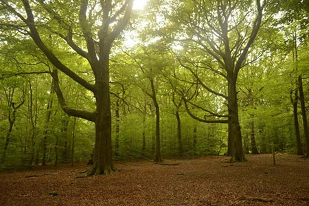
Click image to see photo description.
The Sheffield Round Walk is a 15-mile circular walk taking in several of Sheffield's Green Spaces that lie predominantly on the west and south of the City. There is a booklet to buy from Sheffield City Council that describes the route in detail. The walk is well signed, but only in an anti-clockwise direction. The clockwise signs have been used to replace worn out ones in the other direction. It does not appear as a long-distance trail on OS maps so the following description and attached gpx file should help find the correct paths.
There is on road parking at Rustlings Road but entrances into Endcliffe Park are a bit limited, so you will either have to head back to the entrance near the tennis club or go west on Rustlings Road then find paths back to Holme Wheel Dam. The route from here goes past the Holme Wheel dam then Nether Spurgear Wheel dam before coming out again on Rustlings Road.
Cross over into Bingham Park and follow paths at the side of the Porter Brook to the Shepherd Wheel and dam. The route crosses over Hangingwater Lane and follows the Porter through Whiteley Woods, crossing Whiteley Woods Road and passing the Wire Mill Dam before coming out at Forge Dam playground, café and dam.
Follow the route westwards out of Whiteley Woods then, still following the Porter, cross Wood Cliffe lane and pick up the Clough Lane track and path that leads up to Porter Clough Woods and the car park opposite Moorfield Farm. The route here follows Fulwood Lane to Ringinglow then Sheephill Road - opposite the Norfolk Arms.
50 metres along Sheephill Road take the path that descends alongside the Limb Brook, across open country and through the grounds of Whirlowbrook Hall. Crossing over the A625 the route still follows the Limb brook alongside Whirlow Playing Fields, through Ran Wood and Ecclesall Woods which is Sheffield's largest ancient woodland. The route passes Abbeydale Miniature Railway (open occasional Sundays in spring-summer) and comes out on Abbeydale Road South.
Walk south on the main road, around the front of the station and onto Twentywell Lane. Just after the railway bridge there is a path on the left that becomes a steep climb into Ladies Spring Wood. Coming around the south of the wood you pick up Beauchief Abbey Lane in the direction of 12th-century Beauchief Abbey. Only the abbey's western tower and a more modern church remain.
Turn right before the abbey on a golf club access route and footpath. The route continues through Park Bank Wood, crosses Bocking Lane, goes through Chancet Wood, crosses Meadowhead and heads towards Graves Park. The route goes through heritage woodlands, passes by the Graves Park café and Animal Farm and comes out on Hemsworth Road.
A short section eastward on Hemsworth Road ends when you turn left after the New Inn onto Ashbury Lane. This leads you onto a path heading north across Lees Hall golf club, onto Carr Wood and after passing Meersbrook Allotments you follow Lees Hall Avenue and Upper Albert Road to Meersbrook Park.
There is a great view of Sheffield in the park and a small museum in the 16th-century timber-framed Bishops House. The route becomes more urban from here on. Take Meersbrook Park Road to Chesterfield Road then go under the railway and towards the Sheaf on Little London road. Cross the river and take the path through both bits of park on either side of Broadfield Way.
Half a mile walking along Leyburn Road, Abbeydale Road, Glen Road and Sandford Grove Road will bring you to Brincliffe Edge. Coming out at Chelsea Park this is the last green space on the route. From here there is 0.75 mile along Chelsea Road, Cavendish Road, Osborne Road, Stretton Road and Pinner Road back to Hunters Bar.
Maps 

| Ordnance Survey Explorer OL1 | Sheet Map | 1:25k | BUY |
| Anquet OS Explorer OL1 | Digital Map | 1:25k | BUY |
| Ordnance Survey Digital Map Subscription | |||
| Latest Ordnance Survey Discounts | |||
Other walks nearby
| Walk 3330 | Rivelin Valley from Malin Bridge | easy/mod | 9.7 miles |
| Walk 3436 | Hillsborough to Bradfield & Loxley Valley | moderate | 12.6 miles |
| Walk 2728 | Wadsley and Loxley Commons, Sheffield | easy/mod | 7.9 miles |
| Walk 1479 | Burbage Moor & Redmires from near Ringinglow | easy/mod | 9.8 miles |
| Walk 1285 | Dungworth & Rod Moor | moderate | 9.4 miles |
| Walk 1580 | Redmires Reservoir | easy | 2.5 miles |
| Walk 1579 | Damflask Reservoir | easy | 3.5 miles |
| Walk 1541 | Redmire, Stanage & Ughill Moor circular | moderate | 13.0 miles |
| Walk 2456 | Flask Edge from Dronfield Woodhouse | moderate | 10.0 miles |
| Walk 1093 | Higger Tor & Burbage Rocks | easy/mod | 5.3 miles |
