Ranmore Common Circular near Dorking
Surrey Walk
County/Area - Surrey
Author - Lou Johnson
Length - 5.2 miles / 8.5 km Ascent - 500 feet / 152 metres
Time - 3 hours 10 minutes Grade - easy
Maps 

| Ordnance Survey Explorer 146 | Sheet Map | 1:25k | BUY |
| Anquet OS Explorer 146 | Digital Map | 1:25k | BUY |
| Ordnance Survey Landranger 187 | Sheet Map | 1:50k | BUY |
| Anquet OS Landranger 187 | Digital Map | 1:50k | BUY |
Walk Route Description
Click image to see photo description.
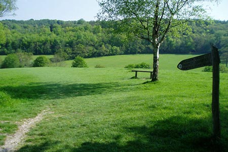
This Surrey circular walk explores part of the North Downs a few miles to the northwest of Dorking. The route includes a variety of scenery from open downs with a patchwork of fields to mixed woodland offering pleasant shady walking. The walk mainly follows well worn paths and tracks and generally signposting and waymarking is good. This walk is popular when the weather is fine and is an obvious circuit starting from the Denbies Hillside car park on the south side of Ranmore Common Road (grid ref. TQ141503). It is a pay and display car park although National Trust members are free.
After parking, cross the road and walk right following a path through trees as far as St Barnabas Church with its fine steeple (grid ref. TQ145504). Walk past the church for about 100 metres and take the bridleway on the left soon passing the Rectory on your left. Stay on this bridleway through Dorking Wood for about a mile towards Bagden Farm reaching open countryside. Just before the farm, turn left by an outbuilding (grid ref. TQ147519). Cross a large field to a gate, which leads onto a track (grid ref. TQ144517).
Turn left along the track and almost immediately right onto a concessionary path. Follow the red way markers and Polesden Valley Walk signs for about 800 metres to pass Polesden Farm on your left and reach a track (grid ref. TQ135519). Turn right along the track and continue up the slope to a cross track with gates and continue ahead along another permissive path. After just under 300 metres go through gate 20 (grid ref. TQ131521) onto Hogden Lane.
Bear left and follow Hogden Lane south for 2 kilometres passing Lonesome Cottage, Pigden Cottage and Hogden Cottage along the way. You soon reach Ranmore Common Road (grid ref. TQ125501). Cross this road with care and take the path opposite, which is marked with a fingerpost. Continue straight ahead for just over 600 metres to reach the North Downs Way (grid ref.127497). Turn left along the North Downs Way. After 700 metres the path reaches open countryside on your right (grid ref. TQ133500). Here you have two options. The first and most direct route is to continue on the North Downs Way through woodland back to the start. The second and preferred option, is to take the path on the right across open downs that follows the edge of the woodland back to the start. This path offers good views down the steep scarp slope to Dorking below.
Other walks nearby
| Walk 1618 | The Box Hill Hike | mod/hard | 8.0 miles |
| Walk 2124 | Leith Hill and Box Hill, two of the Surrey Hills | moderate | 12.5 miles |
| Walk 2102 | Leith Hill circular | easy | 1.5 miles |
| Walk 1447 | Tadworth Circular | easy/mod | 8.5 miles |
| Walk 1869 | Thorncombe Street from Bramley | easy/mod | 6.0 miles |
| Walk 2683 | Farthing Downs and Happy Valley from Coulsdon South | easy/mod | 6.0 miles |
| Walk 1734 | Hampton Court Parks and Gardens | easy/mod | 6.5 miles |
| Walk 2479 | Worth Way from Three Bridges, near Crawley | moderate | 14.0 miles |
| Walk 3406 | The Wey & Arun Canal, Loxwood | easy | 4.5 miles |
| Walk 1714 | Virginia Water & the Wentworth Estate | easy/mod | 9.0 miles |
Recommended Books & eBooks
No suggestions for this area.Messaging & Social Media
Message Walking Britain and follow the latest news.

Mountain Weather
Stay safe on the mountains with detailed weather forecasts - for iOS devices or for Android devices.