Farthing Downs and Happy Valley from Coulsdon South
Surrey Walk
County/Area - Surrey
Author - Peter Smyly
Length - 6.0 miles / 9.8 km Ascent - 400 feet / 121 metres
Time - 3 hours 20 minutes Grade - easy/mod
Walk Route Description
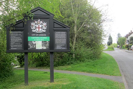
Click image to visit gallery of 6 images.
As London's largest borough by population, the London Borough of Croydon seems an unlikely place for a countryside ramble. Considering its relative proximity to main roads and civilisation, this route passes through some scenery with a remote rural feel to it though the route does take you as far south as the ridge of the North Downs overlooking Redhill in Surrey. If you are travelling to Coulsdon South by train from London Bridge, the journey is only around half an hour.
A highlight of the walk is Happy Valley and this seems an appropriate name for this pretty valley on a day of spring blossoms and sunshine. There are a number of paths with a bridleway running along the foot of the valley and a "balcony" path with some wooden benches where you can sit down, or you can rest on grassy slopes, and drink in the view. This is a popular area for dog walkers. The route temporarily leaves Happy Valley to follow part of the Downlands Circular Walk including a short section of the North Downs Way, before returning to the valley.
Exit Coulsdon South station and follow a tarmac path between railings. Turn left at the first road reached, Reddown Road, and follow it to a T junction. Turn right here and right again at the next turning and the grassy ridge of Farthing Downs appears ahead at the end of a residential road. Take the path to the left of the continuation road for about a mile before a crossroads of paths is reached. Turn left downhill and a choice of a steep direct path, or a less steep alternative, leads to the foot of the shallow valley where the bridleway to the right is a permissive horse ride. The route returns to this point later.
Continue up the other side of the valley to reach a T-junction of paths. There is a view from here by digressing slightly to the left, looking back to the Farthing Downs ridge and people may be seen walking their dogs or jogging on the ridge. Continue the other way, due south east, and as the path continues, glimpses are seen of the valley below to the right before the view opens out.
Keep following the path ahead but, after the valley disappears from view on the right, and before you reach the car park, turn right across a field next to a wood on the right to regain the valley bottom, also on the right. A signpost indicates that Farthing Downs, Coulsdon Common and Chaldon Church are all three-quarters of a mile from here in different directions and this is one of the finer viewpoints on the walk overlooking the valley below. The route heads for Chaldon next. Descend grassy slopes to the floor of the valley and then go up the other side.
The route continues across a field to reach Chaldon Church after crossing a road. Now continue along part of the waymarked Downlands Circular Walk - a mixture of fields, woods and a country lane with one potentially awkward road crossing (Rook Lane) where you must wait for a break in the traffic. On reaching the North Downs Way, turn left along it with the houses of Redhill seen below to the right. Leave the North Downs Way when a sign appears indicating a public footpath to Rook Lane in 2/3 of a mile to the left. Follow this path and after crossing Rook Lane - the same busy road you crossed earlier - follow the lane ahead and turn right along Leazes Avenue which, once the residential area has been passed, continues as a public bridleway to Happy Valley.
You can now complete the route by following the path to the left along the foot of the valley to re-join the steep path down and back along Farthing Downs. By way of slight variety, you can follow the path to the left of the road this time.
Maps 

| Ordnance Survey Explorer 146 | Sheet Map | 1:25k | BUY |
| Anquet OS Explorer 146 | Digital Map | 1:25k | BUY |
| Ordnance Survey Digital Map Subscription | |||
| Latest Ordnance Survey Discounts | |||
Other walks nearby
| Walk 1447 | Tadworth Circular | easy/mod | 8.5 miles |
| Walk 2284 | Limpsfield Circular | easy/mod | 6.0 miles |
| Walk 1618 | The Box Hill Hike | mod/hard | 8.0 miles |
| Walk 2746 | Norbury Park Circular | easy | 4.0 miles |
| Walk 2761 | Box Hill Country Park Circular | easy/mod | 5.3 miles |
| Walk 2011 | Chartwell from Crockham Hill | easy | 2.8 miles |
| Walk 1734 | Hampton Court Parks and Gardens | easy/mod | 6.5 miles |
| Walk 1326 | The Thames Path Putney to Barnes | easy | 4.0 miles |
| Walk 3610 | Ranmore Common Circular near Dorking | easy | 5.2 miles |
| Walk 3054 | Barnes to Richmond along the Thames Path | easy | 6.0 miles |
