Tadworth Circular
Surrey Walk
County/Area - Surrey
Author - Peter Smyly
Length - 8.5 miles / 13.8 km Ascent - 800 feet / 242 metres
Time - 5 hours 0 minutes Grade - easy/mod
Walk Route Description
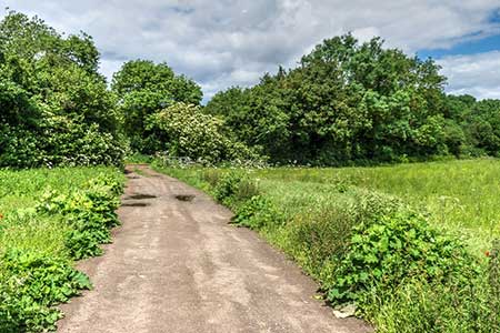
Click image to see photo description.
This circular walk from Tadworth (Surrey) explores downs and countryside. The route explores Walton Downs, follows a section of Stane Street a former Roman Road, and passes through Headley and Walton on the Hill. The walk uses public transport within London's Travelcard Zone 6. Tadworth is the last but one stop on the Tattenham Corner Line and the train operator is Southern. Trains from London Bridge usually divide at Purley; do make sure that you are in the right part of the train if travelling via this route. It is worth noting that extra care is needed when horse racing at Epsom Downs is taking place.
Exit Tadworth station (grid ref. TQ231562) and follow the Avenue ahead past a church on the left. At the end of the road, turn left and take the next road on the right, Motts Hill Lane, with an adjacent fingerpost. The countryside opens out ahead of you. After 120 metres turn right along a public footpath. Follow this path ahead with fields on your left and gardens and houses to the right. The path leads downhill as you contour round to the left and at the next path junction (grid ref. TQ224574), with the Walton Downs in view ahead, turn left along a bridleway, leaving this track with a path up a hill to the right, Six Mile Hill, leading to the highest part of the Walton Downs.
Bear left by following a track (bridleway) downhill, passing through woodland, and at the foot of the hill take the track to the right at a fork. Turn right at the bottom of the hill along the foot of the valley past Langley Vale Farm before taking a sharp left turn uphill (grid ref. TQ207575). At the top of this rise, pass through a gate and follow the path ahead to the left of, and in parallel to, Langley Vale Road. When the path ends, cross the road, and continue ahead to the left along Stane Street. The bridleway passes Thirty Acre Barn and crosses the M25 at a bridge and later, Headley Road. Once past Headley Road keep an eye out for a signed public footpath on the left (grid ref. TQ189558) and this is the way to go next, passing Headley Court on the left and to reach a road. Continue straight ahead into Lee Green Lane (grid ref. TQ197554).
Continue ahead, initially following a path to the right of the road, later to the left. When the path bends round to the left, leave it at this point to turn sharp right in parallel to a road below. When this path ends near a T junction, cross with care the road and continue along a signed public footpath between fences, through Headley Park. This path leads to a country lane, Hurst Lane. Turn right here for about 150 yards before taking a public footpath on the left next to Wingfield Stud. It is paths all the way now between here and Walton on the Hill. Keep following the path ahead, ignoring any turn offs. The path ahead reaches and passes the church at Headley on the right (a possible slight digression). Take the second bridleway on the left (grid ref. TQ206547) which leads under the M25 via a subway. At the next fork (grid ref. TQ214551) take the right-hand path and this leads uphill to Walton on the Hill. The path leads into Queens Close which leads to a T-junction.
Turn left along Chequers Lane (grid ref. TQ222551) - B2220. Keep ahead at a road junction and follow Walton Street, passing the village green on the right and later Mere Pond on the left. Beyond the pond, take a signed public bridleway to the left straight through woodland to reach a road called the Avenue. Turn right for a short distance and cross the road to follow a tarmac path that emerges on Station Approach and Tadworth Station.
Maps 

| Ordnance Survey Explorer 146 | Sheet Map | 1:25k | BUY |
| Anquet OS Explorer 146 | Digital Map | 1:25k | BUY |
| Ordnance Survey Digital Map Subscription | |||
| Latest Ordnance Survey Discounts | |||
Other walks nearby
| Walk 1618 | The Box Hill Hike | mod/hard | 8.0 miles |
| Walk 2683 | Farthing Downs and Happy Valley from Coulsdon South | easy/mod | 6.0 miles |
| Walk 2746 | Norbury Park Circular | easy | 4.0 miles |
| Walk 2761 | Box Hill Country Park Circular | easy/mod | 5.3 miles |
| Walk 3610 | Ranmore Common Circular near Dorking | easy | 5.2 miles |
| Walk 2124 | Leith Hill and Box Hill, two of the Surrey Hills | moderate | 12.5 miles |
| Walk 1734 | Hampton Court Parks and Gardens | easy/mod | 6.5 miles |
| Walk 2102 | Leith Hill circular | easy | 1.5 miles |
| Walk 2284 | Limpsfield Circular | easy/mod | 6.0 miles |
| Walk 3054 | Barnes to Richmond along the Thames Path | easy | 6.0 miles |
