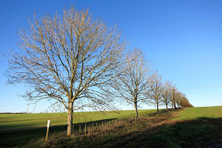
Chaddleworth from Great Shefford
North Wessex Downs Walk
Region - North Wessex Downs
County/Area - Berkshire
Author - Lou Johnson
Length - 8.0 miles / 13 km Ascent - 500 feet / 152 metres
Time - 4 hours 30 minutes Grade - easy/mod
Maps 

| Ordnance Survey Explorer 158 | Sheet Map | 1:25k | BUY |
| Anquet OS Explorer 158 | Digital Map | 1:25k | BUY |
Walk Route Description
Click image to see photo description.
A Berkshire walk from Great Shefford in the Lambourn Valley exploring the downs to the north-west of the village. The route uses bridleways and paths to cross an undulating landscape to reach the village of Chaddleworth with its remarkable church. The return route turns south to the Lambourn Valley, and you should allow time to visit the second notable church of the walk at East Shefford.
The start is the centre of Great Shefford where on street parking is available in Church Street (grid ref. SU382753). Do remember to park with consideration. After parking follow Wantage Road (A338) north out of the village and continue to just after the filling station on the right. Turn right down the waymarked tarmac drive along the Lambourn Valley Way (grid ref. SU386753) to East Shefford Farm (grid ref. SU389749). Turn left past barns onto a rising track.
Continue up the track for 700 metres to a finger post (grid ref. SU3947570. Turn right and follow waymarked path (yellow arrows) across fields and then along side a golf course to a road, Buckham Hill (grid ref. SU407764). Cross the road and follow the path beside a hedge (initially on the right then on the left). Continue ahead at a three-way fingerpost (grid ref. SU412771). 150 metres beyond the fingerpost go half left across fields to reach a road in Chaddleworth (grid ref. SU4111778).
Turn right and continue across the road junction to St. Andrew's Church. After visiting the church return to the road junction and turn left. After 100 metres turn left through a gate onto a signed footpath (grid ref. SU412778). Follow the path through parkland by Chaddleworth House. The path loops round to re-join the road by the village hall.
Cross the road and follow the path across a field to a road (grid ref. SU414774). Turn right and almost immediately left to take the footpath signed to Waylands. Continue ahead to reach the three-way fingerpost passed earlier in the walk (grid ref. SU412771). From here go half left and continue to a road (Sheephouse Way). Turn right and continue to a T-junction (grid ref. SU412762).
Turn right and then left past the Golf Clubhouse. Continue beside the golf course (on your right) soon joining a track (Elton Lane). Follow this track for just over two kilometres to descend into the Lambourn Valley. Turn right past Elton Farm and then left on the Lambourn Valley Way, which is the route of a former railway line. Continue to East Shefford (grid ref. SU389749). A short diversion to the left takes you to St. Thomas's church, East Shefford. To complete the walk, retrace your steps from East Shefford along the Lambourn Valley Way back to the start.
Other walks nearby
| Walk 1737 | West Berkshire downs | easy/mod | 7.4 miles |
| Walk 2180 | Hamstead Park from Kintbury | easy/mod | 7.3 miles |
| Walk 2344 | Newbury to Hungerford via Kennet & Avon Canal | easy/mod | 9.0 miles |
| Walk 3720 | Ham, Inkpen Hill & Lower Green Circular | easy/mod | 6.0 miles |
| Walk 1947 | Coombe Gibbet & Walbury Hill near Inkpen | easy/mod | 6.2 miles |
| Walk 1873 | The Ridgeway from Ardington | easy/mod | 7.0 miles |
| Walk 2410 | Wayland's Smithy, Ashdown House and Ashbury | easy/mod | 7.5 miles |
| Walk 1419 | The Lambourn Downs from near Astbury | moderate | 14.0 miles |
| Walk 2915 | Uffington Castle, the White Horse and Wayland's Smithy | easy/mod | 6.5 miles |
| Walk 3116 | Uffington White Horse & Wayland's Smithy | easy | 3.3 miles |
Recommended Books & eBooks
Walking in the North Wessex Downs
 30 walking routes exploring the North Wessex Downs Area of Outstanding Natural Beauty (AONB). The routes are between 7km to 20km through this peaceful rolling chalk landscape covering parts of four counties: Berkshire, Hampshire, Wiltshire and Oxfordshire, with descriptions to reach the highest points in each one.
More information
The Kennet and Avon Canal
 Guidebook to walking along the Kennet & Avon Canal. The 94 mile route from Reading to Bristol is split into 7 stages of fairly easy walking and includes the UNESCO World Heritage Site of Bath and Bristol's Floating Harbour. 20 circular walks are also included, ranging from 4¼ to 9 miles, taking in the best sections of the canal.
More information
Messaging & Social Media
Message Walking Britain and follow the latest news.

Mountain Weather
Stay safe on the mountains with detailed weather forecasts - for iOS devices or for Android devices.