River Severn from Arlingham
Gloucestershire Walk
County/Area - Gloucestershire
Author - Lou Johnson
Length - 6.0 miles / 9.8 km Ascent - 120 feet / 36 metres
Time - 3 hours 10 minutes Grade - easy
Walk Route Description
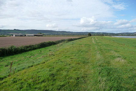
Click image to see photo description.
This walk from Arlingham in Gloucestershire explores a tidal section of the River Severn horseshoe below Gloucester. The Severn Way is followed for much of the route which provides easy walking. Depending on tides you may pass extensive sandbanks or see the full width of the river when the tide is high.
On street parking is generally available in Arlingham's High Street which is adjacent to the Red Lion Inn (grid ref. SO708109). After parking face south and follow Church Road (signed opposite the Inn). Continue past the church and when the road turns sharp right, go through the metal gate ahead with adjacent footpath sign. The clear path leads down to banks of the River Severn (grid ref. SO706099). Turn right along the Severn Way. After just over two kilometres of easy walking you reach the Old Passage Inn (grid ref. SO695113).
Continue ahead and continue following the Severn Way. Across the river is the village of Newnham. Three kilometres from the Old Passage Inn you pass a track leading to farm buildings on the right (grid ref. SO712124). Continue along the Severn Way for a further 1.5 kilometres passing through two fences/hedges.
At the third fence or hedge (grid ref. SO723115) turn right onto a track. Turn right through a small gate and follow the path across four fields (hedge right) to pass through a metal gate onto a track (grid ref. SO715113). Walk the short distance to a lane where you bear right. Ignore the first lane on the left and continue to the next junction. Turn left onto High Street in Arlingham and continue back to the start.
Maps 

| Ordnance Survey Explorer OL14 | Sheet Map | 1:25k | BUY |
| Anquet OS Explorer OL14 | Digital Map | 1:25k | BUY |
| Ordnance Survey Digital Map Subscription | |||
| Latest Ordnance Survey Discounts | |||
Other walks nearby
| Walk 2147 | Arlington Peninsula from Saul Junction | easy/mod | 6.2 miles |
| Walk 1877 | Uley Bury & Cam Long Down | easy/mod | 5.5 miles |
| Walk 3214 | Symonds Yat, High Meadow Woods & Wye Valley | moderate | 12.0 miles |
| Walk 3302 | Symonds Yat Rock and the Biblins | easy/mod | 4.0 miles |
| Walk 2751 | Goodrich Circular | easy/mod | 6.5 miles |
| Walk 2688 | St Briavels Circular | easy/mod | 7.5 miles |
| Walk 1258 | The Tyndale Monument | easy/mod | 5.5 miles |
| Walk 1977 | Lasborough & Ozleworth Bottom | easy/mod | 5.8 miles |
| Walk 1870 | Dymock Daffodil Walk | easy/mod | 9.0 miles |
| Walk 2832 | The Wye Valley | easy/mod | 5.8 miles |
