Glaisdale, Great Fryup Dale and Eskdale from Lealholm
North York Moors Walk
Nat Park - North York Moors - North York Moors East
County/Area - North Yorkshire
Author - Phil Catterall
Length - 7.5 miles / 12.2 km Ascent - 1195 feet / 362 metres
Time - 5 hours 0 minutes Grade - moderate
Walk Route Description
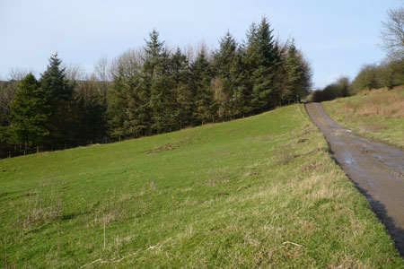
Click image to visit gallery of 12 images.
A circular walk from Lealholm taking in three Dales in the North York Moors. Ample free parking is usually available on the car park adjacent to the School in Lealholm, where there are also public toilets. Our walk starts from here at grid ref. NZ763076. Take the track ESE leading from the car park to Underpark Farm, turn right as you enter the farm yard and then follow the path alongside the River Esk. At grid ref. NZ775069 the public footpath becomes a permissive path and a footbridge crossing the Esk is soon in view. Cross here taking the rough track up the hill. Where the track meets the public road bear right on a waymarked footpath for 500m to Low Brock Rigg. On entering the muddy yard here take a sharp hairpin left to keep the hedgerow on your right. Head due south, through a field gate, then turning slightly left towards High Brock Rigg. Here you climb the low stone wall into what appears to be an extremely tidy private garden. This is actually the public footpath and the owner must be complemented for its maintenance.
At the top of the garden turn square right to follow the path of a stream, taking a right fork at the footpath junction Sunny Brake (grid ref. NZ771062). When you reach a gravel track keep right passing a bungalow on your right. This access track joins the public road at grid ref NZ766060. Turn left here and then take the track immediately on your right before the bridge, passing Lower Swang - a farm that has collected thousands of wooden pallets. Heading WSW pass between Gorse bushes and then through a field gate to emerge at an unnamed remote cottage bordering Glaisdale Moor. From here continue on the access track to join the public road (grid ref. NZ759059).
Turn left here walking downhill to Busco Beck Farm. From the farm take the left hand waymarked path over Glaisdale Moor. A large stone on the moor is visible and if you make for this it will place you on the correct heading to reach the road at grid ref. NZ747056 which is where you want to be. The walk across the heather of Glaisdale Moor is hard going as there is no defined path. An easier choice if you prefer, is to road walk up to the crossroads and then turn left.
From grid ref. NZ747056 a track west to Shaw End Farm leaves the public road, take this for only a few yards before turning sharp right on the footpath running alongside a dry stone wall, giving breathtaking views across Great Fryup Dale. Follow this path for NNE for 300m before turning left through a footpath gate and heading downhill towards Finkel House. Turn left at this farms concrete driveway briefly, before sighting a footpath gate to the right of the cattle grid. Exit here turning right on to the public road for 200m before turning left on a footpath to Finkel Bottoms. Cross a footbridge here and then turn right, crossing several stiles to reach Furnace Farm. Stay to the right of the farm buildings to emerge at the public road (grid ref. NZ741068).
Continue straight on (signposted Danby) for 400m before turning right on a waymarked path towards the River Esk. Houlsyke village can be seen to the north. Cross the Esk via the footbridge taking the left side of the hedge, as you head towards the gated railway crossing, marked by a red and white sign. Take extra care crossing the Esk Valley Line. After 200m the Lealholm to Danby road is reached (grid ref. NZ740078). Turn right for 600m. Shortly after the driveway to Lawns Farm on your left, a waymarked path takes you through several fields with stiles, north of High Park Farm. After passing through Park Wood keep left after the footbridge, to cross the top of Elm Ridge. After going through a gate keep right - waymarked Lealholm. The path becomes a track and soon the Station House is encountered at Lealholm Railway Station. Continue for 100m before turning right to cross the railway line at a pedestrian gate. The grassy path now curves left into the village street, where there is a Shop, Post Office, Garage, Tearoom and Pub. A left turn into the street returns you uphill to the village car park and toilets.
Maps 

| Ordnance Survey Explorer OL27 | Sheet Map | 1:25k | BUY |
| Anquet OS Explorer OL27 | Digital Map | 1:25k | BUY |
| Ordnance Survey Digital Map Subscription | |||
| Latest Ordnance Survey Discounts | |||
Other walks nearby
| Walk 1675 | The Esk Valley & Egton High Moor | moderate | 10.5 miles |
| Walk 1450 | Little & Great Fryup Dales | moderate | 8.3 miles |
| Walk 1452 | Leaholm Moor & Scaling Dam | moderate | 9.8 miles |
| Walk 3737 | Commondale & Esk Valley | easy/mod | 8.2 miles |
| Walk 2077 | Glaisdale Moor circular | moderate | 11.9 miles |
| Walk 3533 | Mallyan Spout and Beck Hole from Goathland | easy | 3.0 miles |
| Walk 2262 | Goathland & Grosmont | easy/mod | 7.7 miles |
| Walk 2563 | Egton Bridge & Grosmont from Goathland | moderate | 12.5 miles |
| Walk 3532 | Runswick Bay to Staithes | easy | 3.8 miles |
| Walk 1887 | Runswick Bay & Kettleness | moderate | 9.0 miles |
Recommended Books & eBooks
Trail and Fell Running in the Yorkshire Dales
 Guidebook to 40 of the best trail and fell runs in the Yorkshire Dales National Park. Ranging from 5 to 24 miles, the graded runs start from bases such as Ribblehead, Dent, Sedbergh, Malham and Grassington and take in the region's diverse delights, from castles and waterfalls to iconic mountains such as Whernside, Ingleborough and Pen Y Ghent.
More information
