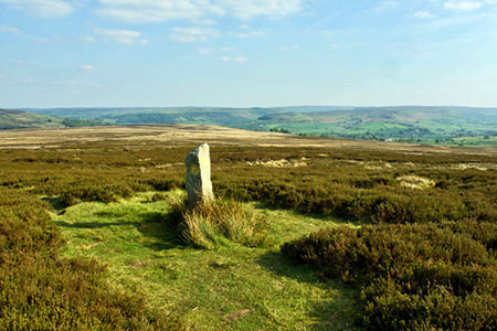
Commondale & Esk Valley from Danby
North York Moors Walk
Nat Park - North York Moors - North York Moors West
County/Area - North Yorkshire
Author - Lou Johnson
Length - 8.2 miles / 13.3 km Ascent - 850 feet / 258 metres
Time - 5 hours 0 minutes Grade - easy/mod
Walk Route Description
Click image to see photo description.
This North York Moors walk starts from Danby in the Esk Valley. The route climbs onto the moors lying to the north of the village from where there are views south across the National Park. The walk continues to Commondale after which the route follows the railway through Esk Dale back to the start. A short section of the Esk Valley Walk is sued for the final section back to Danby.
The start is the village of Danby where limited roadside parking is available (grid ref. NZ707086). After parking walk north uphill following the road signed to Scaling and Whitby. Reaching the end of the 30-m.p.h. speed restriction, bear half right onto a grassy track (grid ref. NZ707091). Follow the track up to re-join the road. Cross the road and take the path heading north (care required to select the correct path). The path heads over Danby Low Moor aiming to the left of Siss Cross Hill - the highest land on the horizon. Along the way you pass Siss Cross (grid ref. NZ704105).
800 metres beyond Siss Cross you reach a well-defined cross track (grid ref. NZ703113). Turn left and head west for 2.8 kilometres to reach White Cross (grid ref. NZ679108). Go straight across and take the road signed to Commondale. Two kilometres of road walking (grass verge for most of the way) takes you down to a road junction by the Cleveland Inn in the centre of the village. Turn left signed towards the station. Continue down the lane for 400 metres to where the lane forks (grid ref. NZ664102). Bear left and follow the lane which soon becomes a track. The route runs roughly parallel with the railway on your right.
After approx. three kilometres of pleasant walking, you reach a road (grid ref. NZ681087). Keep straight ahead and descend towards Castleton. Just after the name board, turn left at the fingerpost onto a clear path (grid ref. NZ683086). You are now following the Esk Valley Walk. The pleasant path passes through Danby Park and leads to a road (grid ref. NZ702085). Bear left along the road to return to the centre of Danby Village.
Maps 

| Ordnance Survey Explorer OL26 | Sheet Map | 1:25k | BUY |
| Anquet OS Explorer OL26 | Digital Map | 1:25k | BUY |
| Ordnance Survey Digital Map Subscription | |||
| Latest Ordnance Survey Discounts | |||
Other walks nearby
| Walk 1450 | Little & Great Fryup Dales | moderate | 8.3 miles |
| Walk 3187 | Esklets and Rosedale Head from Westerdale | moderate | 11.0 miles |
| Walk 2685 | Highcliff Nab and Guisborough Moor | moderate | 11.1 miles |
| Walk 1538 | Baysdale Circular | moderate | 9.5 miles |
| Walk 1012 | Glaisdale, Great Fryup Dale and Eskdale | moderate | 7.5 miles |
| Walk 1452 | Leaholm Moor & Scaling Dam | moderate | 9.8 miles |
| Walk 1675 | The Esk Valley & Egton High Moor | moderate | 10.5 miles |
| Walk 2077 | Glaisdale Moor circular | moderate | 11.9 miles |
| Walk 1050 | Highcliff Nab & Roseberry Topping from Slapewath | moderate | 10.5 miles |
| Walk 2090 | Easington Beck & Staithes from Loftus | moderate | 11.5 miles |
Recommended Books & eBooks
Trail and Fell Running in the Yorkshire Dales
 Guidebook to 40 of the best trail and fell runs in the Yorkshire Dales National Park. Ranging from 5 to 24 miles, the graded runs start from bases such as Ribblehead, Dent, Sedbergh, Malham and Grassington and take in the region's diverse delights, from castles and waterfalls to iconic mountains such as Whernside, Ingleborough and Pen Y Ghent.
More information
