Craigellachie National Nature Reserve from Aviemore
Cairngorms Walk
Nat Park - Cairngorms - Cairngorm North
County/Area - Highland
Author - Peter Smyly
Length - 5.0 miles / 8.1 km Ascent - 1100 feet / 333 metres
Time - 3 hours 40 minutes Grade - easy/mod
Walk Route Description
Click image to visit gallery of 8 images.
This is a walk that can be completed in a couple of hours or less and one which offers a fine view over the town of Aviemore and the mountains of the Cairngorms in the distance. For anybody staying in Aviemore with a couple of hours to spare, and looking for a shorter walk to occupy part of a day, this is a good choice under the right weather conditions as, with minimal effort, there are fine views from the top ridge.
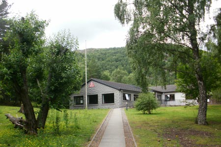
From Aviewmore Railway station (grid ref.NH895123) walk south along the main street. A sign for a catholic church off the main road passing through Aviemore leads not only to the church but Aviemore Youth Hostel. Follow the trail through woods to the right of Aviemore Youth Hostel. The path passes through a tunnel under the busy A9 and, on emerging on the other side, turns right. A noticeboard appears on the left of the path with a map of the route ahead through the woods which has silver birch trees covered in lichen, among other types of trees. A small sheet of water, Loch Puladdern, appears through the trees on the right, a shallow lake that is situated within yards of the traffic noise of the A9. It has one distinctive feature, a peninsula with a hill on it but much of the opposite end is becoming overgrown with reeds. The path skirts along the side of the hill to the left to avoid the cliffs above, but once clear of these, starts gaining height in earnest as it goes up the hill to the left with the hill of Creag nan Gabhar appearing to the right. Prior to that, the path even seems to be going the wrong way at one point as it veers off to the right for a while.
Looking back from the ascent through woodland, some of the mountains of the Cairngorms appear in the distance. There are no difficulties in route finding although the path is steep in places as it makes its way up through trees and emerges on to open felllside with a fine view of Aviemore below. The clear path leads all the way to the summit which, in July 2010, had a summit cairn, the top part of which looked precarious and about to topple over. Three lochs or lochans can be seen from the top, each one further away than the other in a row with Lochan Dubh being the one immediately below. As there is no clear way of making this walk a circular route, return to the start of the walk by reversing the outgoing route.
Maps 

| Ordnance Survey Explorer OL37 | Sheet Map | 1:25k | BUY |
| Anquet OS Explorer OL37 | Digital Map | 1:25k | BUY |
| Ordnance Survey Digital Map Subscription | |||
| Latest Ordnance Survey Discounts | |||
Other walks nearby
| Walk 1906 | Lochan Mor & Rothiemurchus Forest from Inverdruie | easy/mod | 3.6 miles |
| Walk 1721 | Braeriach via Lairig Ghru | hard | 18.2 miles |
| Walk 3299 | Loch an Eilein from Coylumbridge | easy/mod | 7.0 miles |
| Walk 1016 | Devil's Point, Cairn Toul, Braeriach & Lairig Ghru | very hard | 28.0 miles |
| Walk 2067 | Rothiemurchus Forest via Balvattan from Coylumbridge | easy/mod | 4.6 miles |
| Walk 3076 | Cairn Toul Circular | severe | 26.5 miles |
| Walk 1904 | Loch Morlich circular (near Aviemore) | easy | 4.0 miles |
| Walk 2412 | Craiggowrie & Creagan Gorm from Loch Morlich | mod/hard | 7.3 miles |
| Walk 2607 | Lairig Ghru & Chalamain Gap from Glenmore | mod/hard | 11.0 miles |
| Walk 3579 | Meall a'Bhuachaille & Ryvoan Bothy from Glenmore | moderate | 5.5 miles |
Recommended Books & eBooks
Skye's Cuillin Ridge Traverse
 This 2-volume set provides all the information required to complete the main ridge traverse on Skye's Black Cuillin. Strategy, gear, training, navigation and logistics are covered, and 10 classic scrambles are described. A lightweight second guidebook gives the scrambler detailed maps, topos and route description for the ridge traverse itself.
More information
Walking in Torridon
 This guidebook contains 52 day walks in Torridon, a remote and much-loved area of the Scottish Highlands. Based around Shieldaig and Slioch, the routes are split into 3 sections: easy walks, long and high level walks and mountain ascents over 2000ft including 9 Munros, and 5 outline suggestions for major ridge walks.
More information
