Sandridge Circular
Hertfordshire Walk
County/Area - Hertfordshire
Author - Donald Morton
Length - 4.0 miles / 6.5 km Ascent - 200 feet / 61 metres
Time - 2 hours 10 minutes Grade - easy
Walk Route Description
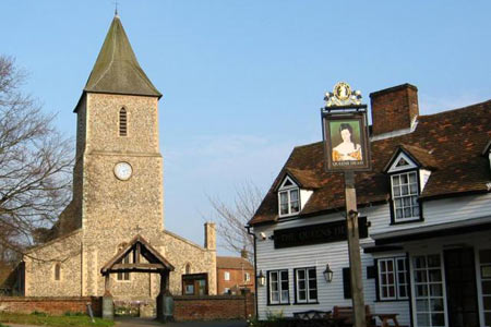
Click image to see photo description.
Sandridge is an ancient settlement a short distance from St Albans on the B651 to Wheathampstead and Hitchin. This Hertfordshire walk starts from the free car park next to the public toilets along the B651 (grid Ref TL169104).
From the car park return to the main road and turn left. Walk along, passing a village store and between the Green Man and the Rose and Crown, and over Sandridgebury Lane to turn left up the bridleway just by Pound Farm. Having gone through the farm buildings a broad track continues straight on uphill and over what is currently open farm land but which has recently been acquired by the Woodland Trust to create on either side an 850 acre broad leaf forest to be named Heartwood Forest. The track descends to a dry valley, with two concrete blocks in the path (possibly part of one of the WW II "stop lines" intended to help Dads' Army slow German invasion forces - we come across another one later in the walk). After this the track rises to meet a lane. Turn left along the lane until reaching a large house - Byways - on the right. Towards the end of its garden fence, turn left on what is officially a footpath but is used as a bridleway, and can be muddy. Follow this as it follows the field edge - hedge right. At the bottom corner go through a hedge gap and turn right, then left up a track which rises to a metalled drive.
At this point you turn left, joining the Hertfordshire Way, to return to Sandridge. When you reach Cheapside Farm turn left before the house to go between farm buildings to a metalled gate. Here bear right across the field to Cheapside Bridge. Once over the bridge the track becomes enclosed and goes on and descends, past the southern edge of the new Heartwood Forest, to the lane at Sandridgebury. On the way look out for a concrete block matching the ones seen earlier. On the other side of the lane go through a new galvanised kissing gate. Immediately veer left (to avoid a patch which except in the driest weather is invariably boggy - why one wonders!) before getting back to the path going diagonally across two fields via two more galvanised kissing gates to come into a sports field. Follow the left hand edge to arrive back at the car park.
Maps 

| Ordnance Survey Landranger 166 | Sheet Map | 1:50k | BUY |
| Anquet OS Landranger 166 | Digital Map | 1:50k | BUY |
| Ordnance Survey Digital Map Subscription | |||
| Latest Ordnance Survey Discounts | |||
Other walks nearby
| Walk 1122 | St Albans & Childwick Green | easy | 4.0 miles |
| Walk 1532 | Wheathampstead circular | easy | 4.5 miles |
| Walk 1343 | St Albans & Gorhambury circular | moderate | 9.5 miles |
| Walk 1139 | St Albans via Redbournbury Watermill from Harpenden | moderate | 12.0 miles |
| Walk 2945 | Lea Valley from Batford to Mill Green | easy/mod | 8.5 miles |
| Walk 2457 | Stanborough Park, Welwyn Garden City | easy | 2.0 miles |
| Walk 2799 | Ayot Green Circular | easy | 4.3 miles |
| Walk 2748 | Bowman's Lakes & Colney Heath | easy/mod | 7.5 miles |
| Walk 1372 | Ayot St Lawrence Circular | easy | 6.0 miles |
| Walk 2338 | The Upper Mimram Valley | easy | 5.7 miles |
