Fair Brook & Kinder Northern Edges from Birchen Clough
Peak District Walk
Nat Park - Peak District - Kinder Scout Edale
County/Area - Derbyshire
Author - Lou Johnson
Length - 8.5 miles / 13.8 km Ascent - 1065 feet / 323 metres
Time - 5 hours 20 minutes Grade - moderate
Walk Route Description
Click image to visit gallery of 9 images.
This Peak District walk tackles the interesting route up Fair Brook to gain the Kinder Plateau then follows the northern edge to reach Ashop Head. The return is via the Snake Path with open views of the outward route. Despite venturing onto the Kinder Plateau it avoids many of the problems of the peat hags and is suitable for most times of the year. It also avoids complicated compass work as for most of the route you have clear landmarks although around Ashop Head a good sense of direction is required in periods of poor visibility.
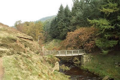
The start is the small car park at Birchen Clough on the A57 Snake Road (Grid ref. SK109914). To avoid some walking on this busy road cross over and go through the gate descending through the woods to a stream. Follow this down staying on the east bank to reach the River Ashop. Do not cross the footbridge on your right and instead turn left on the clear path, which climbs to reach the main road. Turn right towards Sheffield past the Snake Inn and take the first signed footpath on the right. This leads down to a footbridge over the River Ashop (Grid ref. SK114902).
Cross the bridge and follow the river downstream before turning right at the first brook. This is Fair Brook. Follow this upstream staying on the west side for the climb onto the Plateau. Near the top your clamber through rocks to reach the edge path. Turn right to reach Fairbrook Naze, which looks like a ship's prow from the valley.
Stay on the edge path with good views to your right. Away to your left are the peat hags that make Kinder so infamous! Generally the path is fairly dry although there are some unavoidable sections that can be wet and boggy after rain. As you continue along the edge, heading almost due west, you will pass some interesting weathered millstone grit rock features including the "Boxing Gloves".
After about two miles (which in fact seems much longer) you reach the Pennine Way at the top of Ashop Head. Turn right and descend steeply over a flagged path to Ashop Head. At the cross path (Grid ref. 063902) turn right. This is the Snake Path, which leads you back to the start. In places it can again be boggy although most of the worst sections have now been paved. Entering the woods (grid ref. 102907) keep on the lower path that runs parallel to the River Ashop. Cross the footbridge and turn left. You have now rejoined the outward route and all you need do is retrace your steps back to the parking area.
Maps 

| Ordnance Survey Explorer OL1 | Sheet Map | 1:25k | BUY |
| Anquet OS Explorer OL1 | Digital Map | 1:25k | BUY |
| Ordnance Survey Digital Map Subscription | |||
| Latest Ordnance Survey Discounts | |||
Other walks nearby
| Walk 1489 | Blackden Brook, Kinder & Upper Ashop | moderate | 6.8 miles |
| Walk 3049 | Bleaklow Stones from Derwent Valley | mod/hard | 12.0 miles |
| Walk 1159 | Grindsbrook & Edale Head | moderate | 7.5 miles |
| Walk 1264 | Rushup Edge & Crowden Tower | moderate | 10.0 miles |
| Walk 1295 | Ringing Roger & Edale Cross | moderate | 10.0 miles |
| Walk 2595 | Castleton Great Ridge from Edale | moderate | 8.5 miles |
| Walk 2615 | The Kinder Edges | mod/hard | 18.0 miles |
| Walk 3350 | Kinder Scout Summit | moderate | 8.5 miles |
| Walk 1113 | Ringing Roger & Grindslow Knoll | moderate | 5.5 miles |
| Walk 1300 | Hope Cross & Ringing Roger | moderate | 8.0 miles |
Recommended Books & eBooks
Walking in Derbyshire
 Walking guidebook to 60 circular day walks in Derbyshire and the Peak District. Includes the Derwent, Wye and Trent river valleys, near Derby, Matlock, Glossop, Bakewell and Ripley. Routes range from easy to moderate and are between 4 and 14km (2 to 10 miles). Walks focus on places of interest, from Stone Age forts to castles to grand estates.
More information
Great Mountain Days in the Pennines
 An inspirational guidebook to 50 classic walks on the rolling Pennine landscape. The graded routes, between 6 and 13 miles in length, cover classic Pennine fells and moorland such as Whernside, Ilkley Moor and Pendle Hill; exploring the North and South Pennines, Yorkshire Dales, Howgills and Dark Peak. Many routes are also suited to fell running.
More information
