Malham Tarn & Arncliffe
Yorkshire Dales Walk
Nat Park - Yorkshire Dales - Malhamdale
County/Area - North Yorkshire
Author - Lou Johnson
Length - 12.5 miles / 20.3 km Ascent - 1650 feet / 500 metres
Time - 7 hours 50 minutes Grade - moderate
Maps 

| Ordnance Survey Explorer OL2 | Sheet Map | 1:25k | BUY |
| Anquet OS Explorer OL2 | Digital Map | 1:25k | BUY |
| Ordnance Survey Landranger 98 | Sheet Map | 1:50k | BUY |
| Anquet OS Landranger 98 | Digital Map | 1:50k | BUY |
Walk Route Description
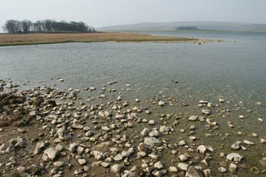
Click image to visit gallery of 7 images.
This lengthy Yorkshire Dales walk provides an insight into the limestone uplands to the north of Malham, visits the picturesque village of Arncliffe and provides plenty of exercise. Despite the length nowhere is it hard going and with an interesting pub in Arncliffe you can take a break. There is very little shelter en-route so try to avoid heavy rain or high winds.
The start is 'Street Gate' (Grid ref. SD904656) where there is adequate parking on the grass. Head west back along the road and take the first track on your right. This leads you to the shores of Malham Tarn. After following the shore for a short way take the signed path on your right (Grid ref. 897671) that leads you over a grassy col and down towards Middle House Farm. This is the Monk's Path that will be followed all the way to Arncliffe. The path descends towards the farm with a finger post and stile in the fence by the farm access road. Do not cross the stile but follow the track/bridleway north to Middle House, a uninhabited farm that was restored by the National Trust.
Just beyond Middle House ignore the path to Darnbrook instead following a generally clear path through pleasant limestone outcrops to reach the top of Yew Cogar Scar with Cowside Beck far below. Beyond are the slopes of Darnbrook Fell and Fountains Fell. The path stays high above the valley for some way before dropping steeply down into Littondale and the village of Arncliffe leading you quite conveniently past the front door of the Falcon public house. This interesting pub opens from noon to 3 p.m. and serves a limited range of food.
Continue through the centre of the village and turn left down the road to Litton. Just before the church take the footpath on your right. This leads across meadows beside the River Skirfare. Stay on this path until you reach a modern footbridge across the river (Grid ref. 952706). Do not cross the footbridge but exit right onto a narrow tarmac lane and head back towards Arncliffe! Reaching a busier road, turn right still heading back towards Arncliffe. Follow this for a short way before turning left up the access road to Arncliffe Cote.
Stay on the track through a zigzag to climb easily up the valley with Cote Gill on your left. You will makes excellent progress on the grassy track soon reaching the point where Cote Gill drops through a series of waterfalls (Grid ref. 934694). Continuing gently uphill you soon reach High Lineseed Head (Grid ref. 925682) from where the track leads downhill, apart from a final short easy climb, towards Street Gate and the end of the route.
Other walks nearby
| Walk 3092 | Malham Cove, Malham Tarn & Watlowes | easy | 4.4 miles |
| Walk 1051 | Gordale Scar & Malham Cove (Route 2) | moderate | 7.0 miles |
| Walk 1239 | Gordale Scar & Malham Cove | easy/mod | 6.5 miles |
| Walk 1274 | Nappa Cross & Malham | easy/mod | 5.5 miles |
| Walk 2602 | Gordale Scar & Malham Cove (Route 3) | moderate | 9.1 miles |
| Walk 2704 | Kirkby Malham & Hanlith from Malham | easy | 4.0 miles |
| Walk 2737 | The River Aire & Kirkby Malham from Malham | easy | 3.0 miles |
| Walk 3577 | Malham Cove from Malham | easy | 3.0 miles |
| Walk 2332 | Mastilles Lane & Bordley from Kilnsey | easy/mod | 6.8 miles |
| Walk 1701 | Bordley Hall & Malham Moor from Threshfield Moor | easy/mod | 7.0 miles |
Recommended Books & eBooks
Trail and Fell Running in the Yorkshire Dales
 Guidebook to 40 of the best trail and fell runs in the Yorkshire Dales National Park. Ranging from 5 to 24 miles, the graded runs start from bases such as Ribblehead, Dent, Sedbergh, Malham and Grassington and take in the region's diverse delights, from castles and waterfalls to iconic mountains such as Whernside, Ingleborough and Pen Y Ghent.
More information
Walking in the Yorkshire Dales: North and East
 This guidebook contains 43 circular day walks in the north and east Yorkshire Dales. It explores the dales, hills and moors between Kirkby Stephen and Pateley Bridge. Walking ranges from gentle 3 mile strolls to more strenuous day-long rambles across the Howgills, Wensleydale, Swaledale, Nidderdale, Mallerstang and Coverdale.
More information
Messaging & Social Media
Message Walking Britain and follow the latest news.

Mountain Weather
Stay safe on the mountains with detailed weather forecasts - for iOS devices or for Android devices.