Broxa & Broxa Forest
North York Moors Walk
Nat Park - North York Moors - North York Moors East
County/Area - North Yorkshire
Author - Andy Chaplin
Length - 8.3 miles / 13.4 km Ascent - 700 feet / 212 metres
Time - 4 hours 50 minutes Grade - easy/mod
Walk Route Description
Click image to see photo description.
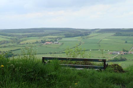
This North York Moors walk explores the area lying to the north of the village of Broxa, which lies to the north-west of Scarborough. Approximately three to four kilometres of the route pass through Broxa Forest but a large part of this is at the side of the River Derwent so it never feels hemmed in by trees, as some forest walking can do.
Park at the Forestry Commission parking area (grid ref. SE965945) and admire the views northwards as you boot-up before walking. Cross the road and take the path westwards that skirts the forest to Ward Hill. Just before the vehicle gate over the track head off downhill on the bridleway that drops down to Lownorth Bridge (grid ref. SE947951).
Take the road over Lownorth Beck and bear left following the path beside the beck into the Lownorth Park ex-military camp. This is now used by the Scarborough motor cycle club as a riding area. The path is clearly marked and separated from paths/tracks where motor bikes may be scrambling.
At Holm Wood cross the Harwood Dale Beck on the footbridge and keep to the right hand path that stays closest to the river Derwent. Do not take the paths that go through the Broxa forest. The path can sometimes become a number of alternatives, partly because it seems to have been churned up by bikes in wet weather. As it is always the river that you are following it is easy to maintain the overall route. At the time I walked this section there were some very impressive ant hills at the side of the path just before it left the forest.
When the forest ends the fence across the path deters further bike churning and walking becomes easier. Follow the path by the river to just before Langdale Bridge (grid ref. SE942910). If you reach the road and go over the stile then you have gone too far. Take the path on the left up Broxa Bank which joins a bridleway before reaching the road into Broxa, where you turn left.
Having walked through the village take the track off to the right (grid ref. SE945915). Having passed the farms and houses take the green lane, signposted as unsuitable for motors. This can be churned up in wet weather but there is a footpath adjacent to it as an alternative. This continues downhill to the road at the bottom (grid ref. SE954913). Again, if it is churned up towards the end an alternative is to walk through the field to the road.
Turn left along the road. A path leads from the footbridge over the stream. This leads through fields to Lowdales Farm. From here there is then a well defined track that leads north up the lush and very pretty Low Dale and Whisper Dale before climbing back into the Broxa Forest and returning to the parking place.
Maps 

| Ordnance Survey Explorer OL27 | Sheet Map | 1:25k | BUY |
| Anquet OS Explorer OL27 | Digital Map | 1:25k | BUY |
| Ordnance Survey Digital Map Subscription | |||
| Latest Ordnance Survey Discounts | |||
Other walks nearby
| Walk 1623 | Burn Howe Rigg from Jugger Howes | moderate | 10.0 miles |
| Walk 1564 | Hayburn Wyke from Scalby | moderate | 10.2 miles |
| Walk 3471 | Robin Hood's Bay from Ravenscar | moderate | 8.5 miles |
| Walk 1744 | Hayburn Wyke & Ravenscar along the Cleveland Way | moderate | 8.5 miles |
| Walk 2325 | Troutsdale Circular | moderate | 10.1 miles |
| Walk 1631 | Scarborough to Filey | moderate | 10.2 miles |
| Walk 2130 | Robin Hood's Bay & Hawkser from Fylingthorpe | moderate | 10.0 miles |
| Walk 1743 | Sneaton Thorpe & Littlebeck from May Beck | moderate | 8.9 miles |
| Walk 1602 | Saltergate, Fylingdales & Allerston High Moor | moderate | 11.5 miles |
| Walk 3534 | Dundale Pond & Hole of Horcum from Saltergate | easy/mod | 5.2 miles |
Recommended Books & eBooks
Trail and Fell Running in the Yorkshire Dales
 Guidebook to 40 of the best trail and fell runs in the Yorkshire Dales National Park. Ranging from 5 to 24 miles, the graded runs start from bases such as Ribblehead, Dent, Sedbergh, Malham and Grassington and take in the region's diverse delights, from castles and waterfalls to iconic mountains such as Whernside, Ingleborough and Pen Y Ghent.
More information
