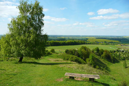
Telegraph Hill & Pegsdon from Hexton
Chilterns Walk
Region - Chilterns
County/Area - Hertfordshire & Bedfordshire
Author - Lou Johnson
Length - 5.0 miles / 8.1 km Ascent - 4001 feet / 1212 metres
Time - 6 hours 30 minutes Grade - easy
Walk Route Description
Click image to see photo description.
This is a pleasant ramble into the relatively unfrequented Chiltern Hills on the Hertfordshire and Bedfordshire border. The start and finish is near the welcoming Raven Public House (grid ref TL106306) in the village of Hexton.
To start the walk head south towards Barton Road - the B655 main road - and cross with care to follow the lane opposite. After a short way take the track on your right. This track leads south. Where the track turns sharp right, take the footpath leading straight ahead which leads through a gap in woodland. At the end of the woodland the path veers slightly right to follow another area of woodland the boundary of which should be on your right. At the corner of the wood, the path turns right and at the next field boundary turns sharp left to reach a lane (grid ref. TL104283).
Turn left along the lane to a T-junction. Turn right and then almost immediately left to join the ancient Icknield Way. The route ahead climbs gently over Telegraph Hill. Following a short descent you reach a junction of paths and bridleways (grid ref. TL120290) with the Pegsdon Hills and Hoo Bit Nature Reserve just off to your left. Turn left here onto the Chiltern Way and follow this clear path as it descends gently to reach the B655 (grid ref. TL118301).
Go straight across to follow the lane towards Apsley End. Please note the tempting direct route along the drive between Pegsdon and Hexton Manor is not a right of way and should not be used. Follow the lane north as far as the entrance to Green End and Bury Farms (grid ref. TL119306). Turn left down the lane and pass between the farms. Continue along the lane ignoring the bridleway on the right at grid ref. TL115310. Reaching a T-junction (grid ref. TL108311), turn left. This will lead you back to reach the Raven pub and the end of the walk.
Maps 

| Ordnance Survey Explorer 193 | Sheet Map | 1:25k | BUY |
| Anquet OS Explorer 193 | Digital Map | 1:25k | BUY |
| Ordnance Survey Digital Map Subscription | |||
| Latest Ordnance Survey Discounts | |||
Other walks nearby
| Walk 1130 | Clophill and Haynes Circular | easy/mod | 6.0 miles |
| Walk 3115 | Ampthill & Steppingley Circular | easy/mod | 9.0 miles |
| Walk 3513 | Ampthill and Clophill Circular | moderate | 12.0 miles |
| Walk 2810 | Haynes Circular | easy/mod | 7.0 miles |
| Walk 2221 | Circular from St Paul's Walden to Little Almshoe | easy/mod | 7.0 miles |
| Walk 2708 | Cuckolds Cross & Whitwell from St Paul's Walden | easy/mod | 7.0 miles |
| Walk 1985 | Houghton Park Circular | easy | 4.0 miles |
| Walk 3409 | The Three Counties Tops | mod/hard | 17.0 miles |
| Walk 2316 | Dunstable Downs Circular | easy | 4.0 miles |
| Walk 3089 | Dunstable Downs & Totternhoe from Robertson Corner | easy/mod | 8.8 miles |
