Peatling Magna from Countesthorpe
Leicestershire Walk
County/Area - Leicestershire
Author - David McMahon
Length - 4.1 miles / 6.7 km Ascent - 150 feet / 45 metres
Time - 2 hours 10 minutes Grade - easy
Walk Route Description
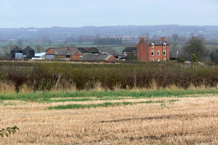
Click image to see photo description.
Countesthorpe is a large village six miles to the south of Leicester. There is a regular bus service Arriva 85 (see timetable) from Leicester St Margaret's Bus Station for those without private transport.
To start the walk go south along Main Street, with St Andrew's Church on your right. Continue along the road that leads to Peatling Magna past the left and right-hand bends. At the second left-hand bend take Austrey Lane, which is on your right.
Continue along Austrey Lane. When you reach a field aim for the furthest point away, go through a gate to join a narrow enclosed footpath. It finishes with another gate. Go left with the hedgerow on your left-hand side. Walk straight ahead along this well-marked footpath through several fields which will take you to the right-hand side of Westdale Farm.
Go along the driveway, past the farm and into the field straight ahead. Follow the hedgerow and then take the left-hand bridleway. Continue along the well-defined track until you reach Sanbury Farm and immediately afterwards a farm track. Turn right along it and very soon turn left onto a wide grassy track and walk along this until you reach a section of the Leicestershire Round off to the left, which will take you into Peatling Magna.
When you reach the road, turn left and go past 'The Cock Inn' and you will find the footpath on the edge of the village, just past the telephone box (now a library) on the left hand side of the road (grid ref. SP593927). The path goes diagonally to the right and is straightforward apart from one kink to the left and later on watch out for a yellow post indicating the path goes off diagonally to the left. This path will take you to a road (grid ref. SP588947). Turn left and walk along the road, passing Austrey Lane on your left. Continue along the lane back into the centre of Countesthorpe.
Maps 

| Ordnance Survey Explorer 233 | Sheet Map | 1:25k | BUY |
| Anquet OS Explorer 233 | Digital Map | 1:25k | BUY |
| Ordnance Survey Digital Map Subscription | |||
| Latest Ordnance Survey Discounts | |||
Other walks nearby
| Walk 1441 | Broughton Astley, Leire, Claybrooke Magna & Sharnford | easy/mod | 11.0 miles |
| Walk 3415 | Wistow and Newton Bridge from Fleckney | easy | 6.5 miles |
| Walk 1455 | Great Glen and Burton Overy circular | easy | 6.0 miles |
| Walk 1457 | Great Glen, Burton Overy, & Illston | easy/mod | 11.0 miles |
| Walk 3338 | Burton Overy from Great Glen | easy | 3.0 miles |
| Walk 3087 | Normanton Park & Desford Crossroads | moderate | 11.5 miles |
| Walk 2084 | Grand Union Canal from Great Glen | easy | 3.1 miles |
| Walk 1972 | Foxton Locks & Laughton from Saddington | easy/mod | 7.9 miles |
| Walk 1456 | Carlton Curlieu & Illston on the Hill | easy | 5.0 miles |
| Walk 1627 | Debdale Wharf & Foxton from Smeeton Westerby | easy/mod | 7.5 miles |
