Grand Union Canal from Great Glen
Leicestershire Walk
County/Area - Leicestershire
Author - David McMahon
Length - 3.1 miles / 5 km Ascent - 50 feet / 15 metres
Time - 1 hours 40 minutes Grade - easy
Walk Route Description
Click image to see photo description.
This easy walk starts from Great Glen, a popular village to the east of Leicester just off the A6. The bus service is the Arriva X3(see timetable). The walk starts from village green. Commence by walking down the cul-de-sac to the left-hand side of the Pug and Greyhound pub. At the end cross over the stile and carry on along the farm track as it firstly bends to the left and then to the right and then reaches a bridge over the Great Glen Bypass.
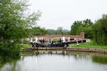
After the bridge, continue along the track past the first hedgerow until it reaches the second one. Turn left before it and then cross the footbridge and carry on straight across the field to the next hedgerow. Cross another footbridge and afterwards aim slightly diagonally right until you reach the next hedgerow. Go the right and carry on along the grassy track which will take you under the railway line and eventually onto the canal by Cranes Lock.
Turn right and continue along the canal towpath until you reach a set of steps. Go down them and through the railway line tunnel and then continue along the well-marked and well-trodden footpath until you reach the bypass again. This time cross it at ground level and carry on for a short distance until you reach a more substantial footbridge than previous. Here you have a choice; straight ahead will bring you out on the old A6, whereas a right turn, a stile and a gate followed by a narrow alleyway will bring you out where you started. Hope you've enjoyed yourself.
Maps 

| Ordnance Survey Explorer 233 | Sheet Map | 1:25k | BUY |
| Anquet OS Explorer 233 | Digital Map | 1:25k | BUY |
| Ordnance Survey Digital Map Subscription | |||
| Latest Ordnance Survey Discounts | |||
Other walks nearby
| Walk 1455 | Great Glen and Burton Overy circular | easy | 6.0 miles |
| Walk 1457 | Great Glen, Burton Overy, & Illston | easy/mod | 11.0 miles |
| Walk 3338 | Burton Overy from Great Glen | easy | 3.0 miles |
| Walk 1456 | Carlton Curlieu & Illston on the Hill | easy | 5.0 miles |
| Walk 3415 | Wistow and Newton Bridge from Fleckney | easy | 6.5 miles |
| Walk 1627 | Debdale Wharf & Foxton from Smeeton Westerby | easy/mod | 7.5 miles |
| Walk 1972 | Foxton Locks & Laughton from Saddington | easy/mod | 7.9 miles |
| Walk 1624 | Willoughby Waterleys & Bruntingthorpe | easy/mod | 9.2 miles |
| Walk 2078 | Peatling Magna & Arnesby From Countesthorpe | easy/mod | 6.8 miles |
| Walk 1685 | Peatling Magna | easy | 4.1 miles |
