Gunby Hall & Park from Candlesby
Lincolnshire Walk
County/Area - Lincolnshire
Author - Lou Johnson
Length - 4.4 miles / 7.2 km Ascent - 200 feet / 61 metres
Time - 2 hours 20 minutes Grade - easy
Walk Route Description
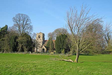
Click image to see photo description.
This circular walk from Candlesby explores an area of rolling countryside, the grounds of Gunby Hall, two interesting churches and follows a section of an old railway. The start is Church Lane on the south side of the A158 through Candlesby. Parking is available by St. Benedict church on Church Street (grid ref. TF455674).
After parking enter the churchyard through the meatal gate. Cross the churchyard keeping the church on your left and exit onto a path. The path turns left and continue to a junction. Bear right and follow a grassy path south across Candlesby Park. Aiming to the right of a small wood. Pass through the gate and maintain direction across the next field aiming for the immediate left of a small wood. Continue ahead with trees on your right and into the next field. The path continues south across the right-hand side of the next field. Continue across another large field and pass through trees to reach a track, Sandy Lane (grid ref. TF456659).
Turn left along Sandy Lane passing through a small wood to reach a Gunby Lane. Reaching a junction turn left (signed Irby in the Marsh). Follow the road to the next junction (with a cottage opposite) where you bear left. Continue to a white house on the right. Turn left here onto a clear track that was once a former railway. Continue along the track for 800 metres passing two small areas of woodland on your left. Reaching the corner of the third wood (grid ref. FT471658), turn left onto a signed footpath. After 300 metres the path bends right (grid ref. TF469660) and heads north to enter the parkland of Gunby Hall (NT).
Continue north through the park to reach the small church of St. Peter's, sheltered by trees. Retrace you steps for 50 metres and turn right onto a grassy path Continue along the garden fence, pass through a gate, and continue along a grassy path heading northeast to reach Gunby Lane (grid ref. TF463671). Go straight across the lane and follow the path with trees on your left. Continue into the next field and follow the right-hand field boundary turning right at the end of the field and continuing along the field edge. After 100 metres turn left and follow the path into Candlesby Park and retrace your steps back to the church and the start of the walk.
Maps 

| Ordnance Survey Explorer 274 | Sheet Map | 1:25k | BUY |
| Anquet OS Explorer 274 | Digital Map | 1:25k | BUY |
| Ordnance Survey Digital Map Subscription | |||
| Latest Ordnance Survey Discounts | |||
Other walks nearby
| Walk 1509 | Old Bolingbroke & East Keal circular | easy | 6.0 miles |
| Walk 2712 | Hagworthingham to Horncastle | moderate | 12.5 miles |
| Walk 2809 | Aby & Belleau | easy | 3.0 miles |
| Walk 3677 | Anderby Creek | easy | 5.4 miles |
| Walk 1792 | Somersby and Tetford Circular | easy/mod | 6.0 miles |
| Walk 1325 | Horncastle, Langton & Thimbleby circular | easy/mod | 6.0 miles |
| Walk 1129 | Tathwell & Haugham circular | easy | 5.5 miles |
| Walk 1914 | Louth, South Elkington, Hallington & Raithby | easy/mod | 7.5 miles |
| Walk 2769 | The Louth Canal Circular Walk | easy/mod | 7.0 miles |
| Walk 2722 | Covenham St. Bartholomew & the Reservoir | easy | 4.8 miles |
