Spaunton Moor from Chimney Bank
North York Moors Walk
Nat Park - North York Moors - North York Moors West
County/Area - North Yorkshire
Author - Andy Chaplin
Length - 8.1 miles / 13.2 km Ascent - 720 feet / 218 metres
Time - 4 hours 50 minutes Grade - easy/mod
Walk Route Description
Click image to visit gallery of 3 images.
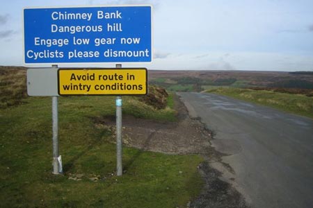
This North York Moors walk around Spaunton Moor starts at the second parking area on Chimney Bank above Rosedale at grid reference SE721946. If you have come up from Rosedale you will understand the reason for the warning signs at the top of the hill.
Take the moors track off to the south east and follow it to the Ana Cross which is 1km away. There are good views across the moor and into the Seven valley, which you walk above for a further 2km. The track that you are following - around the moor and above the river valley - is easier to follow on the ground than it appears on the map. Two other moors tracks cross or go off at right angles - keep straight on - and the main track is the most obvious route at the point where the map shows alternatives above Abraham's Hut.
Look out for the footpath that crosses (grid ref. SE740918). It should be obvious as you will have just come back onto the North Yorks Moors Western Area Explorer Map. Here descend down towards the Tranmire Beck. Cross over the stream, ascend the other side and continue on towards the road up from Lastingham.
There is a signpost here that directs you on towards Hutton-le-Hole. Shortly afterwards there is a rather muddy struggle over the Hole Beck stream and then the path continues on to come out on the road above Spaunton.
Turn right along the road. The bridge over the Fairy Call Beck is a pleasant place to stop for a while then shortly afterwards, as you start to descend into Hutton-le-Hole, turn off right to pick up the Lodge Road that climbs up Hutton Ridge. When the road turns off to the left continue northwards on the track through Low and High Snapes.
Turn right on the moors track and follow it to the road where you turn left and then have just over 500 metres back to the parking place.
Maps 

| Ordnance Survey Explorer OL26 | Sheet Map | 1:25k | BUY |
| Anquet OS Explorer OL26 | Digital Map | 1:25k | BUY |
| Ordnance Survey Explorer OL27 | Sheet Map | 1:25k | BUY |
| Anquet OS Explorer OL27 | Digital Map | 1:25k | BUY |
| Ordnance Survey Digital Map Subscription | |||
| Latest Ordnance Survey Discounts | |||
Other walks nearby
| Walk 2029 | Lastingham & Rosedale from Hutton-le-Hole | moderate | 12.0 miles |
| Walk 1527 | Farndale Circular from Little Blakey | moderate | 12.0 miles |
| Walk 1674 | Rosedale Valley circular from Little Blakey | moderate | 11.0 miles |
| Walk 2077 | Glaisdale Moor circular | moderate | 11.9 miles |
| Walk 3398 | Rollgate Bank & Aumery Park from Fadmoor | moderate | 11.0 miles |
| Walk 2665 | Cawthorne Roman Camp Circular | moderate | 12.2 miles |
| Walk 1930 | Wheeldale Moor circular | moderate | 11.3 miles |
| Walk 1542 | The Rudland Ridge from Ousegill Bridge | moderate | 10.1 miles |
| Walk 1397 | Hole of Horcum from Levisham Station | easy/mod | 8.5 miles |
| Walk 1675 | The Esk Valley & Egton High Moor | moderate | 10.5 miles |
Recommended Books & eBooks
Trail and Fell Running in the Yorkshire Dales
 Guidebook to 40 of the best trail and fell runs in the Yorkshire Dales National Park. Ranging from 5 to 24 miles, the graded runs start from bases such as Ribblehead, Dent, Sedbergh, Malham and Grassington and take in the region's diverse delights, from castles and waterfalls to iconic mountains such as Whernside, Ingleborough and Pen Y Ghent.
More information
