Lower Largo to Elie - Fife Coastal Path
Fife Walk
County/Area - Fife
Author - Lou Johnson
Length - 7.4 miles / 12 km Ascent - 400 feet / 121 metres
Time - 4 hours 10 minutes Grade - easy/mod
Walk Route Description
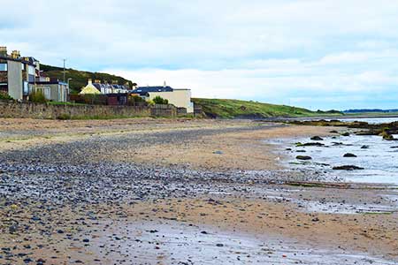
Click image to see photo description.
A linear walk along sections of the Fife Coastal Path from Lower Largo to Elie. The route is easy to follow and includes a section of beach, a rocky headland, and a clifftop path. The walk uses a regular bus service between Elie and Lower Largo (Route 95) with a journey time of about 30 minutes.
The walk starts from the High Street, Elie where unrestricted on-street parking is available (grid ref. NO493001). After parking locate the bus stop on the south side of High Street and take route 95 to alight at the Harbour in Lower Largo (grid ref. NO417026). After alighting from the bus, walk towards the sea. Do not cross the bridge and turn left into Main Street. Continue to where the road curves right to pass behind the beach. Turn right in front of two benches to gain the beach and turn left towards Elie.
Continue along Lower Largo Beach if tides permit. Otherwise continue along Main Street and keep right where the road forks along The Temple to reach the beach. Continue for four kilometres along the beach to reach Ruddons Point. As an alternative at the end of The Temple bear half left and join the path along a disused railway for a kilometre and then veer right back to the beach. Nearing the end of the beach, the path turns inland, loops right across a footbridge and passes through a gap in trees (grid ref. NO458007).
After the trees turn right on a clear path which wends it way around the headland. If you are lucky this a good place to see grey seals. Follow the path along the south side of the headland to re-join the main path with a holiday park on your immediate left and Shell Bay on your right. Continue to the end of the caravans and turn right down towards the sea. Cross a footbridge and join the path with Shell Bay on your right. The path soon turns left and climbs onto the clifftops of Kincraig Point.
After a short descend the path runs parallel to the beach on your right and Earlsferry Links on your left. Stay on the grassy path nearest the sea to reach a small stone obelisk and an excellent view along Elie Beach. Bear left to join Chapel Green Road. Turn right over grass to reach Elie Beach and turn left and continue to the end of the sand to join South Street. Stay on South Street and The Terrace for 500 metres to reach a T-junction where you turn left to reach High Street.
Maps 

| Ordnance Survey Explorer 371 | Sheet Map | 1:25k | BUY |
| Anquet OS Explorer 371 | Digital Map | 1:25k | BUY |
| Ordnance Survey Digital Map Subscription | |||
| Latest Ordnance Survey Discounts | |||
Other walks nearby
| Walk 1562 | Elie to Pittenweem - Fife Coastal Path | easy | 6.0 miles |
| Walk 1563 | Pittenweem to Crail - Fife Coastal Path | easy | 4.5 miles |
| Walk 1558 | Out Head & West Sands, St Andrews | easy | 3.0 miles |
| Walk 3281 | East Lomond from Craigmead | easy | 2.5 miles |
| Walk 3282 | West Lomond from Craigmead | easy/mod | 5.0 miles |
| Walk 1560 | Kingsbarns to St Andrews - Fife Coastal Path | easy/mod | 8.0 miles |
| Walk 1559 | Crail to Kingsbarns - Fife Coastal Path | easy/mod | 6.5 miles |
| Walk 3280 | West Lomond from near Gateside | moderate | 6.8 miles |
| Walk 1700 | Edinburgh - Royal Mile, Arthur's Seat & Princes Street | easy | 5.5 miles |
| Walk 1803 | Edinburgh - Salisbury Crags and the Royal Mile | easy | 4.0 miles |
