Claife Heights & Near Sawrey
Lake District Walk
Nat Park - Lake District - Lake District Lesser Fells
County/Area - Cumbria
Author - Peter Smyly
Length - 2.5 miles / 4.1 km Ascent - 300 feet / 91 metres
Time - 1 hours 30 minutes Grade - easy
Maps 

| Ordnance Survey Explorer OL6 | Sheet Map | 1:25k | BUY |
| Anquet OS Explorer OL6 | Digital Map | 1:25k | BUY |
| Ordnance Survey Landranger 90 | Sheet Map | 1:50k | BUY |
| Anquet OS Landranger 90 | Digital Map | 1:50k | BUY |
Walk Route Description
Click image to visit gallery of 6 images.
Claife Heights is an undulating tract of land situated between two of the lakes of the Lake District, Windermere and Esthwaite Water. Although of modest height by Lakeland standards with Latterbarrow being the highest point at 886 feet, it offers easy and pleasant walking with access points to the south from Near and Far Sawrey and to the north from Hawkshead and High Wray. Several tarns are shown on the ordnance survey map, but around half of them are private and not therefore accessible to the general public.
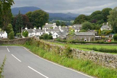
This Lake District walk includes a visit to the two largest tarns on Claife Heights, Moss Eccles Tarn and Wise Een Tarn as well as a third smaller tarn, Scale Head Tarn. The walk route starts from the village of Near Sawrey to the south of Claife Heights, on the B5285 road and it is a mile from the ferry to the east. If approaching from the Windermere/Bowness direction, it may be quicker to drive round the end of the lake to the north or south rather than wait for the ferry, depending on the time of year and how many cars are waiting to cross the lake ahead of you. Near Sawrey is famous for being the home of the author Beatrix Potter who lived at Hill Top Farm in the village.
Park the car off road to the south east of Near Sawrey and walk along the narrow tarmac road, passing the former house of the Lakeland author, Beatrix Potter, on the left, a building which is now a tourist attraction. The key to locating the start of the walk is to branch off the main road to the right past Castle Farm and, as you head due north, the tarmac road soon becomes an unsurfaced bridleway leading away from the houses and rising up between fields. The route divides at a Y junction where you follow the route to the left and within a few minutes, the first tarn, Moss Eccles Tarn, appears on the left. This is a pretty water with one small wooded island and it has woodland as a backdrop with water lilies on the surface at the far end. A raised embankment on the left, as you look from the bridleway, shows clearly that this tarn is artificial.
It is believed that Moss Eccles Tarn was the inspiration behind the water in Beatrix Potter's Jeremy Fisher story as this tarn was a haunt of hers. It was inherited by the National Trust after she died.
A few minutes walk further along the bridleway brings you in sight of another artificial tarn, Wise Een Tarn, with its varied shoreline and the familiar profile of the Langdale Pikes provide a backdrop for the view. Scale Head Tarn, a much smaller body of water, is nearby to the right of the path. While one option is to retrace your route back to the start point from here, another option is to continue on to Latterbarrow, the highest point on Claife Heights. Although not particularly high, this is one of the lower Lakeland fells that offers a fine all-round view, especially of the Langdale and Coniston fells.
Other walks nearby
| Walk 3410 | Latterbarrow from Hawkshead | easy | 4.0 miles |
| Walk 3320 | Grizedale Tarn circular | easy | 2.5 miles |
| Walk 3638 | Satterthwaite Bridge Circular | easy | 3.2 miles |
| Walk 3452 | Ghyll Head & Strawberry Bank Circular | moderate | 7.6 miles |
| Walk 3590 | Orrest Head & Allen Knott from Windermere | easy | 4.4 miles |
| Walk 1217 | Dow Crag & the Old Man of Coniston | mod/hard | 8.5 miles |
| Walk 1761 | Tom Heights and Tarn Hows | easy/mod | 7.0 miles |
| Walk 3028 | Tarn Hows & Tom Gill | easy/mod | 6.5 miles |
| Walk 3220 | Wetherlam via Red Dell | moderate | 7.0 miles |
| Walk 1463 | School Knott & Grandsire from Ings | easy/mod | 6.5 miles |
Recommended Books & eBooks
Walking the Lake District Fells - Wasdale
 Part of the Walking the Lake District Fells series, this guidebook covers a wide range of routes to 25 Lakeland summits that can be climbed from the Wasdale, Eskdale and Ennerdale valleys, with highlights including Scafell Pike, Great Gable and Pillar. Suggestions for longer ridge routes are also included.
More information
Lake District: Low Level and Lake Walks
 This guidebook describes 30 of the best low-level walks in the Lake District. From delightful wooded glades and sparkling tarns, to waterfalls and glacier-carved valleys towered over by craggy mountains. The walks described aim to seek out the best walking that the lower areas of the Lake District have to offer.
More information
Messaging & Social Media
Message Walking Britain and follow the latest news.

Mountain Weather
Stay safe on the mountains with detailed weather forecasts - for iOS devices or for Android devices.